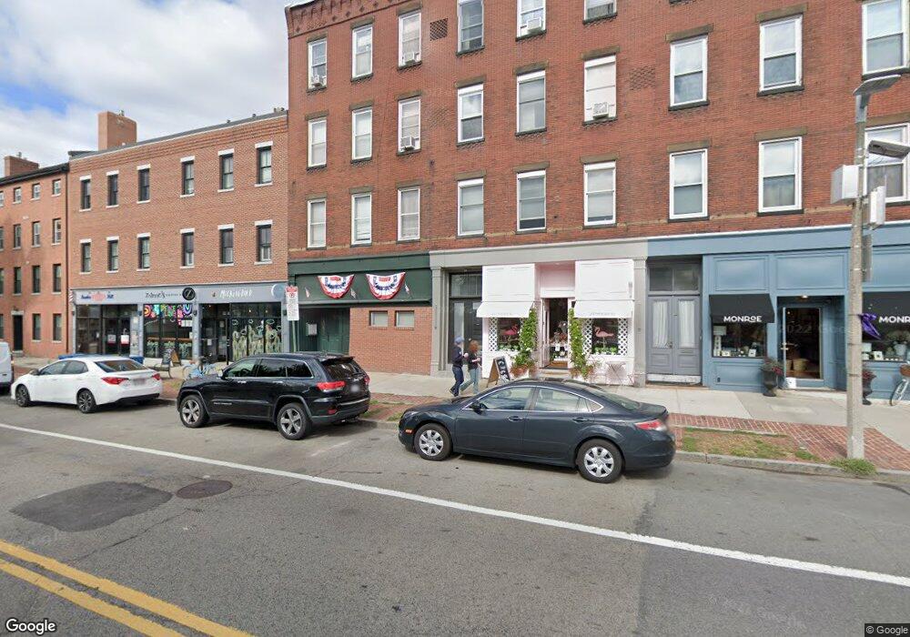
211 Main St Unit 213 Charlestown, MA 02129
Thompson Square-Bunker Hill NeighborhoodEstimated Value: $793,419 - $880,000
2
Beds
1
Bath
925
Sq Ft
$903/Sq Ft
Est. Value
About This Home
This home is located at 211 Main St Unit 213, Charlestown, MA 02129 and is currently estimated at $834,855, approximately $902 per square foot. 211 Main St Unit 213 is a home located in Suffolk County with nearby schools including Community Charter School of Cambridge and Torit Montessori School.
Ownership History
Date
Name
Owned For
Owner Type
Purchase Details
Closed on
Jan 5, 2021
Sold by
Boghos Farrell
Bought by
Racaniello Lauren and Maciver Eric
Current Estimated Value
Home Financials for this Owner
Home Financials are based on the most recent Mortgage that was taken out on this home.
Original Mortgage
$400,000
Outstanding Balance
$357,001
Interest Rate
2.71%
Mortgage Type
Purchase Money Mortgage
Estimated Equity
$477,854
Purchase Details
Closed on
Jun 7, 2012
Sold by
Miller Kristan
Bought by
Boghos Farrell
Home Financials for this Owner
Home Financials are based on the most recent Mortgage that was taken out on this home.
Original Mortgage
$271,200
Interest Rate
4%
Mortgage Type
Adjustable Rate Mortgage/ARM
Purchase Details
Closed on
Mar 14, 2008
Sold by
Dery Jennifer A
Bought by
Miller Kristan
Home Financials for this Owner
Home Financials are based on the most recent Mortgage that was taken out on this home.
Original Mortgage
$294,400
Interest Rate
5.72%
Mortgage Type
Purchase Money Mortgage
Purchase Details
Closed on
Sep 5, 1997
Sold by
Macletchie John G
Bought by
Dery Jennifer A
Home Financials for this Owner
Home Financials are based on the most recent Mortgage that was taken out on this home.
Original Mortgage
$87,000
Interest Rate
7.36%
Mortgage Type
Purchase Money Mortgage
Purchase Details
Closed on
Mar 31, 1995
Sold by
Charlestown Coop Bk
Bought by
Macletchie John G
Home Financials for this Owner
Home Financials are based on the most recent Mortgage that was taken out on this home.
Original Mortgage
$95,000
Interest Rate
8.8%
Mortgage Type
Purchase Money Mortgage
Purchase Details
Closed on
Jan 24, 1995
Sold by
Shields Christopher P
Bought by
Charlestown Coop Bk
Purchase Details
Closed on
Dec 1, 1987
Sold by
Ramella Roberta S
Bought by
Shields C P
Home Financials for this Owner
Home Financials are based on the most recent Mortgage that was taken out on this home.
Original Mortgage
$75,000
Interest Rate
11.59%
Mortgage Type
Purchase Money Mortgage
Create a Home Valuation Report for This Property
The Home Valuation Report is an in-depth analysis detailing your home's value as well as a comparison with similar homes in the area
Home Values in the Area
Average Home Value in this Area
Purchase History
| Date | Buyer | Sale Price | Title Company |
|---|---|---|---|
| Racaniello Lauren | $700,000 | None Available | |
| Boghos Farrell | $339,000 | -- | |
| Miller Kristan | $368,000 | -- | |
| Dery Jennifer A | $145,000 | -- | |
| Macletchie John G | $95,000 | -- | |
| Charlestown Coop Bk | $66,500 | -- | |
| Shields C P | $110,000 | -- |
Source: Public Records
Mortgage History
| Date | Status | Borrower | Loan Amount |
|---|---|---|---|
| Open | Racaniello Lauren | $400,000 | |
| Previous Owner | Boghos Farrell | $271,200 | |
| Previous Owner | Miller Kristan | $294,400 | |
| Previous Owner | Shields C P | $87,000 | |
| Previous Owner | Shields C P | $95,000 | |
| Previous Owner | Shields C P | $75,000 |
Source: Public Records
Tax History Compared to Growth
Tax History
| Year | Tax Paid | Tax Assessment Tax Assessment Total Assessment is a certain percentage of the fair market value that is determined by local assessors to be the total taxable value of land and additions on the property. | Land | Improvement |
|---|---|---|---|---|
| 2025 | $8,153 | $704,100 | $0 | $704,100 |
| 2024 | $7,377 | $676,800 | $0 | $676,800 |
| 2023 | $6,917 | $644,000 | $0 | $644,000 |
| 2022 | $6,736 | $619,100 | $0 | $619,100 |
| 2021 | $5,331 | $499,600 | $0 | $499,600 |
| 2020 | $4,755 | $450,300 | $0 | $450,300 |
| 2019 | $4,434 | $420,700 | $0 | $420,700 |
| 2018 | $4,199 | $400,700 | $0 | $400,700 |
| 2017 | $4,118 | $388,900 | $0 | $388,900 |
| 2016 | $4,073 | $370,300 | $0 | $370,300 |
| 2015 | $4,270 | $352,600 | $0 | $352,600 |
| 2014 | $3,949 | $313,900 | $0 | $313,900 |
Source: Public Records
Map
Nearby Homes
- 56 High St Unit 3
- 46 High St
- 6 Lincoln Place
- 98 Warren St Unit 98
- 22 Pleasant St
- 52 Sullivan St Unit 1
- 100 Main St Unit 5
- 94A Bartlett St Unit 2
- 94A Bartlett St Unit 3
- 1 Washington Place
- 9 Russell St Unit 2
- 9 Russell St Unit 1
- 15 Russell St
- 17 Trenton St
- 236 Bunker Hill St Unit 3
- 33 Russell St
- 207 Bunker Hill St Unit 2
- 247 Bunker Hill St Unit A
- 14 Wall St
- 255 Bunker Hill St Unit 2
- 211 Main St Unit 1
- 211 Main St Unit 213
- 211 Main St Unit 213
- 211 Main St Unit 3
- 211 Main St Unit 4
- 211 Main St
- 211 Main St Unit 2
- 215 Main St Unit 217
- 217 Main St Unit 1
- 217 Main St Unit 2
- 213 Main St Unit 2
- 213 Main St Unit 3
- 213 Main St Unit 4
- 223 Main St Unit 2
- 223 Main St
- 223 Main St Unit 1
- 223 Main St Unit 4
- 223 Main St Unit PH3
- 219 Main St Unit 1
- 6 Hathon Square Unit 2