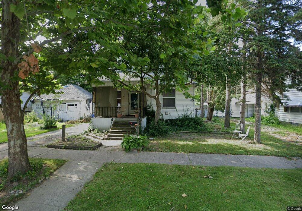
211 N Bond St Saginaw, MI 48602
Covenant NeighborhoodEstimated Value: $68,000 - $82,170
--
Bed
--
Bath
1,685
Sq Ft
$44/Sq Ft
Est. Value
About This Home
This home is located at 211 N Bond St, Saginaw, MI 48602 and is currently estimated at $74,793, approximately $44 per square foot. 211 N Bond St is a home located in Saginaw County with nearby schools including Herig Elementary School, Thompson Middle School, and Arthur Hill High School.
Ownership History
Date
Name
Owned For
Owner Type
Purchase Details
Closed on
Oct 8, 1998
Sold by
Patchett Robert B and Patchett Barbara J
Bought by
Conway Robert L and Conway Marcida D
Current Estimated Value
Home Financials for this Owner
Home Financials are based on the most recent Mortgage that was taken out on this home.
Original Mortgage
$31,333
Interest Rate
6.83%
Purchase Details
Closed on
Dec 30, 1994
Sold by
Andrews Terry Dale and Andrews Mary K
Bought by
Patchett Robert B and Patchett Barbara J
Create a Home Valuation Report for This Property
The Home Valuation Report is an in-depth analysis detailing your home's value as well as a comparison with similar homes in the area
Home Values in the Area
Average Home Value in this Area
Purchase History
| Date | Buyer | Sale Price | Title Company |
|---|---|---|---|
| Conway Robert L | $32,000 | Lawyers Title Insurance Corp | |
| Conway Robert L | $32,000 | -- | |
| Patchett Robert B | $44,900 | -- |
Source: Public Records
Mortgage History
| Date | Status | Borrower | Loan Amount |
|---|---|---|---|
| Previous Owner | Conway Robert L | $31,333 |
Source: Public Records
Tax History Compared to Growth
Tax History
| Year | Tax Paid | Tax Assessment Tax Assessment Total Assessment is a certain percentage of the fair market value that is determined by local assessors to be the total taxable value of land and additions on the property. | Land | Improvement |
|---|---|---|---|---|
| 2025 | $1,503 | $37,300 | $0 | $0 |
| 2024 | $1,205 | $33,700 | $0 | $0 |
| 2023 | $1,170 | $26,900 | $0 | $0 |
| 2022 | $1,394 | $22,700 | $0 | $0 |
| 2021 | $1,306 | $20,000 | $0 | $0 |
| 2020 | $1,160 | $20,000 | $0 | $0 |
| 2019 | $1,160 | $18,600 | $900 | $17,700 |
| 2018 | $1,012 | $21,405 | $0 | $0 |
| 2017 | $1,217 | $21,450 | $0 | $0 |
| 2016 | $1,191 | $21,473 | $0 | $0 |
| 2014 | -- | $21,170 | $0 | $20,072 |
| 2013 | -- | $21,170 | $0 | $0 |
Source: Public Records
Map
Nearby Homes
- 1014 Hancock St
- 1003 Hancock St
- 401 N Porter St
- 413 N Bond St
- 412 N Oakley St
- 211 N Woodbridge St
- 203 N Webster St
- 129 S Oakley St
- 125 S Webster St
- 516 N Granger St
- 1118 Cass St
- 1315 Adams St
- 1420 Adams St
- 311 S Porter St
- 620 Madison St
- 1610 Cleveland St
- 1509 Monroe St
- 709 N Granger St
- 717 N Porter St
- 1121 Throop St
- 217 N Bond St
- 1108 Hancock St
- 1102 Hancock St
- 223 N Bond St
- 210 N Bond St
- 1115 Ames St
- 1021 Ames St
- 1021 Ames St Unit . 2
- 1021 Ames St Unit 1
- 204 N Bond St
- 210 N Oakley St
- 208 N Oakley St
- 220 N Oakley St
- 1015 Ames St
- 1109 Hancock St
- 129 N Bond St
- 1114 Ames St
- 1020 Ames St
- 1117 Hancock St
- 307 N Bond St