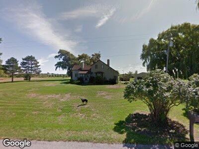
211 S Finn Rd Munger, MI 48747
Estimated Value: $198,636 - $223,000
3
Beds
2
Baths
1,576
Sq Ft
$134/Sq Ft
Est. Value
About This Home
This home is located at 211 S Finn Rd, Munger, MI 48747 and is currently estimated at $210,659, approximately $133 per square foot. 211 S Finn Rd is a home located in Bay County with nearby schools including Hampton Elementary School, Handy Middle School, and Bay City Central High School.
Ownership History
Date
Name
Owned For
Owner Type
Purchase Details
Closed on
Sep 19, 2019
Sold by
Miller Kenneth V and Miller Mary Ellen
Bought by
Stevenson Todd W and Stevenson Sara
Current Estimated Value
Home Financials for this Owner
Home Financials are based on the most recent Mortgage that was taken out on this home.
Original Mortgage
$123,262
Interest Rate
3.6%
Mortgage Type
New Conventional
Purchase Details
Closed on
Jan 9, 2006
Sold by
Miller Kenneth V and Miller Mary Ellen
Bought by
Hellebuyck William F and Hellebuyck Roseann E
Create a Home Valuation Report for This Property
The Home Valuation Report is an in-depth analysis detailing your home's value as well as a comparison with similar homes in the area
Home Values in the Area
Average Home Value in this Area
Purchase History
| Date | Buyer | Sale Price | Title Company |
|---|---|---|---|
| Stevenson Todd W | $129,750 | None Available | |
| Hellebuyck William F | $1,200 | None Available |
Source: Public Records
Mortgage History
| Date | Status | Borrower | Loan Amount |
|---|---|---|---|
| Open | Stevenson Todd W | $26,000 | |
| Open | Stevenson Todd W | $126,000 | |
| Closed | Stevenson Todd W | $123,262 |
Source: Public Records
Tax History Compared to Growth
Tax History
| Year | Tax Paid | Tax Assessment Tax Assessment Total Assessment is a certain percentage of the fair market value that is determined by local assessors to be the total taxable value of land and additions on the property. | Land | Improvement |
|---|---|---|---|---|
| 2024 | $1,407 | $90,800 | $0 | $0 |
| 2023 | $1,339 | $76,800 | $0 | $0 |
| 2022 | $2,224 | $68,200 | $0 | $0 |
| 2021 | $2,072 | $60,500 | $60,500 | $0 |
| 2020 | $1,999 | $56,000 | $56,000 | $0 |
| 2019 | $1,721 | $49,700 | $0 | $0 |
| 2018 | $1,680 | $51,000 | $12,400 | $38,600 |
| 2017 | $1,639 | $50,000 | $0 | $0 |
| 2016 | $1,645 | $48,000 | $0 | $48,000 |
| 2015 | $1,596 | $46,000 | $0 | $46,000 |
| 2014 | $1,596 | $45,000 | $0 | $45,000 |
Source: Public Records
Map
Nearby Homes
- 173 S Mielens Rd
- 742 N Knight Rd
- 56 E Munger Rd
- 568 W Center Rd
- 1581 S Tuscola Rd
- 1175 S Boutell Rd SE
- 990 Underwood Ln
- 398 E Center Rd
- 0 W Borton Rd
- VL N Cotter Rd
- 254 W Borton Rd
- 171 E Brown Rd
- 535 W Borton Rd
- 0 W German Rd Roads
- 1333 E Munger Rd
- 1324 E Munger Rd
- 1010 Island Blvd
- 1076 Orchard Rd
- 838 Whispering Pines Ln
- 0 Eastland Dr