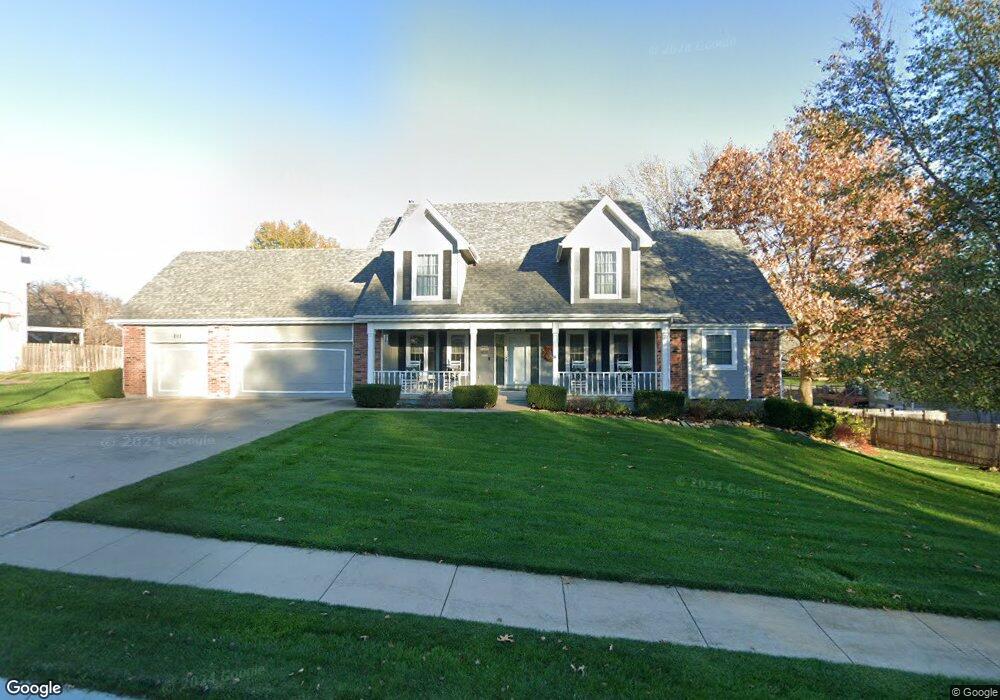
211 Southfork Rd Lansing, KS 66043
Estimated Value: $464,499 - $494,000
6
Beds
4
Baths
2,546
Sq Ft
$189/Sq Ft
Est. Value
About This Home
This home is located at 211 Southfork Rd, Lansing, KS 66043 and is currently estimated at $480,375, approximately $188 per square foot. 211 Southfork Rd is a home located in Leavenworth County with nearby schools including Lansing Elementary School, Lansing Middle 6-8, and Lansing High 9-12.
Ownership History
Date
Name
Owned For
Owner Type
Purchase Details
Closed on
Dec 1, 1998
Bought by
Gleisberg James W and Gleisberg Particia R
Current Estimated Value
Home Financials for this Owner
Home Financials are based on the most recent Mortgage that was taken out on this home.
Original Mortgage
$167,068
Interest Rate
6.78%
Mortgage Type
New Conventional
Create a Home Valuation Report for This Property
The Home Valuation Report is an in-depth analysis detailing your home's value as well as a comparison with similar homes in the area
Home Values in the Area
Average Home Value in this Area
Purchase History
| Date | Buyer | Sale Price | Title Company |
|---|---|---|---|
| Gleisberg James W | $206,500 | -- |
Source: Public Records
Mortgage History
| Date | Status | Borrower | Loan Amount |
|---|---|---|---|
| Closed | Gleisberg James W | $167,068 |
Source: Public Records
Tax History Compared to Growth
Tax History
| Year | Tax Paid | Tax Assessment Tax Assessment Total Assessment is a certain percentage of the fair market value that is determined by local assessors to be the total taxable value of land and additions on the property. | Land | Improvement |
|---|---|---|---|---|
| 2025 | $7,151 | $54,729 | $6,499 | $48,230 |
| 2024 | $6,611 | $52,624 | $6,499 | $46,125 |
| 2023 | $6,611 | $50,600 | $6,499 | $44,101 |
| 2022 | $6,356 | $46,000 | $6,171 | $39,829 |
| 2021 | $6,214 | $43,022 | $6,171 | $36,851 |
| 2020 | $6,055 | $41,251 | $6,171 | $35,080 |
| 2019 | $5,914 | $40,239 | $6,171 | $34,068 |
| 2018 | $5,667 | $38,591 | $6,171 | $32,420 |
| 2017 | $5,513 | $37,467 | $6,171 | $31,296 |
| 2016 | $5,516 | $37,467 | $6,171 | $31,296 |
| 2015 | $5,387 | $36,708 | $6,171 | $30,537 |
| 2014 | $5,192 | $36,122 | $6,171 | $29,951 |
Source: Public Records
Map
Nearby Homes
- 875 Clearview Dr
- 866 Clearview Dr
- 833 Rock Creek Dr
- 1322 Rock Creek Ct
- 1221 S Desoto Rd
- 24431 139th St
- 922 Southfork St
- 13965 Mc Intyre Rd
- 13788 McIntyre1 Rd
- 13788 Mcintyre Rd
- 13788 McIntyre2 Rd
- 811 4-H Rd
- 000 4-H Rd
- 527 S Valley Dr
- 401 W Olive St
- 104 Olive St
- 522 Forestglen Ln
- 24303 131st St
- 546 Hithergreen Dr
- 202 S Main St
- 209 Southfork Rd
- 181 Canyon View Dr
- 183 Canyon View Dr
- 185 Canyon View Dr
- 187 Canyon View Dr
- 210 Southfork Rd
- 208 Southfork Rd
- 207 Southfork Rd
- 189 Canyon View Dr
- 200 Cottonwood Dr
- 206 Southfork Rd
- 191 Canyon View Dr
- 205 Southfork Rd
- 204 Southfork Rd
- 170 Canyon View Dr
- 168 Canyon View Dr
- 202 Cottonwood Dr
- 174 Canyon View Dr
- 178 Canyon View Dr
- 176 Canyon View Dr