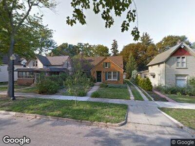
211 W 11th St Holland, MI 49423
Historic District NeighborhoodEstimated Value: $342,527 - $516,000
3
Beds
3
Baths
2,360
Sq Ft
$166/Sq Ft
Est. Value
About This Home
This home is located at 211 W 11th St, Holland, MI 49423 and is currently estimated at $391,882, approximately $166 per square foot. 211 W 11th St is a home located in Ottawa County with nearby schools including Holland High School, Vanderbilt Charter Academy, and Black River Public School Elementary.
Ownership History
Date
Name
Owned For
Owner Type
Purchase Details
Closed on
Jun 2, 2016
Sold by
Verduin Kathleen and Workman Leslie John
Bought by
Verduin Kathleen
Current Estimated Value
Purchase Details
Closed on
Nov 20, 2000
Sold by
O'Farrell Desmond J
Bought by
Verduin Kathleen
Purchase Details
Closed on
Aug 26, 1996
Sold by
O'Farrell Desmond J
Bought by
O'Farrell Desmond J
Purchase Details
Closed on
Sep 30, 1991
Sold by
O'Farrell Desmond J
Create a Home Valuation Report for This Property
The Home Valuation Report is an in-depth analysis detailing your home's value as well as a comparison with similar homes in the area
Home Values in the Area
Average Home Value in this Area
Purchase History
| Date | Buyer | Sale Price | Title Company |
|---|---|---|---|
| Verduin Kathleen | -- | Attorney | |
| Verduin Kathleen | $150,000 | -- | |
| O'Farrell Desmond J | -- | -- | |
| -- | $73,500 | -- |
Source: Public Records
Mortgage History
| Date | Status | Borrower | Loan Amount |
|---|---|---|---|
| Open | Kathleen | $10,000 | |
| Open | Kathleen | $115,000 |
Source: Public Records
Tax History Compared to Growth
Tax History
| Year | Tax Paid | Tax Assessment Tax Assessment Total Assessment is a certain percentage of the fair market value that is determined by local assessors to be the total taxable value of land and additions on the property. | Land | Improvement |
|---|---|---|---|---|
| 2024 | $4,699 | $141,500 | $0 | $0 |
| 2023 | $4,530 | $130,800 | $0 | $0 |
| 2022 | $4,326 | $127,500 | $0 | $0 |
| 2021 | $4,207 | $128,700 | $0 | $0 |
| 2020 | $4,199 | $129,100 | $0 | $0 |
| 2019 | $4,233 | $116,200 | $0 | $0 |
| 2018 | $3,981 | $110,200 | $0 | $0 |
| 2017 | $3,862 | $110,200 | $0 | $0 |
| 2016 | $3,862 | $109,200 | $0 | $0 |
| 2015 | $3,741 | $101,900 | $0 | $0 |
| 2014 | $3,741 | $98,600 | $0 | $0 |
Source: Public Records
Map
Nearby Homes
- 208 W 10th St
- 176 W 10th St
- 186 W 12th St
- 358 Maple Ave
- 88 W 12th St
- 316 W 13th St
- 70 W 12th St
- 21 W 7th St
- 326 W 15th St
- 98 W 16th St
- 159 S River Ave Unit 401
- 159 S River Ave Unit 306
- 159 S River Ave Unit 403
- 159 S River Ave Unit 307
- 159 S River Ave Unit 502
- 159 S River Ave Unit 504
- 159 S River Ave Unit 406
- 99 W 18th St
- 141 Central Ave Unit 110
- 29 E 6th St Unit 314