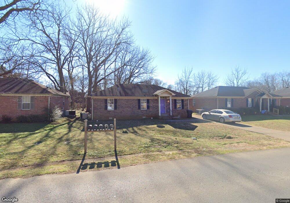
211 W Lokey Ave Murfreesboro, TN 37130
Estimated Value: $280,414 - $383,000
--
Bed
2
Baths
1,100
Sq Ft
$283/Sq Ft
Est. Value
About This Home
This home is located at 211 W Lokey Ave, Murfreesboro, TN 37130 and is currently estimated at $311,104, approximately $282 per square foot. 211 W Lokey Ave is a home located in Rutherford County with nearby schools including Mitchell-Neilson Elementary, Siegel Middle School, and Siegel High School.
Ownership History
Date
Name
Owned For
Owner Type
Purchase Details
Closed on
Apr 12, 2017
Sold by
Rhodes and Womack
Bought by
Criswell David and Criswell Kathleen W
Current Estimated Value
Home Financials for this Owner
Home Financials are based on the most recent Mortgage that was taken out on this home.
Original Mortgage
$1,455,000
Outstanding Balance
$1,207,116
Interest Rate
4.1%
Mortgage Type
Purchase Money Mortgage
Estimated Equity
-$896,012
Purchase Details
Closed on
Aug 15, 2012
Sold by
Rhodes Drew A Jean A
Bought by
Rhodes Womack
Create a Home Valuation Report for This Property
The Home Valuation Report is an in-depth analysis detailing your home's value as well as a comparison with similar homes in the area
Home Values in the Area
Average Home Value in this Area
Purchase History
| Date | Buyer | Sale Price | Title Company |
|---|---|---|---|
| Criswell David | $805,000 | None Available | |
| Rhodes Womack | -- | -- |
Source: Public Records
Mortgage History
| Date | Status | Borrower | Loan Amount |
|---|---|---|---|
| Open | Criswell David | $1,455,000 |
Source: Public Records
Tax History Compared to Growth
Tax History
| Year | Tax Paid | Tax Assessment Tax Assessment Total Assessment is a certain percentage of the fair market value that is determined by local assessors to be the total taxable value of land and additions on the property. | Land | Improvement |
|---|---|---|---|---|
| 2025 | $1,589 | $56,175 | $13,750 | $42,425 |
| 2024 | $1,589 | $56,175 | $13,750 | $42,425 |
| 2023 | $1,054 | $56,175 | $13,750 | $42,425 |
| 2022 | $908 | $56,175 | $13,750 | $42,425 |
| 2021 | $779 | $35,100 | $8,750 | $26,350 |
| 2020 | $779 | $35,100 | $8,750 | $26,350 |
| 2019 | $779 | $35,100 | $8,750 | $26,350 |
| 2018 | $1,070 | $35,100 | $0 | $0 |
| 2017 | $987 | $25,400 | $0 | $0 |
| 2016 | $987 | $25,400 | $0 | $0 |
| 2015 | $987 | $25,400 | $0 | $0 |
| 2014 | $632 | $25,400 | $0 | $0 |
| 2013 | -- | $25,200 | $0 | $0 |
Source: Public Records
Map
Nearby Homes
- 904 N Maple St
- 906 N Maple St
- 814 N Church St
- 717 N Church St
- 1019 N Maple St Unit 2D
- 804 N Academy St
- 513 N Maple St
- 1007 Grantland Ave
- 1107 Owen Layne Dr
- 1116 Owen Layne Dr
- 608 Lynn St
- 412 N Church St
- 1006 Jones Blvd
- 422 N Academy St
- 428 Forrest St
- 446 Roberts St
- 301 Kingwood Dr
- 725 N Highland Ave
- 225 N Academy St
- 418 Winfrey Dr
- 207 W Lokey Ave
- 215 W Lokey Ave
- 841 N Maple St
- 219 W Lokey Ave
- 203 W Lokey Ave
- 738 N Walnut St
- 742 N Walnut St
- 829 N Maple St
- 206 W Lokey Ave
- 210 W Lokey Ave
- 734 N Walnut St
- 214 W Lokey Ave
- 905 N Maple St
- 737 N Walnut St
- 848 N Maple St
- 830 N Maple St
- 913 N Maple St
- 913 N Maple St Unit B
- 913 N Maple St Unit A
- 850 N Maple St