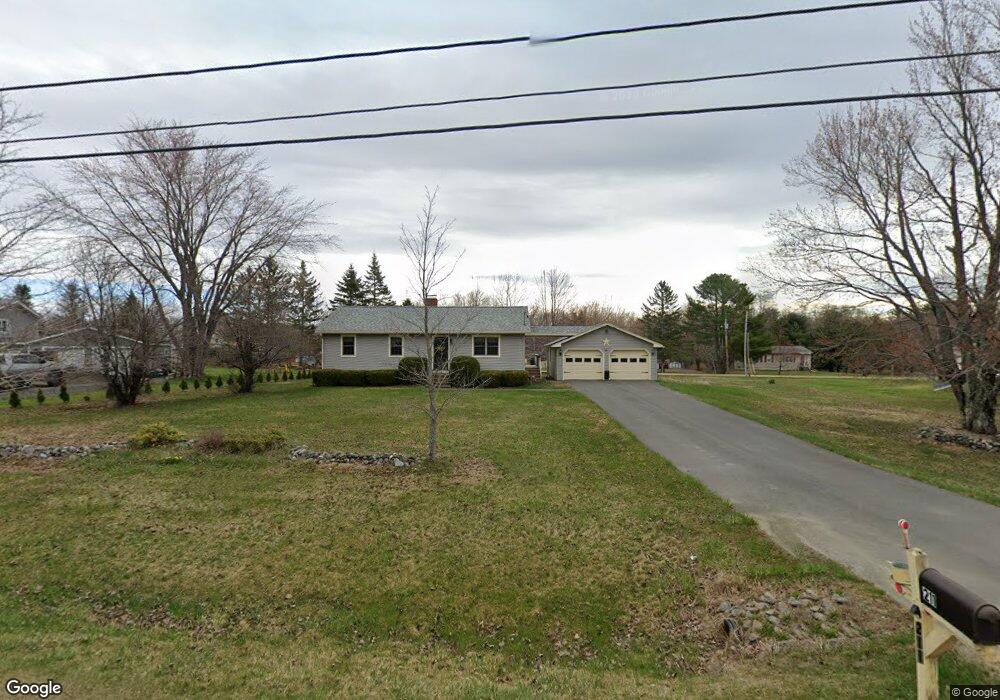
211 Williams Rd Newport, ME 04953
Estimated Value: $253,000 - $298,000
3
Beds
1
Bath
960
Sq Ft
$291/Sq Ft
Est. Value
About This Home
This home is located at 211 Williams Rd, Newport, ME 04953 and is currently estimated at $279,690, approximately $291 per square foot. 211 Williams Rd is a home located in Penobscot County with nearby schools including Sebasticook Valley Elementary School and Nokomis Regional Middle School/High School.
Ownership History
Date
Name
Owned For
Owner Type
Purchase Details
Closed on
Dec 7, 2010
Sold by
Grandshaw Joan T
Bought by
Grandshaw Richard E
Current Estimated Value
Purchase Details
Closed on
Nov 5, 2008
Sold by
Dorman Gary R and Dorman Cynthia E
Bought by
Grandshaw Richard E and Grandshaw Joan T
Home Financials for this Owner
Home Financials are based on the most recent Mortgage that was taken out on this home.
Original Mortgage
$78,400
Interest Rate
6.08%
Mortgage Type
Purchase Money Mortgage
Create a Home Valuation Report for This Property
The Home Valuation Report is an in-depth analysis detailing your home's value as well as a comparison with similar homes in the area
Home Values in the Area
Average Home Value in this Area
Purchase History
| Date | Buyer | Sale Price | Title Company |
|---|---|---|---|
| Grandshaw Richard E | -- | -- | |
| Grandshaw Richard E | -- | -- |
Source: Public Records
Mortgage History
| Date | Status | Borrower | Loan Amount |
|---|---|---|---|
| Previous Owner | Grandshaw Richard E | $10,000 | |
| Previous Owner | Grandshaw Richard E | $78,400 |
Source: Public Records
Tax History Compared to Growth
Tax History
| Year | Tax Paid | Tax Assessment Tax Assessment Total Assessment is a certain percentage of the fair market value that is determined by local assessors to be the total taxable value of land and additions on the property. | Land | Improvement |
|---|---|---|---|---|
| 2024 | $2,928 | $167,300 | $31,500 | $135,800 |
| 2023 | $2,549 | $156,400 | $29,500 | $126,900 |
| 2022 | $2,423 | $123,600 | $23,300 | $100,300 |
| 2021 | $2,433 | $118,100 | $22,200 | $95,900 |
| 2020 | $2,751 | $115,900 | $21,800 | $94,100 |
| 2019 | $2,330 | $109,400 | $20,600 | $88,800 |
| 2018 | $2,330 | $109,400 | $20,600 | $88,800 |
| 2017 | $2,188 | $109,400 | $20,600 | $88,800 |
| 2016 | $2,122 | $109,400 | $20,600 | $88,800 |
| 2015 | $1,958 | $109,400 | $20,600 | $88,800 |
| 2014 | $1,882 | $109,400 | $20,600 | $88,800 |
Source: Public Records
Map
Nearby Homes
- Lot 4 Moosehead Trail
- Lot 2 Golf Course Cameo Sub Rd
- 315 Golf Course Rd
- 53 Hope Rd
- Lot # 31 Hope Rd
- 37 Loon Dr
- 16 Libby Hill Rd
- 107 Barrows Point Rd
- 49 North St
- 3 Canadian Geese Dr
- 35 North St
- 84 Hicks Pond Rd
- 265 Grove St
- 8 Grove St
- 22 Shaw St
- 277 Grove St
- 10 Sheridan St
- 8 Hicks Pond Rd
- 147 Main St
- 16 Pleasant St
- 217 Williams Rd
- 205 Williams Rd
- 18 Nokomis Way
- 12 Nokomis Way
- 223 Williams Rd
- 22 Nokomis Way
- 162 Williams Rd
- 15 Fernald Rd
- 199 Williams Rd
- 28 Nokomis Way
- 231 Williams Rd
- 21 Fernald Rd
- 193 Williams Rd
- 4620 Fernald Rd
- 32 Nokomis Way
- 16 Fernald Rd
- 22 Fernald Rd
- 4685 Fernald Rd
- 187 Williams Rd
- 237 Williams Rd