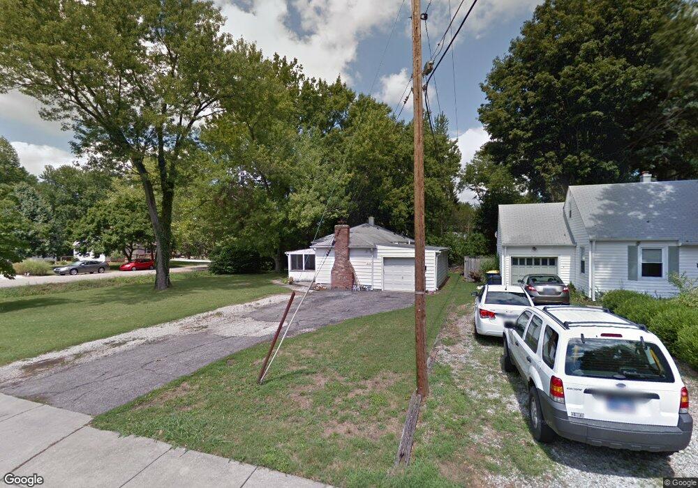
2110 Douglas Rd Indianapolis, IN 46220
Broad Ripple NeighborhoodEstimated Value: $301,000 - $322,000
3
Beds
--
Bath
1,614
Sq Ft
$192/Sq Ft
Est. Value
About This Home
This home is located at 2110 Douglas Rd, Indianapolis, IN 46220 and is currently estimated at $310,028, approximately $192 per square foot. 2110 Douglas Rd is a home located in Marion County with nearby schools including Clearwater Elementary School, Eastwood Middle School, and North Central High School.
Ownership History
Date
Name
Owned For
Owner Type
Purchase Details
Closed on
Jul 23, 2025
Sold by
Blair Christopher L and Blair Leah M
Bought by
Blair Christopher L
Current Estimated Value
Purchase Details
Closed on
Jan 31, 2019
Sold by
Blair Christopher L
Bought by
Blair Christopher L and Blair Leah M
Home Financials for this Owner
Home Financials are based on the most recent Mortgage that was taken out on this home.
Original Mortgage
$134,400
Interest Rate
4.5%
Mortgage Type
New Conventional
Purchase Details
Closed on
Jun 30, 2005
Sold by
Kaiser Adam
Bought by
Blair Christopher L
Home Financials for this Owner
Home Financials are based on the most recent Mortgage that was taken out on this home.
Original Mortgage
$100,500
Interest Rate
6.75%
Mortgage Type
Adjustable Rate Mortgage/ARM
Create a Home Valuation Report for This Property
The Home Valuation Report is an in-depth analysis detailing your home's value as well as a comparison with similar homes in the area
Home Values in the Area
Average Home Value in this Area
Purchase History
| Date | Buyer | Sale Price | Title Company |
|---|---|---|---|
| Blair Christopher L | -- | None Listed On Document | |
| Blair Christopher L | -- | None Available | |
| Blair Christopher L | -- | None Available |
Source: Public Records
Mortgage History
| Date | Status | Borrower | Loan Amount |
|---|---|---|---|
| Previous Owner | Blair Christopher L | $134,400 | |
| Previous Owner | Blair Christopher L | $100,500 |
Source: Public Records
Tax History Compared to Growth
Tax History
| Year | Tax Paid | Tax Assessment Tax Assessment Total Assessment is a certain percentage of the fair market value that is determined by local assessors to be the total taxable value of land and additions on the property. | Land | Improvement |
|---|---|---|---|---|
| 2024 | $2,672 | $218,600 | $42,500 | $176,100 |
| 2023 | $2,672 | $219,400 | $42,500 | $176,900 |
| 2022 | $2,592 | $219,400 | $42,500 | $176,900 |
| 2021 | $2,312 | $177,700 | $24,100 | $153,600 |
| 2020 | $1,909 | $159,100 | $24,100 | $135,000 |
| 2019 | $1,756 | $156,900 | $24,100 | $132,800 |
| 2018 | $1,766 | $160,000 | $24,100 | $135,900 |
| 2017 | $1,603 | $150,800 | $24,100 | $126,700 |
| 2016 | $1,390 | $141,700 | $24,100 | $117,600 |
| 2014 | $1,134 | $137,600 | $24,100 | $113,500 |
| 2013 | $1,099 | $151,000 | $24,100 | $126,900 |
Source: Public Records
Map
Nearby Homes
- 2131 Douglas Rd
- 6343 Maple Dr
- 2028 Burch Dr
- 6322 Douglas Rd
- 2204 Pamela Dr
- 2113 E 65th St
- 2201 E 65th St
- 6306 N Keystone Ave
- 6313 N Tacoma Ave
- 6229 Crittenden Ave
- 6317 N Temple Ave
- 6490 N Rural St
- 6186 Evanston Ave
- 6235 N Temple Ave
- 6170 Crittenden Ave
- 6180 Norwaldo Ave
- 6030 Evanston Ave
- 6223 N Parker Ave
- 6150 N Oxford St
- 6025 Kingsley Dr
- 2120 Douglas Rd
- 2130 Douglas Rd
- 6422 Maple Dr
- 6430 Maple Dr
- 6349 Maple Dr
- 6412 Maple Dr
- 2117 Pamela Dr
- 2140 Douglas Rd
- 2121 Douglas Rd
- 6402 Maple Dr
- 2129 Pamela Dr
- 2135 Pamela Dr
- 6350 Maple Dr
- 6442 Maple Dr
- 2220 Douglas Rd
- 2205 Pamela Dr
- 6337 Maple Dr
- 6342 Burlington Ave
- 6344 Maple Dr
- 6411 Evanston Ave