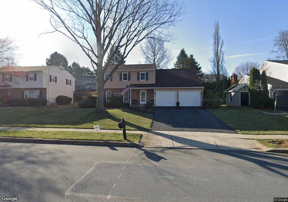
2110 Gring Dr Reading, PA 19610
Whitfield NeighborhoodEstimated Value: $369,633 - $424,000
4
Beds
3
Baths
2,084
Sq Ft
$190/Sq Ft
Est. Value
About This Home
This home is located at 2110 Gring Dr, Reading, PA 19610 and is currently estimated at $396,908, approximately $190 per square foot. 2110 Gring Dr is a home located in Berks County with nearby schools including Spring Ridge Elementary School, Wilson West Middle School, and Wilson High School.
Ownership History
Date
Name
Owned For
Owner Type
Purchase Details
Closed on
Aug 16, 2005
Sold by
Thomas Oommen C and Thomas Leelamma
Bought by
Curran Patrick M and Curran Tresa L
Current Estimated Value
Home Financials for this Owner
Home Financials are based on the most recent Mortgage that was taken out on this home.
Original Mortgage
$238,623
Interest Rate
5.84%
Mortgage Type
VA
Create a Home Valuation Report for This Property
The Home Valuation Report is an in-depth analysis detailing your home's value as well as a comparison with similar homes in the area
Home Values in the Area
Average Home Value in this Area
Purchase History
| Date | Buyer | Sale Price | Title Company |
|---|---|---|---|
| Curran Patrick M | $231,000 | First American Title Ins Co |
Source: Public Records
Mortgage History
| Date | Status | Borrower | Loan Amount |
|---|---|---|---|
| Previous Owner | Curran Patrick M | $238,623 |
Source: Public Records
Tax History
| Year | Tax Paid | Tax Assessment Tax Assessment Total Assessment is a certain percentage of the fair market value that is determined by local assessors to be the total taxable value of land and additions on the property. | Land | Improvement |
|---|---|---|---|---|
| 2025 | $2,351 | $129,000 | $23,700 | $105,300 |
| 2024 | $5,519 | $129,000 | $23,700 | $105,300 |
| 2023 | $5,259 | $129,000 | $23,700 | $105,300 |
| 2022 | $5,130 | $129,000 | $23,700 | $105,300 |
| 2021 | $4,949 | $129,000 | $23,700 | $105,300 |
| 2020 | $4,949 | $129,000 | $23,700 | $105,300 |
| 2019 | $4,809 | $129,000 | $23,700 | $105,300 |
| 2018 | $4,767 | $129,000 | $23,700 | $105,300 |
| 2017 | $4,687 | $129,000 | $23,700 | $105,300 |
Source: Public Records
Map
Nearby Homes
- 12 Kevin Ct
- 2300 Gring Dr
- 2121 Bressler Dr
- 118 Laurel Ct Unit 118B
- 130 Laurel Ct Unit 130B
- 132 Laurel Ct Unit 132A
- 2405 Garden Ln
- 162 Hawthorne Ct
- 37 Dorchester Dr
- 103 Hawthorne Ct
- 112 Grandview Blvd
- 105 Hawthorne Ct
- 101 Robert Rd
- 120 Coventry Ln
- 2133 Fairview St
- 65 Wyomissing Hills Blvd
- 450 Warwick Dr
- 124 Hickory Ln
- 1745 York Rd
- 309 Charleston Ln
- 2112 Gring Dr
- 2108 Gring Dr
- 2111 Buckman Ave
- 2109 Buckman Ave
- 2113 Buckman Ave
- 2106 Gring Dr
- 2113 Gring Dr
- 2107 Buckman Ave
- 2115 Gring Dr
- 2111 Gring Dr
- 2115 Buckman Ave
- 2109 Gring Dr
- 2117 Gring Dr
- 2116 Gring Dr
- 2104 Gring Dr
- 2105 Buckman Ave
- 2117 Buckman Ave
- 2112 Buckman Ave
- 2108 Buckman Ave
- 2114 Buckman Ave
Your Personal Tour Guide
Ask me questions while you tour the home.