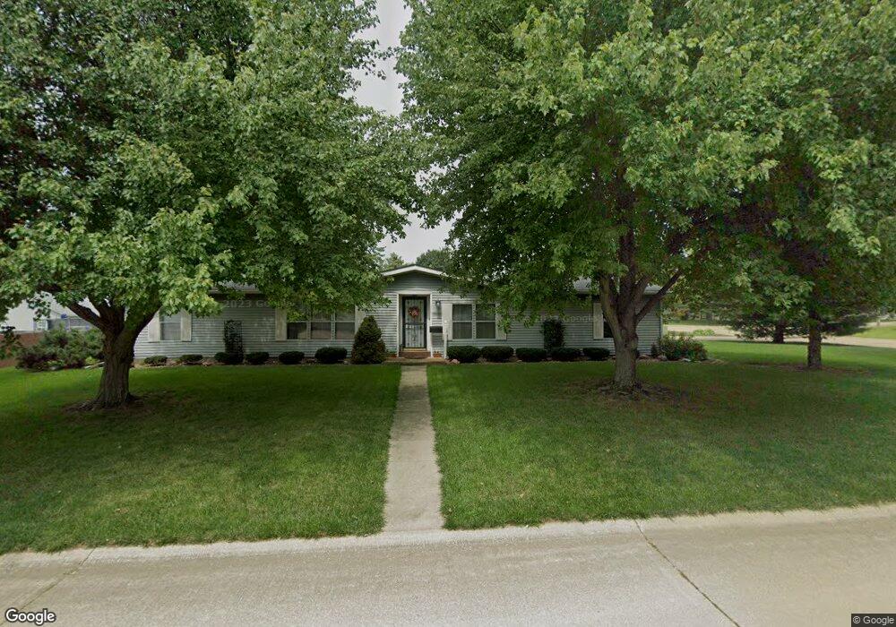
2110 Pheasant Ridge Rd Mahomet, IL 61853
Estimated Value: $221,000 - $272,000
--
Bed
3
Baths
1,996
Sq Ft
$120/Sq Ft
Est. Value
About This Home
This home is located at 2110 Pheasant Ridge Rd, Mahomet, IL 61853 and is currently estimated at $239,712, approximately $120 per square foot. 2110 Pheasant Ridge Rd is a home located in Champaign County with nearby schools including Middletown Prairie Elementary, Mahomet Christian School, and First School.
Ownership History
Date
Name
Owned For
Owner Type
Purchase Details
Closed on
Apr 14, 2020
Sold by
Lambright Larry G and Lambright Diane
Bought by
Lambright Larry G and Lambright Diane
Current Estimated Value
Purchase Details
Closed on
May 3, 2004
Sold by
Lambright Lawrence and Lambright Diane
Bought by
Lambright Larry G and Lambright Diane
Home Financials for this Owner
Home Financials are based on the most recent Mortgage that was taken out on this home.
Original Mortgage
$50,000
Interest Rate
5.5%
Mortgage Type
New Conventional
Create a Home Valuation Report for This Property
The Home Valuation Report is an in-depth analysis detailing your home's value as well as a comparison with similar homes in the area
Home Values in the Area
Average Home Value in this Area
Purchase History
| Date | Buyer | Sale Price | Title Company |
|---|---|---|---|
| Lambright Larry G | -- | None Available | |
| Lambright Larry G | -- | Allied Title Services |
Source: Public Records
Mortgage History
| Date | Status | Borrower | Loan Amount |
|---|---|---|---|
| Closed | Lambright Larry G | $50,000 |
Source: Public Records
Tax History Compared to Growth
Tax History
| Year | Tax Paid | Tax Assessment Tax Assessment Total Assessment is a certain percentage of the fair market value that is determined by local assessors to be the total taxable value of land and additions on the property. | Land | Improvement |
|---|---|---|---|---|
| 2024 | $2,837 | $56,030 | $13,020 | $43,010 |
| 2023 | $2,837 | $50,940 | $11,840 | $39,100 |
| 2022 | $2,579 | $46,950 | $10,910 | $36,040 |
| 2021 | $2,353 | $44,370 | $10,310 | $34,060 |
| 2020 | $2,353 | $43,630 | $10,140 | $33,490 |
| 2019 | $2,284 | $42,940 | $9,980 | $32,960 |
| 2018 | $2,206 | $42,020 | $9,770 | $32,250 |
| 2017 | $2,086 | $40,010 | $9,300 | $30,710 |
| 2016 | $2,078 | $40,010 | $9,300 | $30,710 |
| 2015 | $2,088 | $40,010 | $9,300 | $30,710 |
| 2014 | $2,028 | $39,340 | $9,140 | $30,200 |
| 2013 | $2,022 | $39,340 | $9,140 | $30,200 |
Source: Public Records
Map
Nearby Homes
- 2109 Mallard Dr
- 1201 Robin Rd
- 1105 Olen Dr
- 1101 James Ct
- 2302 Pheasant Ridge Rd
- Douglas 1804 Plan at Ridge Creek
- Ridgecrest 1919 Plan at Ridge Creek
- Wellington Plan at Ridge Creek
- Eldridge Plan at Ridge Creek
- Ridgeland Plan at Ridge Creek
- Greenbriar Plan at Ridge Creek
- Ridgecrest 1865 Plan at Ridge Creek
- Douglas 1984 Plan at Ridge Creek
- 2112 E Slade Ln
- 2213 Olen Dr
- 166 Randolph St
- 1010 Parkview Dr
- 289 Du Page St
- 1203 Marianne Ct
- 612 Bureau Ct
- 1213 Fox Ct
- 2108 Pheasant Ridge Rd
- 1214 Robin Rd
- 2109 Pheasant Ridge Rd
- 2111 Pheasant Ridge Rd
- 2112 Pheasant Ridge Rd
- 1208 Robin Rd
- 1215 Fox Ct
- 1216 Robin Rd
- 1212 Fox Ct
- 2113 Pheasant Ridge Rd
- 2110 Mallard Dr
- 1214 Fox Ct
- 2109 Robin Rd
- 2106 Mallard Dr
- 2112 Mallard Dr
- 1211 Robin Rd
- 1209 Robin Rd
- 1213 Robin Rd
- 2111 Robin Rd