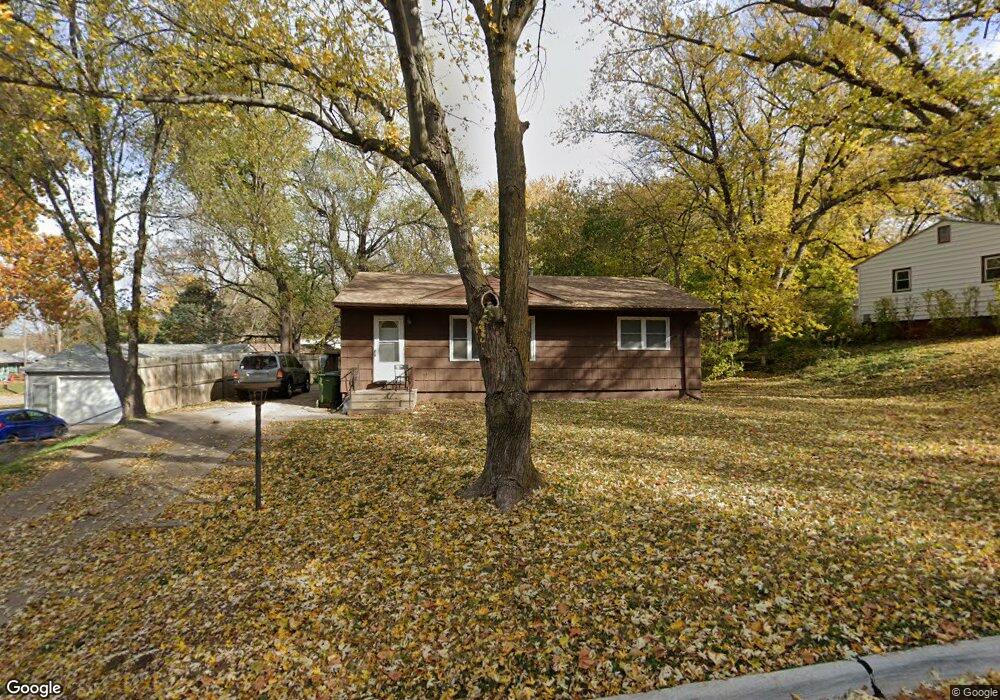
2110 Power Dr Bellevue, NE 68005
Estimated Value: $210,000 - $221,000
5
Beds
3
Baths
1,716
Sq Ft
$126/Sq Ft
Est. Value
About This Home
This home is located at 2110 Power Dr, Bellevue, NE 68005 and is currently estimated at $215,405, approximately $125 per square foot. 2110 Power Dr is a home located in Sarpy County with nearby schools including Avery Elementary School, Logan Fontenelle Middle School, and Bellevue East High School.
Ownership History
Date
Name
Owned For
Owner Type
Purchase Details
Closed on
Oct 29, 2002
Sold by
Bro Brian T and Bro Robin H
Bought by
Campbell Mechere E
Current Estimated Value
Home Financials for this Owner
Home Financials are based on the most recent Mortgage that was taken out on this home.
Original Mortgage
$89,200
Outstanding Balance
$36,472
Interest Rate
5.95%
Estimated Equity
$178,933
Purchase Details
Closed on
Nov 12, 1999
Sold by
Commercial Federal Bank
Bought by
Bro Brian T and Bro Robin H
Create a Home Valuation Report for This Property
The Home Valuation Report is an in-depth analysis detailing your home's value as well as a comparison with similar homes in the area
Home Values in the Area
Average Home Value in this Area
Purchase History
| Date | Buyer | Sale Price | Title Company |
|---|---|---|---|
| Campbell Mechere E | $90,000 | -- | |
| Bro Brian T | $65,000 | Tower Title & Escrow Co |
Source: Public Records
Mortgage History
| Date | Status | Borrower | Loan Amount |
|---|---|---|---|
| Open | Campbell Mechere E | $89,200 |
Source: Public Records
Tax History
| Year | Tax Paid | Tax Assessment Tax Assessment Total Assessment is a certain percentage of the fair market value that is determined by local assessors to be the total taxable value of land and additions on the property. | Land | Improvement |
|---|---|---|---|---|
| 2025 | $3,141 | $193,783 | $31,000 | $162,783 |
| 2024 | $3,515 | $180,193 | $27,000 | $153,193 |
| 2023 | $3,515 | $166,459 | $26,000 | $140,459 |
| 2022 | $3,402 | $158,068 | $26,000 | $132,068 |
| 2021 | $3,021 | $138,883 | $26,000 | $112,883 |
| 2020 | $2,810 | $128,770 | $17,000 | $111,770 |
| 2019 | $2,597 | $119,775 | $17,000 | $102,775 |
| 2018 | $2,419 | $114,571 | $17,000 | $97,571 |
| 2017 | $2,290 | $107,712 | $17,000 | $90,712 |
| 2016 | $2,227 | $107,053 | $17,000 | $90,053 |
| 2015 | $2,211 | $106,891 | $17,000 | $89,891 |
| 2014 | $2,188 | $105,122 | $17,000 | $88,122 |
| 2012 | -- | $94,704 | $17,000 | $77,704 |
Source: Public Records
Map
Nearby Homes
- 1705 Gregg Rd
- 1811 Brenda Dr
- 1104 Thurston Ave
- 10102 S 14th St
- 1104 Bruce Cir
- 612 Nob Hill Terrace
- 1206 Skyview Dr
- LOT 11A1B Tbd
- 1217 Wilroy Rd
- 2006 Pleasantview Ln
- 1314 Hansen Ave
- 1302 Wilroy Rd Unit 1
- 1404 Thomas Dr
- 9804 S 20th St
- 703 Vernon Ave
- 2804 Greensboro Ave
- tbd Ridgewood Dr
- 1103 Sunny Ln
- 2015 Geri Cir
- 709 Sherman Dr