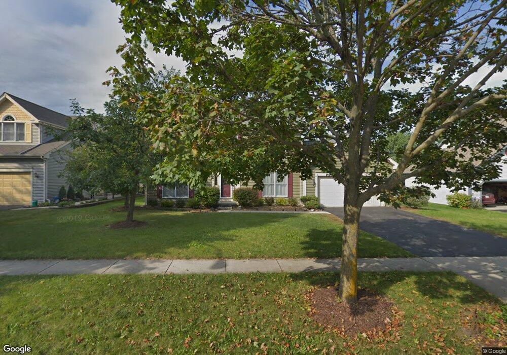
2110 Spaulding Ave West Dundee, IL 60118
Estimated Value: $415,750 - $477,000
4
Beds
--
Bath
2,346
Sq Ft
$191/Sq Ft
Est. Value
About This Home
This home is located at 2110 Spaulding Ave, West Dundee, IL 60118 and is currently estimated at $448,438, approximately $191 per square foot. 2110 Spaulding Ave is a home located in Kane County with nearby schools including Dundee Highlands Elementary School, Dundee Middle School, and Harry D Jacobs High School.
Ownership History
Date
Name
Owned For
Owner Type
Purchase Details
Closed on
Jan 10, 2004
Sold by
Ponder James K
Bought by
Ponder Angela S
Current Estimated Value
Purchase Details
Closed on
Mar 9, 2001
Sold by
Campbell John R and Campbell Juli H
Bought by
Ponder James K and Ponder Angela S
Home Financials for this Owner
Home Financials are based on the most recent Mortgage that was taken out on this home.
Original Mortgage
$195,200
Outstanding Balance
$71,663
Interest Rate
7.13%
Estimated Equity
$376,775
Create a Home Valuation Report for This Property
The Home Valuation Report is an in-depth analysis detailing your home's value as well as a comparison with similar homes in the area
Home Values in the Area
Average Home Value in this Area
Purchase History
| Date | Buyer | Sale Price | Title Company |
|---|---|---|---|
| Ponder Angela S | -- | -- | |
| Ponder James K | $244,000 | -- |
Source: Public Records
Mortgage History
| Date | Status | Borrower | Loan Amount |
|---|---|---|---|
| Open | Ponder James K | $195,200 | |
| Closed | Ponder James K | $36,600 |
Source: Public Records
Tax History
| Year | Tax Paid | Tax Assessment Tax Assessment Total Assessment is a certain percentage of the fair market value that is determined by local assessors to be the total taxable value of land and additions on the property. | Land | Improvement |
|---|---|---|---|---|
| 2024 | $9,380 | $123,074 | $25,730 | $97,344 |
| 2023 | $8,792 | $110,738 | $23,151 | $87,587 |
| 2022 | $8,637 | $104,038 | $23,151 | $80,887 |
| 2021 | $8,334 | $98,232 | $21,859 | $76,373 |
| 2020 | $8,180 | $96,024 | $21,368 | $74,656 |
| 2019 | $7,916 | $91,156 | $20,285 | $70,871 |
| 2018 | $8,287 | $92,894 | $19,883 | $73,011 |
| 2017 | $7,892 | $86,898 | $18,600 | $68,298 |
| 2016 | $7,637 | $83,248 | $23,811 | $59,437 |
| 2015 | -- | $78,006 | $22,312 | $55,694 |
| 2014 | -- | $75,852 | $21,696 | $54,156 |
| 2013 | -- | $78,174 | $22,360 | $55,814 |
Source: Public Records
Map
Nearby Homes
- 817 Lindsay Ln
- 809 Lindsay Ln
- 815 Lindsay Ln
- 850 Tartans Dr
- 1107 Pember Cir Unit 2
- 1146 Pember Cir Unit 2
- 822 Lindsay Ln
- 816 Lindsay Ln
- 818 Lindsay Ln
- 1811 W Main St
- 801 Lindsay Ln
- 821 Lindsay Ln
- 820 Lindsay Ln
- 804 Lindsay Ln
- 808 Lindsay Ln
- 810 Lindsay Ln
- 1023 Shagbark Ln
- 1031 Shagbark Ln
- 1601 Higgins Rd
- 805 Lindsay Ln
- 2114 Spaulding Ave
- 2068 Spaulding Ave
- 948 Pember Cir
- 936 Pember Cir
- 2128 Spaulding Ave Unit 2
- 956 Pember Cir
- 2054 Spaulding Ave
- 2109 Spaulding Ave Unit 2
- 2113 Spaulding Ave
- 2065 Spaulding Ave
- 922 Pember Cir
- 964 Pember Cir
- 2134 Spaulding Ave
- 2046 Spaulding Ave
- 2127 Spaulding Ave
- 2061 Spaulding Ave
- 2139 Spaulding Ave
- 2038 Spaulding Ave
- 939 Pember Cir
- 918 Pember Cir Unit 2
Your Personal Tour Guide
Ask me questions while you tour the home.