Estimated Value: $152,000 - $158,620
3
Beds
2
Baths
1,190
Sq Ft
$131/Sq Ft
Est. Value
About This Home
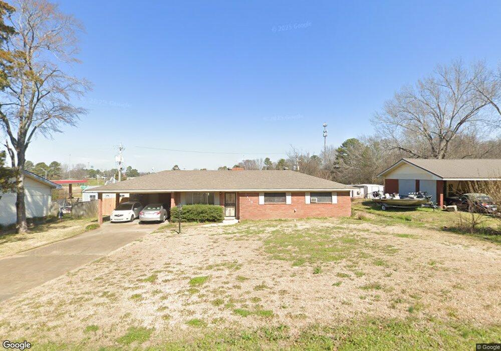
This home is located at 2110 Upper Dr, Pearl, MS 39208 and is currently estimated at $155,655, approximately $130 per square foot. 2110 Upper Dr is a home located in Rankin County with nearby schools including Pearl Lower Elementary School, Pearl Upper School, and Northside Elementary School.
Ownership History
Date
Name
Owned For
Owner Type
Purchase Details
Closed on
Mar 26, 2021
Sold by
Robinson Properties Llc
Bought by
Horne Maxine L
Current Estimated Value
Home Financials for this Owner
Home Financials are based on the most recent Mortgage that was taken out on this home.
Original Mortgage
$166,500
Outstanding Balance
$147,632
Interest Rate
2.73%
Mortgage Type
Purchase Money Mortgage
Estimated Equity
$8,023
Purchase Details
Closed on
Aug 18, 2017
Sold by
Servisolutions A Department Of Alabama H
Bought by
Horne Maxine
Home Financials for this Owner
Home Financials are based on the most recent Mortgage that was taken out on this home.
Original Mortgage
$34,267
Interest Rate
3.96%
Mortgage Type
Unknown
Purchase Details
Closed on
Jun 15, 2015
Sold by
T & J Investments Llc
Bought by
Rhone Timothy J
Home Financials for this Owner
Home Financials are based on the most recent Mortgage that was taken out on this home.
Original Mortgage
$3,240
Interest Rate
3.92%
Mortgage Type
New Conventional
Purchase Details
Closed on
Jun 21, 2012
Sold by
Deutsche Bank National Trust Company
Bought by
Jones Terri R
Create a Home Valuation Report for This Property
The Home Valuation Report is an in-depth analysis detailing your home's value as well as a comparison with similar homes in the area
Home Values in the Area
Average Home Value in this Area
Purchase History
| Date | Buyer | Sale Price | Title Company |
|---|---|---|---|
| Horne Maxine L | -- | None Available | |
| Horne Maxine | -- | None Available | |
| Rhone Timothy J | -- | Title&Escrow Services Inc | |
| Jones Terri R | $41,500 | Title & Escorw Services Inc. |
Source: Public Records
Mortgage History
| Date | Status | Borrower | Loan Amount |
|---|---|---|---|
| Open | Horne Maxine L | $166,500 | |
| Previous Owner | Horne Maxine | $34,267 | |
| Previous Owner | Rhone Timothy J | $3,240 | |
| Previous Owner | Rhone Timothy J | $108,007 |
Source: Public Records
Tax History
| Year | Tax Paid | Tax Assessment Tax Assessment Total Assessment is a certain percentage of the fair market value that is determined by local assessors to be the total taxable value of land and additions on the property. | Land | Improvement |
|---|---|---|---|---|
| 2025 | $1,869 | $14,669 | $0 | $0 |
| 2024 | $1,869 | $14,669 | $0 | $0 |
| 2023 | $1,441 | $11,262 | $0 | $0 |
| 2022 | $1,424 | $11,262 | $0 | $0 |
| 2021 | $649 | $7,508 | $0 | $0 |
| 2020 | $649 | $7,508 | $0 | $0 |
| 2019 | $599 | $6,823 | $0 | $0 |
| 2018 | $874 | $6,823 | $0 | $0 |
| 2017 | $874 | $6,823 | $0 | $0 |
| 2016 | $886 | $6,913 | $0 | $0 |
| 2015 | $1,277 | $9,966 | $0 | $0 |
| 2014 | $1,277 | $9,966 | $0 | $0 |
| 2013 | -- | $10,128 | $0 | $0 |
Source: Public Records
Map
Nearby Homes
- 2069 Murray Dr
- 0 River Ridge Pkwy Unit 4145485
- 305 Lionel Rd
- 411 Poplar Blvd
- 2051 Melvin Rd
- 2372 Upper Dr
- 2389 Napoleon Ave
- 0 White Blvd Unit 4128485
- 2009 Melvin Rd
- 1905 Gloria Dr
- 1904 Edwin Ave
- 2384 Harahan Rd
- 312 E Magnolia Place
- 205 W Pine Dr
- 116 Oak Park Dr
- 1912 Carolyn Ln
- 1923 Carolyn Ln
- 517 Vista Pointe Dr
- 527 Vista Pointe Dr
- 526 Vista Pointe Dr
- 2118 Upper Dr
- 2109 Upper Dr
- 2117 Upper Dr
- 2126 Upper Dr
- 2125 Upper Dr
- 432 S Pearson Rd
- 2134 Upper Dr
- 2104 Napoleon Ave
- 2112 Napoleon Ave
- 2133 Upper Dr
- 2120 Napoleon Ave
- 2128 Napoleon Ave
- 2141 Upper Dr
- 427 Ruston St
- 2136 Napoleon Ave
- 2142 Upper Dr
- 2111 Napoleon Ave
- 456 S Pearson Rd
- 441 Ruston St
- 2119 Napoleon Ave
Your Personal Tour Guide
Ask me questions while you tour the home.