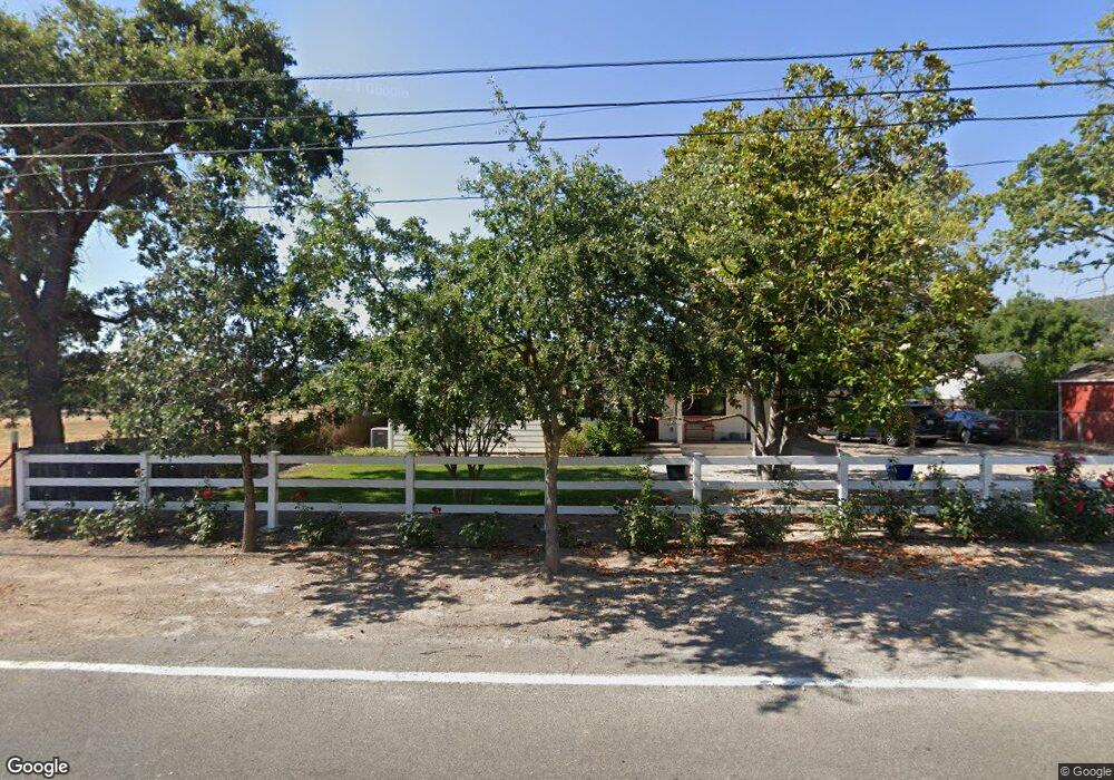
21100 Burndale Rd Sonoma, CA 95476
Estimated Value: $1,317,000 - $1,620,506
2
Beds
1
Bath
1,351
Sq Ft
$1,096/Sq Ft
Est. Value
About This Home
This home is located at 21100 Burndale Rd, Sonoma, CA 95476 and is currently estimated at $1,480,127, approximately $1,095 per square foot. 21100 Burndale Rd is a home located in Sonoma County with nearby schools including Prestwood Elementary School, Adele Harrison Middle School, and Creekside High School.
Ownership History
Date
Name
Owned For
Owner Type
Purchase Details
Closed on
Apr 26, 2018
Sold by
Robertson Sarah C Vaughn and Robertson Michel
Bought by
Robertson Sarah Vaughn and Robertson Michael T
Current Estimated Value
Purchase Details
Closed on
Feb 24, 2016
Sold by
Manges Elva Louise
Bought by
Robertson Sarah C Vaughn and Robertson Michael T
Home Financials for this Owner
Home Financials are based on the most recent Mortgage that was taken out on this home.
Original Mortgage
$639,200
Outstanding Balance
$510,417
Interest Rate
3.92%
Mortgage Type
New Conventional
Estimated Equity
$969,710
Purchase Details
Closed on
Dec 28, 2000
Sold by
Manges Willie H and Manges Elva L
Bought by
Manges Willie H and Manges Elva Louise
Create a Home Valuation Report for This Property
The Home Valuation Report is an in-depth analysis detailing your home's value as well as a comparison with similar homes in the area
Home Values in the Area
Average Home Value in this Area
Purchase History
| Date | Buyer | Sale Price | Title Company |
|---|---|---|---|
| Robertson Sarah Vaughn | -- | None Available | |
| Robertson Sarah C Vaughn | $799,000 | First American Title Company | |
| Manges Willie H | -- | -- |
Source: Public Records
Mortgage History
| Date | Status | Borrower | Loan Amount |
|---|---|---|---|
| Open | Robertson Sarah C Vaughn | $639,200 |
Source: Public Records
Tax History Compared to Growth
Tax History
| Year | Tax Paid | Tax Assessment Tax Assessment Total Assessment is a certain percentage of the fair market value that is determined by local assessors to be the total taxable value of land and additions on the property. | Land | Improvement |
|---|---|---|---|---|
| 2025 | $11,693 | $1,015,482 | $473,516 | $541,966 |
| 2024 | $11,693 | $995,572 | $464,232 | $531,340 |
| 2023 | $11,693 | $976,052 | $455,130 | $520,922 |
| 2022 | $11,271 | $956,914 | $446,206 | $510,708 |
| 2021 | $11,056 | $938,152 | $437,457 | $500,695 |
| 2020 | $11,053 | $928,533 | $432,972 | $495,561 |
| 2019 | $10,823 | $910,328 | $424,483 | $485,845 |
| 2018 | $10,562 | $892,479 | $416,160 | $476,319 |
| 2017 | $9,765 | $814,980 | $408,000 | $406,980 |
| 2016 | $989 | $72,881 | $14,488 | $58,393 |
| 2015 | $966 | $71,787 | $14,271 | $57,516 |
| 2014 | $952 | $70,382 | $13,992 | $56,390 |
Source: Public Records
Map
Nearby Homes
- 21278 Burndale Rd
- 21925 Hyde Rd
- 2710 Knob Hill Rd
- 2560 Knob Hill Rd
- 21000 8th St E
- 21200 8th St E
- 0 8th St E Unit 325006549
- 1025 Napa Rd
- 2034 Fremont Dr
- 2575 Fremont Dr
- 19539 Arrowhead Mountain Rd
- 21200 Silva Rd
- 20780 8th St E
- 20742 Denmark Ct
- 570 E Watmaugh Rd
- 1549 E Napa St
- 20018 Saint Germain Ln
- 3556 Wood Valley Rd
- 20464 5th St E
- 20685 5th St E
- 21150 Burndale Rd
- 21282 Burndale Rd
- 21040 Peary Ave
- 21101 Burndale Rd
- 21131 Burndale Rd
- 20950 Burndale Rd
- 21005 Peary Ave
- 20930 Burndale Rd
- 21045 Peary Ave
- 21117 Burndale Rd
- 20910 Burndale Rd
- 21057 Peary Ave
- 20890 Burndale Rd
- 21191 Burndale Rd
- 20850 Burndale Rd
- 21205 Burndale Rd
- 2187 Napa Rd
- 20838 Burndale Rd
- 21369 Burndale Rd
- 20857 Burndale Rd