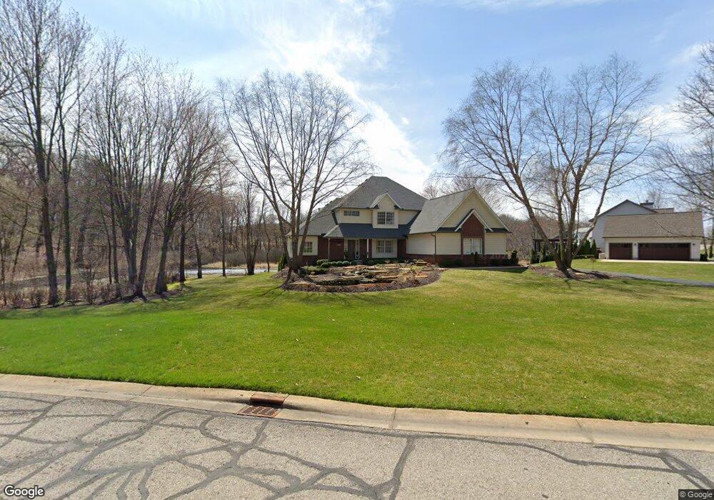
2111 Sundance Ridge Unit 12 Howell, MI 48843
Estimated Value: $581,000 - $701,000
4
Beds
2
Baths
2,894
Sq Ft
$218/Sq Ft
Est. Value
About This Home
This home is located at 2111 Sundance Ridge Unit 12, Howell, MI 48843 and is currently estimated at $629,811, approximately $217 per square foot. 2111 Sundance Ridge Unit 12 is a home located in Livingston County with nearby schools including Parker Middle School and Howell High School.
Ownership History
Date
Name
Owned For
Owner Type
Purchase Details
Closed on
May 20, 2022
Sold by
Nashar Jeffrey L
Bought by
Nashar Jeffrey L and Nashar Jeffrey L
Current Estimated Value
Purchase Details
Closed on
Oct 19, 2004
Sold by
Micks George B and Micks Marilyn
Bought by
J M H Building Co Llc
Purchase Details
Closed on
Jan 23, 2003
Sold by
Micks George B and Micks Marilyn
Bought by
Micks George B and Micks Marilyn
Purchase Details
Closed on
Jun 30, 2000
Sold by
Pybus Richard K and Pybus Carolyn E
Bought by
Micks George B and Micks Marilyn
Create a Home Valuation Report for This Property
The Home Valuation Report is an in-depth analysis detailing your home's value as well as a comparison with similar homes in the area
Home Values in the Area
Average Home Value in this Area
Purchase History
| Date | Buyer | Sale Price | Title Company |
|---|---|---|---|
| Nashar Jeffrey L | -- | Hubbert James D | |
| J M H Building Co Llc | $74,000 | Philip R Seaver Title Co Inc | |
| Micks George B | -- | Philip R Seaver Title Co Inc | |
| Micks George B | $54,000 | American Title Co |
Source: Public Records
Tax History Compared to Growth
Tax History
| Year | Tax Paid | Tax Assessment Tax Assessment Total Assessment is a certain percentage of the fair market value that is determined by local assessors to be the total taxable value of land and additions on the property. | Land | Improvement |
|---|---|---|---|---|
| 2025 | $2,865 | $291,900 | $0 | $0 |
| 2024 | $2,783 | $283,600 | $0 | $0 |
| 2023 | $2,658 | $238,300 | $0 | $0 |
| 2022 | $3,615 | $220,800 | $0 | $0 |
| 2021 | $3,525 | $220,800 | $0 | $0 |
| 2020 | $3,694 | $215,100 | $0 | $0 |
| 2019 | $3,539 | $209,600 | $0 | $0 |
| 2018 | $3,500 | $188,800 | $0 | $0 |
| 2017 | $3,451 | $179,600 | $0 | $0 |
| 2016 | $3,432 | $168,300 | $0 | $0 |
| 2014 | $3,169 | $155,600 | $0 | $0 |
| 2012 | $3,169 | $138,500 | $0 | $0 |
Source: Public Records
Map
Nearby Homes
- 4428 Sundance Cir
- 2214 White Hawk Trail
- 2763 Clivedon Rd
- 2568 W Coon Lake Rd
- 2878 Clivedon Rd
- 2705 Black Eagle Ridge Unit 49
- 1 Brighton Rd
- 0000 Brighton Rd
- 150 Brighton Rd
- 3031 Cedar Point Rd
- 1286 Gray Fox Ct
- 3760 Southwick Dr
- 2686 Magnolia Garden Dr Unit 31
- 04 Prince Edward Dr
- 05 Prince Edward Dr
- 4681 Roya Trail
- 2105 Webster Park Dr
- 4789 Lakeshire Dr
- 4121 Cedar Lake Rd
- 2146 Webster Park Dr
- 2139 Sundance Ridge Unit 13
- 2167 Sundance Ridge #14
- 2167 Sundance Ridge
- 2167 Sundance Ridge Unit 14
- 2055 Sundance Ridge
- 2055 Sundance Ridge Unit 10
- 2055 Sundance Ridge #10
- 2100 Sundance Ridge Unit 7
- 2195 Sundance Ridge #15
- 2195 Sundance Ridge
- 2195 Sundance Ridge Unit 15
- 2027 Sundance Ridge
- 2027 Sundance Ridge Unit 9
- 2040 Sundance Ridge
- 2150 Sundance Ridge Unit 6
- 2223 Sundance Ridge Unit 16
- 1987 Sundance Ridge
- 2251 Sundance Ridge Unit 17
- 1975 Sundance Ridge
- 4416 Sundance Cir