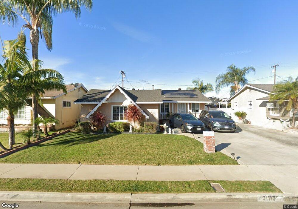
21113 Hawaiian Ave Lakewood, CA 90715
Imperial Estates NeighborhoodEstimated Value: $736,315 - $924,000
3
Beds
1
Bath
1,064
Sq Ft
$758/Sq Ft
Est. Value
About This Home
This home is located at 21113 Hawaiian Ave, Lakewood, CA 90715 and is currently estimated at $806,079, approximately $757 per square foot. 21113 Hawaiian Ave is a home located in Los Angeles County with nearby schools including Melbourne (Ella P.) Elementary School, Fedde (Pharis F.) Middle School, and Artesia High School.
Ownership History
Date
Name
Owned For
Owner Type
Purchase Details
Closed on
Jul 11, 1995
Sold by
Pak Chong Kwan and Pak Son Hui
Bought by
Torres Samuel
Current Estimated Value
Home Financials for this Owner
Home Financials are based on the most recent Mortgage that was taken out on this home.
Original Mortgage
$153,200
Interest Rate
7.61%
Purchase Details
Closed on
Oct 24, 1993
Sold by
Pak Chong Kwan and Pak Son Hui
Bought by
Pak Chong Kwan
Create a Home Valuation Report for This Property
The Home Valuation Report is an in-depth analysis detailing your home's value as well as a comparison with similar homes in the area
Home Values in the Area
Average Home Value in this Area
Purchase History
| Date | Buyer | Sale Price | Title Company |
|---|---|---|---|
| Torres Samuel | $158,000 | South Coast Title | |
| Pak Chong Kwan | -- | -- |
Source: Public Records
Mortgage History
| Date | Status | Borrower | Loan Amount |
|---|---|---|---|
| Closed | Torres Samuel | $153,200 |
Source: Public Records
Tax History Compared to Growth
Tax History
| Year | Tax Paid | Tax Assessment Tax Assessment Total Assessment is a certain percentage of the fair market value that is determined by local assessors to be the total taxable value of land and additions on the property. | Land | Improvement |
|---|---|---|---|---|
| 2025 | $3,406 | $262,446 | $156,807 | $105,639 |
| 2024 | $3,406 | $257,301 | $153,733 | $103,568 |
| 2023 | $3,301 | $252,257 | $150,719 | $101,538 |
| 2022 | $3,250 | $247,312 | $147,764 | $99,548 |
| 2021 | $3,174 | $242,464 | $144,867 | $97,597 |
| 2019 | $3,102 | $235,274 | $140,571 | $94,703 |
| 2018 | $2,852 | $230,662 | $137,815 | $92,847 |
| 2016 | $2,733 | $221,707 | $132,464 | $89,243 |
| 2015 | $2,698 | $218,378 | $130,475 | $87,903 |
| 2014 | $2,652 | $214,102 | $127,920 | $86,182 |
Source: Public Records
Map
Nearby Homes
- 20833 Verne Ave
- 12308 Centralia St
- 12523 Lemming St
- 12750 Centralia St Unit 24
- 12750 Centralia St Unit 191
- 12750 Centralia St Unit 159
- 12750 Centralia St Unit 94
- 12141 Centralia St Unit 119
- 12550 E Carson St
- 12550 E Carson St Unit 149
- 12550 E Carson St Unit 173
- 21327 Norwalk Blvd Unit 31
- 4322 Fontainbleau Ave
- 20841 Horst Ave
- 12550 Carson St Unit 87
- 12550 Carson St Unit 20
- 9080 Bloomfield St Unit 231
- 9080 Bloomfield Ave Unit 79
- 9080 Bloomfield Ave Unit 11
- 9080 Bloomfield Ave Unit 77
- 21119 Hawaiian Ave
- 21107 Hawaiian Ave
- 21112 Verne Ave
- 21103 Hawaiian Ave
- 21118 Verne Ave
- 21106 Verne Ave
- 21112 Hawaiian Ave
- 21102 Verne Ave
- 21106 Hawaiian Ave
- 21023 Hawaiian Ave
- 21102 Hawaiian Ave
- 12448 212th St
- 12452 212th St
- 12442 212th St
- 12458 212th St
- 21017 Hawaiian Ave
- 12438 212th St
- 12502 212th St
- 21032 Verne Ave
- 21115 Verne Ave