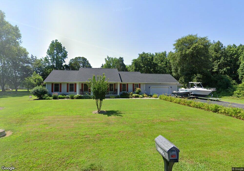
21115 Carter Ave Rock Hall, MD 21661
Estimated Value: $391,000 - $421,057
--
Bed
2
Baths
1,856
Sq Ft
$217/Sq Ft
Est. Value
About This Home
This home is located at 21115 Carter Ave, Rock Hall, MD 21661 and is currently estimated at $402,764, approximately $217 per square foot. 21115 Carter Ave is a home located in Kent County with nearby schools including Center for Innovation, Kent County Middle School, and Kent County High School.
Ownership History
Date
Name
Owned For
Owner Type
Purchase Details
Closed on
Oct 9, 2007
Sold by
Middleton Kevin J
Bought by
Harry Paul W
Current Estimated Value
Home Financials for this Owner
Home Financials are based on the most recent Mortgage that was taken out on this home.
Original Mortgage
$242,400
Outstanding Balance
$152,592
Interest Rate
6.37%
Mortgage Type
Purchase Money Mortgage
Estimated Equity
$250,172
Purchase Details
Closed on
Aug 15, 2007
Sold by
Middleton Kevin J
Bought by
Harry Paul W
Home Financials for this Owner
Home Financials are based on the most recent Mortgage that was taken out on this home.
Original Mortgage
$242,400
Outstanding Balance
$152,592
Interest Rate
6.37%
Mortgage Type
Purchase Money Mortgage
Estimated Equity
$250,172
Purchase Details
Closed on
Jul 14, 2000
Bought by
Middleton Kevin J and Middleton Tracey A
Create a Home Valuation Report for This Property
The Home Valuation Report is an in-depth analysis detailing your home's value as well as a comparison with similar homes in the area
Home Values in the Area
Average Home Value in this Area
Purchase History
| Date | Buyer | Sale Price | Title Company |
|---|---|---|---|
| Harry Paul W | $303,000 | -- | |
| Harry Paul W | $303,000 | -- | |
| Middleton Kevin J | -- | -- |
Source: Public Records
Mortgage History
| Date | Status | Borrower | Loan Amount |
|---|---|---|---|
| Open | Harry Paul W | $242,400 | |
| Previous Owner | Harry Paul W | $242,400 |
Source: Public Records
Tax History Compared to Growth
Tax History
| Year | Tax Paid | Tax Assessment Tax Assessment Total Assessment is a certain percentage of the fair market value that is determined by local assessors to be the total taxable value of land and additions on the property. | Land | Improvement |
|---|---|---|---|---|
| 2025 | $2,454 | $243,000 | $0 | $0 |
| 2024 | $2,326 | $205,100 | $83,700 | $121,400 |
| 2023 | $2,272 | $203,600 | $0 | $0 |
| 2022 | $2,272 | $202,100 | $0 | $0 |
| 2021 | $2,265 | $200,600 | $83,700 | $116,900 |
| 2020 | $2,265 | $199,767 | $0 | $0 |
| 2019 | $2,256 | $198,933 | $0 | $0 |
| 2018 | $2,246 | $198,100 | $83,700 | $114,400 |
| 2017 | $2,246 | $198,100 | $0 | $0 |
| 2016 | -- | $198,100 | $0 | $0 |
| 2015 | $2,500 | $205,000 | $0 | $0 |
| 2014 | $2,500 | $205,000 | $0 | $0 |
Source: Public Records
Map
Nearby Homes
- 21305 Haven Rd
- 21336 Haven Rd
- 5898 Williams St
- 6119 New St Unit 2
- 5791 S Hawthorne Ave
- 5829 N Main St
- 21133 Striper Run
- 21119 Striper Run
- 21131 Striper Run
- 21139 Striper Run
- 21141 Striper Run
- 5750 Walnut St
- 21332 E Sharp St
- 21090 W Sharp St Unit 133
- 21090 W Sharp St Unit 112
- 5686 S Main St
- 0 Judefind Ave Unit MDKE2001688
- 5697 Walnut St
- 21163 Chesapeake Ave
- #2 Lawton Ave
- 0 Lot 18 Carter Ave Unit MDKE2001846
- 21105 Carter Ave
- 21100 Spring Cove Rd
- 21090 Carter Ave
- 21109 Carter Ave
- 21112 Spring Cove Rd
- 21121 Carter Ave
- 21120 Spring Cove Rd
- 0 Carter Ave Unit 1006340446
- 0 Carter Ave Unit KE9940134
- 0 Carter Ave Unit 1000083683
- 0 Carter Ave Unit 1001838482
- 0 Carter Ave Unit 1000084153
- 21132 Spring Cove Rd
- Lot 18 Carter Ave
- 21141 Carter Ave
- 21136 Spring Cove Rd
- 21130 Carter Ave
- 21060 Spring Cove Rd
- 21153 Carter Ave