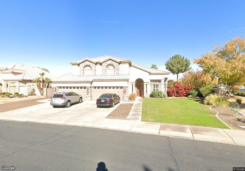
2112 E Amber Ln Gilbert, AZ 85296
East Gilbert NeighborhoodEstimated Value: $920,286 - $1,025,000
5
Beds
4
Baths
3,994
Sq Ft
$245/Sq Ft
Est. Value
About This Home
This home is located at 2112 E Amber Ln, Gilbert, AZ 85296 and is currently estimated at $980,322, approximately $245 per square foot. 2112 E Amber Ln is a home located in Maricopa County with nearby schools including Finley Farms Elementary School, Greenfield Junior High School, and Gilbert Arts Academy.
Ownership History
Date
Name
Owned For
Owner Type
Purchase Details
Closed on
Dec 13, 2012
Sold by
Rascon Rick R and Rascon Laura L
Bought by
Rascon Laura L
Current Estimated Value
Purchase Details
Closed on
Nov 17, 2003
Sold by
Cendant Mobility Financial Corp
Bought by
Rascon Rick R and Rascon Laura L
Purchase Details
Closed on
Sep 25, 2003
Sold by
Swanson Todd Darrold and Swanson Cynthia Ellen
Bought by
Cendant Mobility Financial Corp
Purchase Details
Closed on
Sep 26, 1995
Sold by
Jackson Properties Inc
Bought by
Swanson Todd Darrold and Swanson Cynthia Ellen
Home Financials for this Owner
Home Financials are based on the most recent Mortgage that was taken out on this home.
Original Mortgage
$194,432
Interest Rate
7.97%
Mortgage Type
Seller Take Back
Create a Home Valuation Report for This Property
The Home Valuation Report is an in-depth analysis detailing your home's value as well as a comparison with similar homes in the area
Home Values in the Area
Average Home Value in this Area
Purchase History
| Date | Buyer | Sale Price | Title Company |
|---|---|---|---|
| Rascon Laura L | -- | Sonoran Title Services Inc | |
| Rascon Rick R | $350,000 | First American Title | |
| Cendant Mobility Financial Corp | -- | First American Title | |
| Swanson Todd Darrold | $243,040 | Nations Title Insurance |
Source: Public Records
Mortgage History
| Date | Status | Borrower | Loan Amount |
|---|---|---|---|
| Previous Owner | Swanson Todd Darrold | $194,432 | |
| Closed | Swanson Todd Darrold | $187,484 | |
| Closed | Rascon Rick R | $0 |
Source: Public Records
Tax History
| Year | Tax Paid | Tax Assessment Tax Assessment Total Assessment is a certain percentage of the fair market value that is determined by local assessors to be the total taxable value of land and additions on the property. | Land | Improvement |
|---|---|---|---|---|
| 2025 | $3,595 | $45,586 | -- | -- |
| 2024 | $3,458 | $43,415 | -- | -- |
| 2023 | $3,458 | $69,080 | $13,810 | $55,270 |
| 2022 | $3,343 | $50,110 | $10,020 | $40,090 |
| 2021 | $3,479 | $47,360 | $9,470 | $37,890 |
| 2020 | $3,417 | $45,000 | $9,000 | $36,000 |
| 2019 | $3,132 | $43,570 | $8,710 | $34,860 |
| 2018 | $3,034 | $42,310 | $8,460 | $33,850 |
| 2017 | $2,928 | $41,430 | $8,280 | $33,150 |
| 2016 | $3,032 | $37,580 | $7,510 | $30,070 |
| 2015 | $2,763 | $35,250 | $7,050 | $28,200 |
Source: Public Records
Map
Nearby Homes
- 2069 E Sierra Madre Ave
- 2333 E Finley St
- 2062 E Palomino Dr
- 1866 E Sagebrush St
- 1745 E Cheyenne St
- 1831 E Linda Ln
- 1644 E Orangewood St
- 1911 E Bruce Ave
- 1754 E Cotton Ct
- 2601 E Mesquite St
- 1645 E Orangewood St
- 2062 E Arabian Dr
- 1678 E Rawhide St
- 557 S Lemon Ct
- 2222 E Arabian Dr
- 1735 E Saratoga St
- 127 N Date Palm Dr
- 652 S Bahama Dr
- 335 S Red Rock St
- 1648 E Palomino Dr
- 2098 E Amber Ln
- 2123 E Stephens Rd
- 2105 E Stephens Rd
- 2082 E Amber Ln
- 2107 E Amber Ln
- 2091 E Stephens Rd Unit II
- 2091 E Amber Ln
- 2077 E Stephens Rd
- 2070 E Amber Ln
- 2077 E Amber Ln
- 245 S Joan Ln
- 2065 E Stephens Rd
- 2102 E Stephens Rd
- 2056 E Amber Ln
- 2088 E Stephens Rd
- 2063 E Amber Ln
- 2053 E Stephens Rd Unit II
- 231 S Joan Ln
- 2074 E Stephens Rd
- 2042 E Amber Ln
Your Personal Tour Guide
Ask me questions while you tour the home.