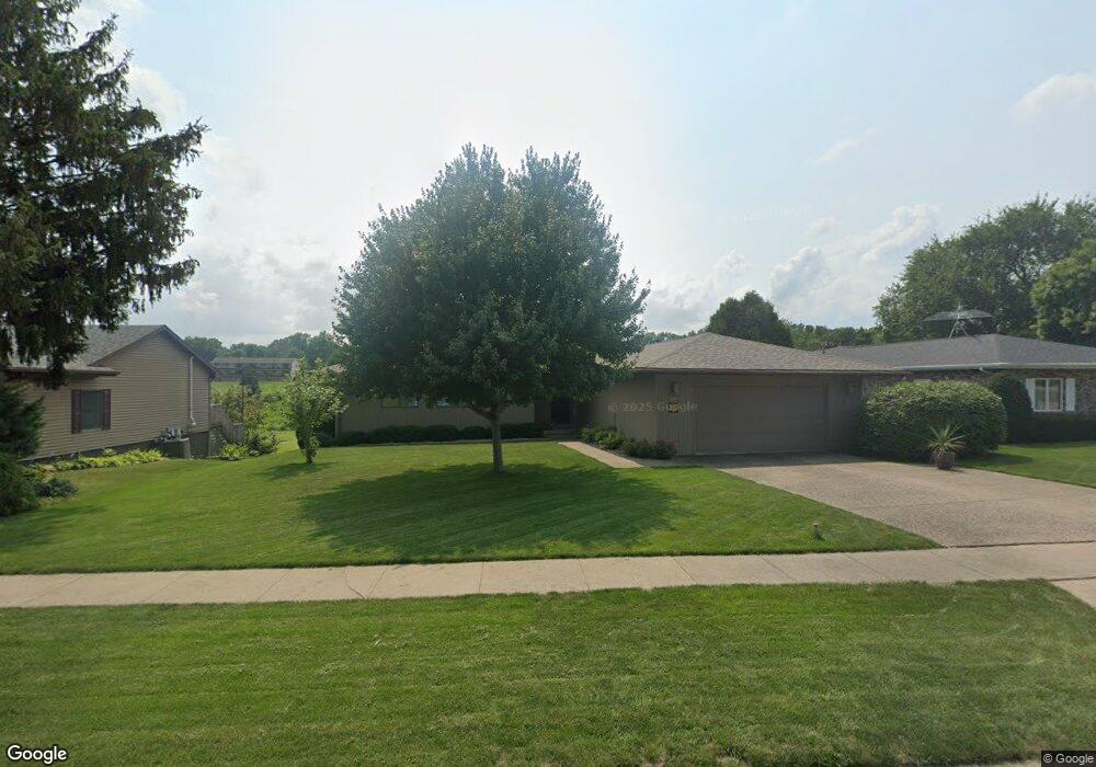
2112 Fareway Dr Muscatine, IA 52761
Estimated Value: $272,000 - $329,000
3
Beds
5
Baths
1,884
Sq Ft
$162/Sq Ft
Est. Value
About This Home
This home is located at 2112 Fareway Dr, Muscatine, IA 52761 and is currently estimated at $304,764, approximately $161 per square foot. 2112 Fareway Dr is a home located in Muscatine County with nearby schools including Grant Elementary School, Central Middle School, and Susan Clark Junior High School.
Ownership History
Date
Name
Owned For
Owner Type
Purchase Details
Closed on
Sep 15, 2010
Sold by
Ogilvie Harold W and Ogilivie Jane
Bought by
Angell William F
Current Estimated Value
Home Financials for this Owner
Home Financials are based on the most recent Mortgage that was taken out on this home.
Original Mortgage
$300,000
Outstanding Balance
$198,602
Interest Rate
4.49%
Mortgage Type
Future Advance Clause Open End Mortgage
Estimated Equity
$106,162
Create a Home Valuation Report for This Property
The Home Valuation Report is an in-depth analysis detailing your home's value as well as a comparison with similar homes in the area
Home Values in the Area
Average Home Value in this Area
Purchase History
| Date | Buyer | Sale Price | Title Company |
|---|---|---|---|
| Angell William F | $245,000 | None Available |
Source: Public Records
Mortgage History
| Date | Status | Borrower | Loan Amount |
|---|---|---|---|
| Open | Angell William F | $300,000 |
Source: Public Records
Tax History Compared to Growth
Tax History
| Year | Tax Paid | Tax Assessment Tax Assessment Total Assessment is a certain percentage of the fair market value that is determined by local assessors to be the total taxable value of land and additions on the property. | Land | Improvement |
|---|---|---|---|---|
| 2025 | $5,246 | $316,250 | $42,380 | $273,870 |
| 2024 | $5,246 | $313,340 | $42,380 | $270,960 |
| 2023 | $5,146 | $313,177 | $42,453 | $270,724 |
| 2022 | $4,752 | $238,500 | $40,050 | $198,450 |
| 2021 | $4,752 | $241,840 | $40,050 | $201,790 |
| 2020 | $4,782 | $236,380 | $40,050 | $196,330 |
| 2019 | $4,684 | $220,570 | $0 | $0 |
| 2018 | $4,616 | $220,570 | $0 | $0 |
| 2017 | $4,790 | $220,570 | $0 | $0 |
| 2016 | $4,790 | $220,570 | $0 | $0 |
| 2015 | $4,790 | $218,640 | $0 | $0 |
| 2014 | $4,780 | $218,640 | $0 | $0 |
Source: Public Records
Map
Nearby Homes
- 1251 Vista Ct
- 2020 Bidwell Rd
- 1203 Sunrise Cir
- 613 Lake Park Blvd
- 108 Middle Rd
- 503 Mcarthur St
- 702 Woodland Way
- 630 Jackson St
- 709 Leroy St
- 2016 Lincoln Blvd
- 514 Jackson St
- 16 Coventry Ln Unit J1
- 205 Amherst Ave
- 606 Leroy St
- 416 Jackson St
- 1707 Lincoln Blvd
- 504 Adams St
- 1509 Lincoln Blvd
- 1416 Lincoln Blvd
- 818 Woodlawn Ave