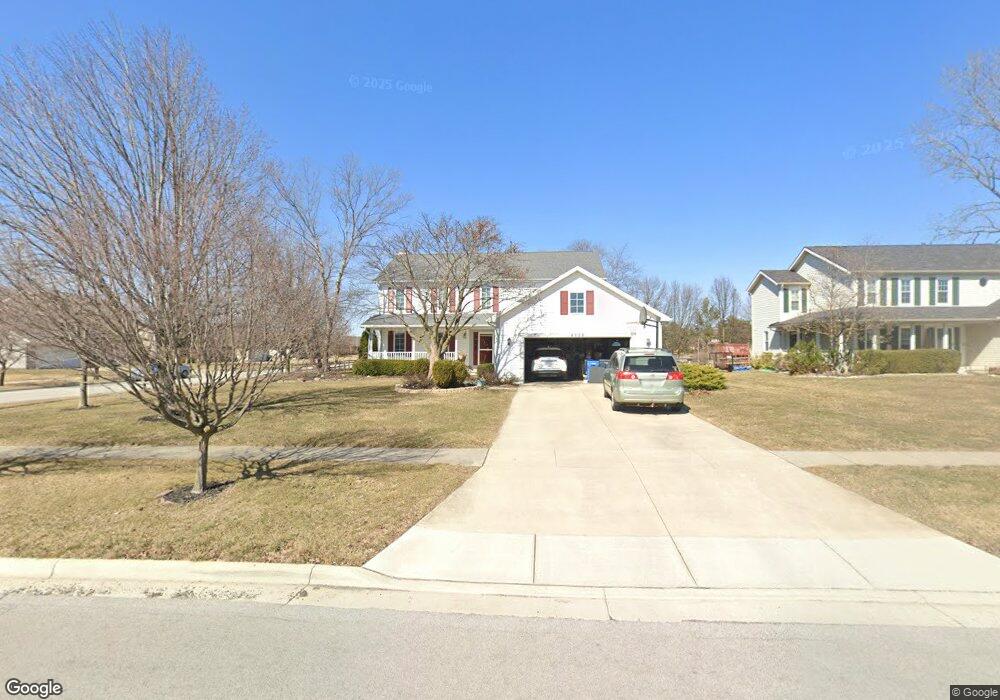
2112 Lonetree Dr Findlay, OH 45840
Estimated Value: $359,000 - $416,000
4
Beds
3
Baths
2,816
Sq Ft
$134/Sq Ft
Est. Value
About This Home
This home is located at 2112 Lonetree Dr, Findlay, OH 45840 and is currently estimated at $378,613, approximately $134 per square foot. 2112 Lonetree Dr is a home located in Hancock County with nearby schools including Van Buren Elementary School, Van Buren Middle School, and Van Buren High School.
Ownership History
Date
Name
Owned For
Owner Type
Purchase Details
Closed on
May 30, 2003
Sold by
Hickey Patrick C and Hickey Susan K
Bought by
Domke Roger L and Domke Mary B
Current Estimated Value
Home Financials for this Owner
Home Financials are based on the most recent Mortgage that was taken out on this home.
Original Mortgage
$95,000
Outstanding Balance
$41,916
Interest Rate
5.88%
Mortgage Type
Purchase Money Mortgage
Estimated Equity
$336,697
Purchase Details
Closed on
Aug 30, 1996
Sold by
Dold Homes Inc
Bought by
Hickey Patrick and Hickey Susan
Home Financials for this Owner
Home Financials are based on the most recent Mortgage that was taken out on this home.
Original Mortgage
$152,900
Interest Rate
8.3%
Mortgage Type
New Conventional
Purchase Details
Closed on
Jul 22, 1987
Bought by
Manley W R Co
Create a Home Valuation Report for This Property
The Home Valuation Report is an in-depth analysis detailing your home's value as well as a comparison with similar homes in the area
Home Values in the Area
Average Home Value in this Area
Purchase History
| Date | Buyer | Sale Price | Title Company |
|---|---|---|---|
| Domke Roger L | $195,000 | Assured Title | |
| Hickey Patrick | $170,240 | -- | |
| Manley W R Co | -- | -- |
Source: Public Records
Mortgage History
| Date | Status | Borrower | Loan Amount |
|---|---|---|---|
| Open | Domke Roger L | $95,000 | |
| Previous Owner | Hickey Patrick | $152,900 |
Source: Public Records
Tax History Compared to Growth
Tax History
| Year | Tax Paid | Tax Assessment Tax Assessment Total Assessment is a certain percentage of the fair market value that is determined by local assessors to be the total taxable value of land and additions on the property. | Land | Improvement |
|---|---|---|---|---|
| 2024 | $2,825 | $90,460 | $13,530 | $76,930 |
| 2023 | $2,811 | $90,460 | $13,530 | $76,930 |
| 2022 | $2,812 | $90,460 | $13,530 | $76,930 |
| 2021 | $2,640 | $80,200 | $13,000 | $67,200 |
| 2020 | $2,637 | $80,200 | $13,000 | $67,200 |
| 2019 | $2,732 | $80,200 | $13,000 | $67,200 |
| 2018 | $2,403 | $69,740 | $11,310 | $58,430 |
| 2017 | $1,205 | $69,740 | $11,310 | $58,430 |
| 2016 | $2,346 | $69,740 | $11,310 | $58,430 |
| 2015 | $2,403 | $70,200 | $11,310 | $58,890 |
| 2014 | $2,413 | $70,200 | $11,310 | $58,890 |
| 2012 | $2,557 | $68,430 | $11,310 | $57,120 |
Source: Public Records
Map
Nearby Homes
- 828 Longmeadow Ln
- 801 Fox Run Rd
- 822 Bright Rd
- 1926 Queenswood Dr
- 2245 Fox Run Cir Unit 1037
- 2252 Fox Run Cir
- 1203 Chateau Ct
- 1364 Chateau Cir Unit 31
- 1364 Chateau Cir Unit 26
- 2000 Rush Creek Ct
- 1303 Chateau Cir Unit 60
- 1902 Queenswood Dr
- 505 Bright Rd
- 1611 Brand Manor Dr Unit 5
- 1309 Chateau Cir Unit 63
- 1306 Chateau Cir Unit 55
- 1306 Chateau Cir Unit 62
- 1306 Chateau Cir Unit 61
- 0 Meadowview Dr
- 1825 Greendale Ave
- 2116 Lonetree Dr
- 2120 Lonetree Dr
- 824 Sunset Dr
- 828 Sunset Dr
- 2113 Lonetree Dr
- 2117 Lonetree Dr
- 832 Sunset Dr
- 2109 Lonetree Dr
- 2121 Lonetree Dr
- 0 Lonetree Dr Unit H138260
- 0 Lone Tree Dr Parcel C Unit 138260
- 0 Lone Tree Dr Parcel A Unit 6032948
- 0 Lone Tree Dr Parcel C Unit 6032950
- 0 Lone Tree Dr Parcel B Unit 6032949
- 0 Lonetree Dr Unit 2
- 0 Lone Tree Dr Parcel C Unit 6033116
- 0 Lone Tree Dr Parcel B Unit 6033113
- 0 Lone Tree Dr Parcel A Unit 6033112
- 2105 Lonetree Dr
- 836 Sunset Dr