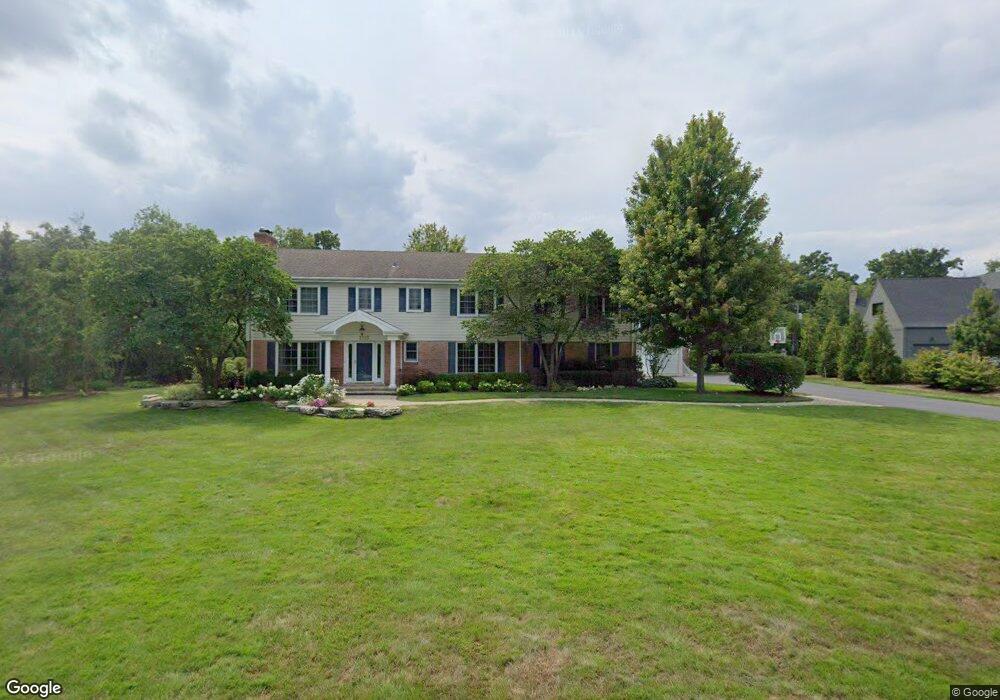
2112 Middlefork Rd Northfield, IL 60093
Estimated Value: $1,721,281 - $2,142,000
6
Beds
5
Baths
4,699
Sq Ft
$419/Sq Ft
Est. Value
About This Home
This home is located at 2112 Middlefork Rd, Northfield, IL 60093 and is currently estimated at $1,967,760, approximately $418 per square foot. 2112 Middlefork Rd is a home located in Cook County with nearby schools including Middlefork Primary School, Sunset Ridge Elementary School, and New Trier Township High School - Northfield.
Ownership History
Date
Name
Owned For
Owner Type
Purchase Details
Closed on
Jul 16, 2004
Sold by
Cobb Truman E and Cobb Ann C
Bought by
Omeara Norton
Current Estimated Value
Home Financials for this Owner
Home Financials are based on the most recent Mortgage that was taken out on this home.
Original Mortgage
$1,000,000
Outstanding Balance
$423,940
Interest Rate
4.25%
Mortgage Type
Purchase Money Mortgage
Estimated Equity
$1,543,820
Purchase Details
Closed on
Jul 16, 1999
Sold by
Chicago Title Land Trust Company
Bought by
Cobb Truman E and Cobb Ann C
Home Financials for this Owner
Home Financials are based on the most recent Mortgage that was taken out on this home.
Original Mortgage
$450,000
Interest Rate
7.54%
Purchase Details
Closed on
Oct 26, 1998
Sold by
Webbe Margery M
Bought by
The Chicago Trust Company and Trust #1106505
Create a Home Valuation Report for This Property
The Home Valuation Report is an in-depth analysis detailing your home's value as well as a comparison with similar homes in the area
Home Values in the Area
Average Home Value in this Area
Purchase History
| Date | Buyer | Sale Price | Title Company |
|---|---|---|---|
| Omeara Norton | $1,500,000 | First American Title | |
| Cobb Truman E | $890,000 | -- | |
| The Chicago Trust Company | -- | -- |
Source: Public Records
Mortgage History
| Date | Status | Borrower | Loan Amount |
|---|---|---|---|
| Open | Omeara Norton | $1,000,000 | |
| Previous Owner | Cobb Truman E | $450,000 |
Source: Public Records
Tax History
| Year | Tax Paid | Tax Assessment Tax Assessment Total Assessment is a certain percentage of the fair market value that is determined by local assessors to be the total taxable value of land and additions on the property. | Land | Improvement |
|---|---|---|---|---|
| 2025 | $26,933 | $175,000 | $52,272 | $122,728 |
| 2024 | $26,933 | $128,095 | $43,560 | $84,535 |
| 2023 | $26,472 | $128,095 | $43,560 | $84,535 |
| 2022 | $26,472 | $132,747 | $43,560 | $89,187 |
| 2021 | $24,317 | $103,608 | $30,492 | $73,116 |
| 2020 | $23,825 | $103,608 | $30,492 | $73,116 |
| 2019 | $24,372 | $118,316 | $30,492 | $87,824 |
| 2018 | $24,828 | $114,712 | $26,136 | $88,576 |
| 2017 | $24,063 | $114,712 | $26,136 | $88,576 |
| 2016 | $22,881 | $114,712 | $26,136 | $88,576 |
| 2015 | $18,917 | $86,884 | $21,780 | $65,104 |
| 2014 | $18,560 | $86,884 | $21,780 | $65,104 |
| 2013 | $17,769 | $86,884 | $21,780 | $65,104 |
Source: Public Records
Map
Nearby Homes
- 2122 Middlefork Rd
- 590 Briar Ln
- 898 Bridlegate Ln
- 1990 Southridge Terrace
- 2154 Northgate Rd
- 1930 Sunset Ridge Rd
- 513 Edens Ln
- 405 Voltz Rd
- 831 Balmoral Ln
- 265 Dickens St
- 2700 Summit Dr Unit 101
- 220 Sunset Ridge Rd
- 947 Kensington Dr Unit 7E3
- 308 Happ Rd Unit 201
- 118 Dickens Rd
- 1827 Waterbury Cir
- 2220 Founders Dr Unit 213
- 2220 Founders Dr Unit 107
- 2220 Founders Dr Unit P102
- 2220 Founders Dr Unit 316
- 2113 Middlefork Rd
- 2116 Middlefork Rd
- 22 Country Ln
- 2110 Middlefork Rd
- 2117 Middlefork Rd
- 20 Country Ln
- 2111 Middlefork Rd
- 2120 Middlefork Rd
- 2108 Middlefork Rd
- 240 Shadowood Ln
- 24 Country Ln
- 2131 Middlefork Rd
- 2121 Middlefork Rd
- 230 Shadowood Ln
- 14 Country Ln
- 2109 Middlefork Rd
- 19 Country Ln
- 10 Country Ln
- 2129 Middlefork Rd
- 12 Country Ln
Your Personal Tour Guide
Ask me questions while you tour the home.