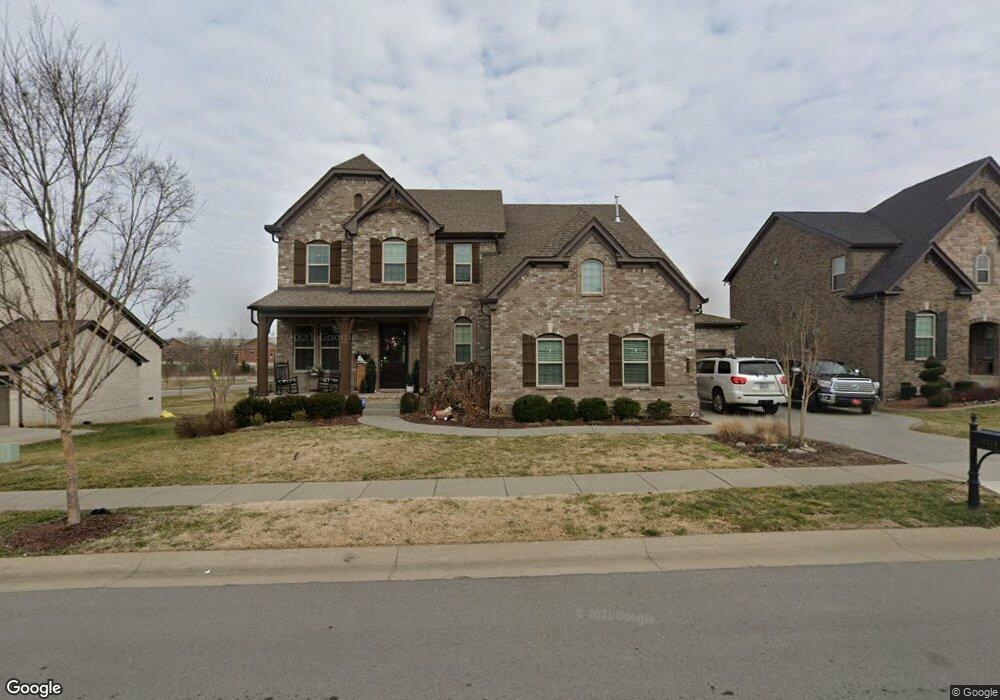
2113 Belsford Dr Unit 2 Nolensville, TN 37135
Estimated Value: $1,041,847 - $1,091,000
4
Beds
4
Baths
3,340
Sq Ft
$320/Sq Ft
Est. Value
About This Home
This home is located at 2113 Belsford Dr Unit 2, Nolensville, TN 37135 and is currently estimated at $1,069,462, approximately $320 per square foot. 2113 Belsford Dr Unit 2 is a home located in Williamson County with nearby schools including Mill Creek Elementary School, Mill Creek Middle School, and Nolensville High School.
Ownership History
Date
Name
Owned For
Owner Type
Purchase Details
Closed on
Jun 30, 2016
Sold by
Drees Premier Homes Inc
Bought by
Breckenridge Robert Damon and Breckenridge Rachel Ann
Current Estimated Value
Home Financials for this Owner
Home Financials are based on the most recent Mortgage that was taken out on this home.
Original Mortgage
$476,500
Outstanding Balance
$380,104
Interest Rate
3.64%
Mortgage Type
New Conventional
Estimated Equity
$689,358
Create a Home Valuation Report for This Property
The Home Valuation Report is an in-depth analysis detailing your home's value as well as a comparison with similar homes in the area
Home Values in the Area
Average Home Value in this Area
Purchase History
| Date | Buyer | Sale Price | Title Company |
|---|---|---|---|
| Breckenridge Robert Damon | $529,660 | Stewart Title Co |
Source: Public Records
Mortgage History
| Date | Status | Borrower | Loan Amount |
|---|---|---|---|
| Open | Breckenridge Robert Damon | $476,500 |
Source: Public Records
Tax History Compared to Growth
Tax History
| Year | Tax Paid | Tax Assessment Tax Assessment Total Assessment is a certain percentage of the fair market value that is determined by local assessors to be the total taxable value of land and additions on the property. | Land | Improvement |
|---|---|---|---|---|
| 2025 | $3,465 | $241,875 | $62,500 | $179,375 |
| 2024 | $3,465 | $159,700 | $37,500 | $122,200 |
| 2023 | $3,465 | $159,700 | $37,500 | $122,200 |
| 2022 | $3,465 | $159,700 | $37,500 | $122,200 |
| 2021 | $3,465 | $159,700 | $37,500 | $122,200 |
| 2020 | $3,238 | $129,000 | $22,500 | $106,500 |
| 2019 | $3,058 | $129,000 | $22,500 | $106,500 |
| 2018 | $2,968 | $129,000 | $22,500 | $106,500 |
| 2017 | $2,942 | $129,000 | $22,500 | $106,500 |
| 2016 | $1,740 | $77,350 | $22,500 | $54,850 |
| 2015 | -- | $0 | $0 | $0 |
Source: Public Records
Map
Nearby Homes
- 1525 Halsey Dr
- 4604 Robin Ln
- 3136 Bradfield Dr
- 2622 Sanford Rd
- 3236 Bradfield Dr
- 112 Telfair Ln
- 3231 Bradfield Dr
- 1114 Crossfield Dr
- 1160 Mcclellan Ln
- 1165 Mcclellan Ln
- 1169 Mcclellan Ln
- 842 Nolenmeade Place
- 3052 Ash Dale Ln
- 3016 Ashdale Ln
- 2677 York Rd
- 1137 Mcclellan Ln
- 1140 Mcclellan Ln
- 1117 Millshed Dr
- 2036 Bocage Cir
- 3009 Canal St
- 2113 Belsford Dr
- 2113 Belsford Dr
- 2109 Belsford Dr
- 2109 Belsford Dr Unit 3
- 2109 Belsford Dr
- 2117 Belsford Dr
- 2117 Belsford Dr
- 2117 Belsford Dr
- 3016 Bradfield Dr
- 2105 Belsford Dr
- 2105 Belsford Dr Unit 4
- 2105 Belsford Dr
- 2112 Belsford Dr Unit 14
- 2112 Belsford Dr
- 2112 Belsford Dr
- 3020 Bradfield Dr
- 2108 Belsford Dr
- 2116 Belsford Dr
- 2108 Belsford Dr Unit 13
- 2108 Belsford Dr