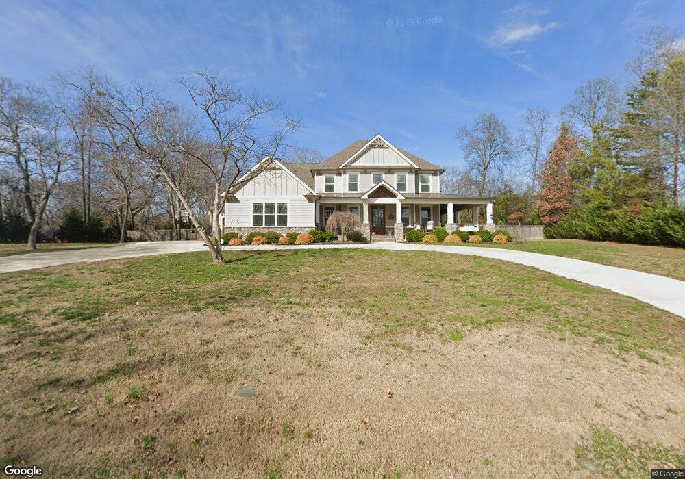
2113 Driftwood Rd Unit 22 Soddy Daisy, TN 37379
Estimated Value: $557,000 - $1,060,000
--
Bed
1
Bath
4,626
Sq Ft
$191/Sq Ft
Est. Value
About This Home
This home is located at 2113 Driftwood Rd Unit 22, Soddy Daisy, TN 37379 and is currently estimated at $885,403, approximately $191 per square foot. 2113 Driftwood Rd Unit 22 is a home located in Hamilton County with nearby schools including McConnell Elementary School and Loftis Middle School.
Ownership History
Date
Name
Owned For
Owner Type
Purchase Details
Closed on
May 18, 2016
Sold by
Parks Terry L and Royal Debra A
Bought by
Copeland William E and Copeland Cindy M
Current Estimated Value
Purchase Details
Closed on
Jul 20, 2012
Sold by
Bass Robert B
Bought by
Royal Debra A
Purchase Details
Closed on
Sep 27, 2005
Sold by
Voss Wilkins Diane
Bought by
Parks Terry L and Royal Debra A
Home Financials for this Owner
Home Financials are based on the most recent Mortgage that was taken out on this home.
Original Mortgage
$79,137
Interest Rate
5.72%
Mortgage Type
Purchase Money Mortgage
Purchase Details
Closed on
Jul 27, 2004
Sold by
Sharpe Eugene and Charitable Remainder Unitrust
Bought by
Voss Wilkins Diane
Purchase Details
Closed on
Oct 19, 2001
Sold by
Sharpe Eugene and Sharpe Jamie P
Bought by
Sharpe Jamie P
Create a Home Valuation Report for This Property
The Home Valuation Report is an in-depth analysis detailing your home's value as well as a comparison with similar homes in the area
Home Values in the Area
Average Home Value in this Area
Purchase History
| Date | Buyer | Sale Price | Title Company |
|---|---|---|---|
| Copeland William E | $125,000 | First Title | |
| Royal Debra A | -- | First Title | |
| Parks Terry L | $86,000 | Legal Title | |
| Voss Wilkins Diane | $75,000 | Legal Title & Escrow Inc | |
| Sharpe Jamie P | -- | -- | |
| Sharpe Eugene | -- | -- |
Source: Public Records
Mortgage History
| Date | Status | Borrower | Loan Amount |
|---|---|---|---|
| Previous Owner | Parks Terry L | $79,137 |
Source: Public Records
Tax History Compared to Growth
Tax History
| Year | Tax Paid | Tax Assessment Tax Assessment Total Assessment is a certain percentage of the fair market value that is determined by local assessors to be the total taxable value of land and additions on the property. | Land | Improvement |
|---|---|---|---|---|
| 2024 | $3,803 | $170,000 | $0 | $0 |
| 2023 | $4,152 | $170,000 | $0 | $0 |
| 2022 | $4,152 | $170,000 | $0 | $0 |
| 2021 | $4,025 | $164,775 | $0 | $0 |
| 2020 | $4,165 | $138,525 | $0 | $0 |
| 2019 | $4,165 | $150,875 | $0 | $0 |
| 2018 | $3,314 | $110,175 | $0 | $0 |
| 2017 | $894 | $30,000 | $0 | $0 |
| 2016 | $675 | $0 | $0 | $0 |
| 2015 | $675 | $22,500 | $0 | $0 |
| 2014 | $675 | $0 | $0 | $0 |
Source: Public Records
Map
Nearby Homes
- 8901 Dalton Ln
- 2207 Driftwood Rd
- 0 Warwickshire Dr
- 1988 Warwickshire Dr
- 2014 Albermarle Dr
- 2028 Port Royal Dr
- 1915 Port Royal Dr
- 2107 Port Royal Dr
- 8900 Wellthor Cir
- 1876 N Prairie Cir
- 2125 Port Royal Dr
- 1806 Dallas Lake Rd
- 1814 Dallas Lake Rd
- 2221 Chimney Hills Dr
- 2119 Collins Ln
- 2316 Lakesite Dr
- 2548 Chimney Lake Cir
- 1568 Dallas Lake Rd
- 2607 Chimney Lake Cir
- 8520 Kensley Ln
- 2113 Driftwood Rd
- 2117 Driftwood Rd
- 2109 Driftwood Rd
- 8900 Dalton Ln
- 8902 Dalton Ln
- 2131 Driftwood Rd
- 2105 Driftwood Rd
- 8905 Dalton Ln
- 8906 Dalton Ln
- 2112 Driftwood Rd
- 8907 Dalton Ln
- 2004 Battleground Cir
- 2129 Driftwood Rd
- 2110 Driftwood Rd
- 2000 Battleground Cir
- 2120 Driftwood Rd
- 2103 Driftwood Rd
- 2116 Driftwood Rd
- 8909 Dalton Ln
- 2126 Driftwood Rd