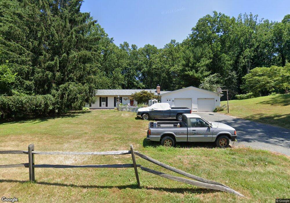
2113 High Point Rd Forest Hill, MD 21050
Estimated Value: $481,280 - $680,000
Studio
2
Baths
2,016
Sq Ft
$277/Sq Ft
Est. Value
About This Home
This home is located at 2113 High Point Rd, Forest Hill, MD 21050 and is currently estimated at $558,570, approximately $277 per square foot. 2113 High Point Rd is a home located in Harford County with nearby schools including Forest Lakes Elementary School, Fallston Middle School, and Fallston High School.
Ownership History
Date
Name
Owned For
Owner Type
Purchase Details
Closed on
Aug 22, 1988
Sold by
Deahl Delonnie D
Bought by
Penn Michael A and Penn Brenda L
Current Estimated Value
Home Financials for this Owner
Home Financials are based on the most recent Mortgage that was taken out on this home.
Original Mortgage
$117,000
Interest Rate
10.71%
Purchase Details
Closed on
Oct 16, 1984
Sold by
Mccarty William E and Mccarty Wf
Bought by
Deahl Delonnie D
Home Financials for this Owner
Home Financials are based on the most recent Mortgage that was taken out on this home.
Original Mortgage
$87,850
Interest Rate
14.19%
Create a Home Valuation Report for This Property
The Home Valuation Report is an in-depth analysis detailing your home's value as well as a comparison with similar homes in the area
Home Values in the Area
Average Home Value in this Area
Purchase History
| Date | Buyer | Sale Price | Title Company |
|---|---|---|---|
| Penn Michael A | $130,000 | -- | |
| Deahl Delonnie D | $92,500 | -- |
Source: Public Records
Mortgage History
| Date | Status | Borrower | Loan Amount |
|---|---|---|---|
| Closed | Penn Michael A | $117,000 | |
| Previous Owner | Deahl Delonnie D | $87,850 |
Source: Public Records
Tax History
| Year | Tax Paid | Tax Assessment Tax Assessment Total Assessment is a certain percentage of the fair market value that is determined by local assessors to be the total taxable value of land and additions on the property. | Land | Improvement |
|---|---|---|---|---|
| 2025 | $3,774 | $355,500 | $135,100 | $220,400 |
| 2024 | $3,774 | $340,800 | $0 | $0 |
| 2023 | $3,614 | $326,100 | $0 | $0 |
| 2022 | $3,454 | $311,400 | $135,100 | $176,300 |
| 2021 | $3,647 | $311,100 | $0 | $0 |
| 2020 | $3,647 | $310,800 | $0 | $0 |
| 2019 | $3,643 | $310,500 | $155,400 | $155,100 |
| 2018 | $3,610 | $310,400 | $0 | $0 |
| 2017 | $3,609 | $310,500 | $0 | $0 |
| 2016 | -- | $310,200 | $0 | $0 |
| 2015 | $3,547 | $309,300 | $0 | $0 |
| 2014 | $3,547 | $308,400 | $0 | $0 |
Source: Public Records
Map
Nearby Homes
- 1229 W Jarrettsville Rd
- 600 Rock Spring Church Rd
- 1701 Ingleside Rd
- 1702 Lasalle Rd
- 1705 Moonriver Ct
- 1376 W Jarrettsville Rd
- 1601 Rushing Stream Ct
- 1932 Pleasantville Rd
- 1127 Darlene Rd
- 1705 Grafton Ridge Ct
- 904 Delray Dr
- 2033 Packard Dr
- 2027 Brandy Dr
- 1234 Bear Hollow Ct
- 2003 Hialeah Ct
- 2022 Baldwin Mill Rd
- 434 Dellcrest Dr
- 207 Cartland Way
- 1614 Randallwood Ct
- 142 Paden Ct
- 2111 High Point Rd
- 2119 High Point Rd
- 2109 High Point Rd
- 1798 Sparks Dr
- 2123 High Point Rd
- 2120 High Point Rd
- 2040 High Point Rd
- 2107 High Point Rd
- 1800 Sparks Dr
- 2127 High Point Rd
- 2133 High Point Rd
- 1801 Sparks Dr
- 2105 High Point Rd
- 1640 Denwright Ct
- 1638 Denwright Ct
- 2129 High Point Rd
- 1802 Sparks Dr
- 2103A High Point Rd
- 2103 High Point Rd
- 1636 Denwright Ct
Your Personal Tour Guide
Ask me questions while you tour the home.