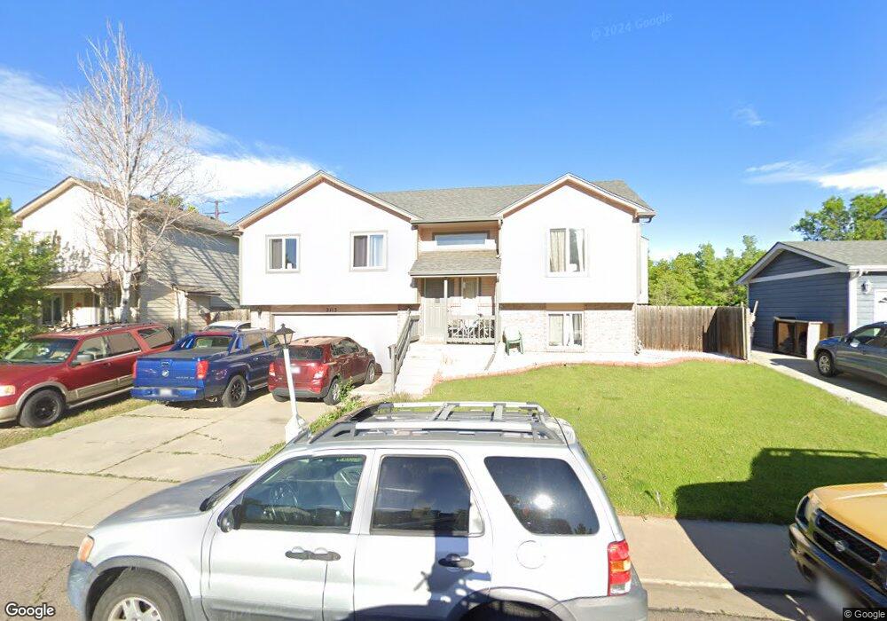
2113 Steele St Longmont, CO 80501
Garden Acres NeighborhoodEstimated Value: $459,195 - $500,000
4
Beds
3
Baths
1,678
Sq Ft
$287/Sq Ft
Est. Value
About This Home
This home is located at 2113 Steele St, Longmont, CO 80501 and is currently estimated at $481,299, approximately $286 per square foot. 2113 Steele St is a home located in Boulder County with nearby schools including Sanborn Elementary School, Longs Peak Middle School, and Longmont High School.
Ownership History
Date
Name
Owned For
Owner Type
Purchase Details
Closed on
Feb 23, 2005
Sold by
Burns James E and Burns Sharon R
Bought by
Rodriguez Jose M
Current Estimated Value
Home Financials for this Owner
Home Financials are based on the most recent Mortgage that was taken out on this home.
Original Mortgage
$221,523
Outstanding Balance
$113,495
Interest Rate
5.77%
Mortgage Type
FHA
Estimated Equity
$367,804
Purchase Details
Closed on
Jun 16, 1997
Sold by
Dunn Family Revocable Trust
Bought by
Burns James E
Home Financials for this Owner
Home Financials are based on the most recent Mortgage that was taken out on this home.
Original Mortgage
$95,000
Interest Rate
7.93%
Purchase Details
Closed on
Apr 27, 1995
Sold by
Marquis Homes Inc
Bought by
The Dunn Family Revocable Trust
Create a Home Valuation Report for This Property
The Home Valuation Report is an in-depth analysis detailing your home's value as well as a comparison with similar homes in the area
Home Values in the Area
Average Home Value in this Area
Purchase History
| Date | Buyer | Sale Price | Title Company |
|---|---|---|---|
| Rodriguez Jose M | $225,000 | Fahtco | |
| Burns James E | $142,000 | -- | |
| The Dunn Family Revocable Trust | $128,500 | Commonwealth Land Title |
Source: Public Records
Mortgage History
| Date | Status | Borrower | Loan Amount |
|---|---|---|---|
| Open | Rodriguez Jose M | $221,523 | |
| Previous Owner | Burns James E | $95,000 |
Source: Public Records
Tax History
| Year | Tax Paid | Tax Assessment Tax Assessment Total Assessment is a certain percentage of the fair market value that is determined by local assessors to be the total taxable value of land and additions on the property. | Land | Improvement |
|---|---|---|---|---|
| 2025 | $2,711 | $29,175 | $5,881 | $23,294 |
| 2024 | $2,711 | $29,175 | $5,881 | $23,294 |
| 2023 | $2,674 | $28,341 | $6,620 | $25,407 |
| 2022 | $2,345 | $23,700 | $4,782 | $18,918 |
| 2021 | $2,376 | $24,381 | $4,919 | $19,462 |
| 2020 | $2,232 | $22,973 | $4,433 | $18,540 |
| 2019 | $2,196 | $22,973 | $4,433 | $18,540 |
| 2018 | $1,933 | $20,354 | $4,032 | $16,322 |
| 2017 | $1,907 | $22,503 | $4,458 | $18,045 |
| 2016 | $1,742 | $18,221 | $5,413 | $12,808 |
| 2015 | $1,660 | $14,710 | $4,378 | $10,332 |
| 2014 | $1,374 | $14,710 | $4,378 | $10,332 |
Source: Public Records
Map
Nearby Homes
- 2612 Pheasant Dr
- 4700 Falcon Dr
- 2034 Sumac St
- 1851 Trevor Cir
- 2330 Wedgewood Ave
- 2121 Addie Rose Ln
- 2109 Addie Rose Ln
- 2104 18th Ave
- 2138 Daley Dr
- 1828 Stratford Ln
- 2433 Sunset Dr
- 2521 Danbury Dr
- 1729 Tulip St
- 1759 Sunset St
- 2961 Sonata Bay Ct
- 9172 Jotipa Dr
- 2623 Danbury Dr
- 1912 Rice St
- 2193 Sand Dollar Cir
- 2620 Denver Ave
Your Personal Tour Guide
Ask me questions while you tour the home.