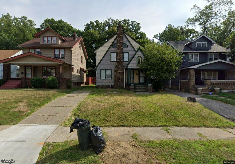
2113 Westburn Ave Cleveland, OH 44112
Estimated Value: $84,394 - $146,000
4
Beds
2
Baths
1,520
Sq Ft
$69/Sq Ft
Est. Value
About This Home
This home is located at 2113 Westburn Ave, Cleveland, OH 44112 and is currently estimated at $104,349, approximately $68 per square foot. 2113 Westburn Ave is a home located in Cuyahoga County with nearby schools including Shaw High School, Apex Academy, and East Academy.
Ownership History
Date
Name
Owned For
Owner Type
Purchase Details
Closed on
Nov 5, 2012
Sold by
Williams Margarette
Bought by
Merriweather Diane A
Current Estimated Value
Purchase Details
Closed on
Oct 10, 2012
Sold by
State Of Ohio
Bought by
Williams Margrette
Purchase Details
Closed on
Dec 20, 2006
Sold by
Carter Dushen
Bought by
Jones Tangi L
Home Financials for this Owner
Home Financials are based on the most recent Mortgage that was taken out on this home.
Original Mortgage
$81,000
Interest Rate
9.52%
Mortgage Type
Purchase Money Mortgage
Purchase Details
Closed on
Jan 12, 2006
Sold by
Mickshaw Kristopher M
Bought by
Carter Dushen
Purchase Details
Closed on
Jun 1, 1978
Sold by
Mickshaw Mary K and Mickshaw Larry
Bought by
Mickshaw Mary K
Purchase Details
Closed on
Jan 1, 1975
Bought by
Mickshaw Mary K and Mickshaw Larry
Create a Home Valuation Report for This Property
The Home Valuation Report is an in-depth analysis detailing your home's value as well as a comparison with similar homes in the area
Home Values in the Area
Average Home Value in this Area
Purchase History
| Date | Buyer | Sale Price | Title Company |
|---|---|---|---|
| Merriweather Diane A | $3,000 | None Available | |
| Williams Margrette | $2,400 | None Available | |
| Jones Tangi L | $90,000 | Shaker Heights | |
| Carter Dushen | $18,863 | None Available | |
| Mickshaw Mary K | -- | -- | |
| Mickshaw Mary K | -- | -- |
Source: Public Records
Mortgage History
| Date | Status | Borrower | Loan Amount |
|---|---|---|---|
| Previous Owner | Jones Tangi L | $81,000 |
Source: Public Records
Tax History Compared to Growth
Tax History
| Year | Tax Paid | Tax Assessment Tax Assessment Total Assessment is a certain percentage of the fair market value that is determined by local assessors to be the total taxable value of land and additions on the property. | Land | Improvement |
|---|---|---|---|---|
| 2024 | $1,005 | $14,455 | $4,725 | $9,730 |
| 2023 | $649 | $5,640 | $2,350 | $3,290 |
| 2022 | $1,161 | $5,635 | $2,345 | $3,290 |
| 2021 | $643 | $5,640 | $2,350 | $3,290 |
| 2020 | $693 | $5,740 | $2,380 | $3,360 |
| 2019 | $1,019 | $16,400 | $6,800 | $9,600 |
| 2018 | $358 | $5,740 | $2,380 | $3,360 |
| 2017 | $234 | $920 | $600 | $320 |
| 2016 | $1,368 | $920 | $600 | $320 |
| 2015 | $2,726 | $920 | $600 | $320 |
| 2014 | $2,726 | $19,500 | $3,710 | $15,790 |
Source: Public Records
Map
Nearby Homes
- 2116 Reyburn Rd
- 2121 Alton Rd
- 2133 Reyburn Rd
- 1875 Lampson Rd
- 3595 Runnymede Blvd
- 1816 Lampson Rd
- 3609 Langton Rd
- 3511 Randolph Rd
- 16208 Greyton Rd
- 1767 Algonac Rd Unit 2
- 3547 Randolph Rd
- 1758 Algonac Rd
- 1897 Torbenson Dr
- 3598 Atherstone Rd
- 3655 Langton Rd
- 825 Helmsdale Rd
- 1762 Alcoy Rd
- 833 Nela View Rd
- 839 Nela View Rd
- 841 Helmsdale Rd
- 2117 Westburn Ave
- 2109 Westburn Ave
- 2121 Westburn Ave
- 2105 Westburn Ave
- 2125 Westburn Ave
- 2101 Westburn Ave
- 2112 Reyburn Rd
- 2108 Reyburn Rd
- 2120 Reyburn Rd
- 2108 Westburn Ave
- 2114 Westburn Ave
- 2129 Westburn Ave
- 2104 Westburn Ave
- 2124 Reyburn Rd
- 1990 Reyburn Rd
- 2100 Westburn Ave
- 2093 Westburn Ave
- 2126 Reyburn Rd
- 2126 Westburn Ave
- 1988 Reyburn Rd