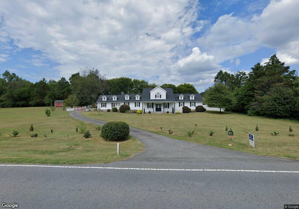
2114 W Highway 27 Lincolnton, NC 28092
Estimated Value: $467,000 - $597,000
3
Beds
2
Baths
3,848
Sq Ft
$143/Sq Ft
Est. Value
About This Home
This home is located at 2114 W Highway 27, Lincolnton, NC 28092 and is currently estimated at $548,364, approximately $142 per square foot. 2114 W Highway 27 is a home located in Lincoln County with nearby schools including Norris S. Childers Elementary School, West Lincoln Middle, and West Lincoln High School.
Ownership History
Date
Name
Owned For
Owner Type
Purchase Details
Closed on
Sep 8, 2023
Sold by
Boss Robert and Boss Anna
Bought by
Dinkins Floyd and Dinkins Cheryle W
Current Estimated Value
Purchase Details
Closed on
Oct 25, 2021
Sold by
Cook Brian S and Cook Carol F
Bought by
Boss Robert and Boss Anna
Home Financials for this Owner
Home Financials are based on the most recent Mortgage that was taken out on this home.
Original Mortgage
$364,000
Interest Rate
3.01%
Mortgage Type
VA
Purchase Details
Closed on
Feb 28, 2013
Sold by
Smith Judy
Bought by
Cook Brian S and Cook Carol F
Home Financials for this Owner
Home Financials are based on the most recent Mortgage that was taken out on this home.
Original Mortgage
$239,580
Interest Rate
3.4%
Mortgage Type
FHA
Purchase Details
Closed on
Sep 30, 1992
Bought by
Smith Judy
Create a Home Valuation Report for This Property
The Home Valuation Report is an in-depth analysis detailing your home's value as well as a comparison with similar homes in the area
Home Values in the Area
Average Home Value in this Area
Purchase History
| Date | Buyer | Sale Price | Title Company |
|---|---|---|---|
| Dinkins Floyd | -- | None Listed On Document | |
| Boss Robert | $455,000 | None Available | |
| Cook Brian S | $244,000 | None Available | |
| Smith Judy | $90,000 | -- |
Source: Public Records
Mortgage History
| Date | Status | Borrower | Loan Amount |
|---|---|---|---|
| Previous Owner | Boss Robert | $364,000 | |
| Previous Owner | Cook Brian S | $239,580 |
Source: Public Records
Tax History Compared to Growth
Tax History
| Year | Tax Paid | Tax Assessment Tax Assessment Total Assessment is a certain percentage of the fair market value that is determined by local assessors to be the total taxable value of land and additions on the property. | Land | Improvement |
|---|---|---|---|---|
| 2025 | $3,406 | $514,715 | $42,632 | $472,083 |
| 2024 | $3,386 | $514,715 | $42,632 | $472,083 |
| 2023 | $3,381 | $514,715 | $42,632 | $472,083 |
| 2022 | $2,395 | $302,211 | $33,538 | $268,673 |
| 2021 | $2,395 | $302,211 | $33,538 | $268,673 |
| 2020 | $2,212 | $301,104 | $32,431 | $268,673 |
| 2019 | $2,212 | $301,104 | $32,431 | $268,673 |
| 2018 | $1,889 | $243,786 | $29,574 | $214,212 |
| 2017 | $1,788 | $243,786 | $29,574 | $214,212 |
| 2016 | $1,788 | $243,786 | $29,574 | $214,212 |
| 2015 | $1,833 | $243,786 | $29,574 | $214,212 |
| 2014 | $2,016 | $275,001 | $31,669 | $243,332 |
Source: Public Records
Map
Nearby Homes
- 146 Gallup Ln
- 2508 Rock Dam Rd
- 00 Pleasant Grove Church Rd
- 1865 Rockdam Creek Ct
- 00 George Brown Rd Unit 10
- 00 George Brown Rd Unit 9
- 00 George Brown Rd Unit 8
- 00 George Brown Rd Unit 7
- 00 George Brown Rd Unit 6
- 00 George Brown Rd Unit 5
- 00 George Brown Rd Unit 4
- 00 George Brown Rd Unit 3
- 00 George Brown Rd Unit 2
- 963 Sunbeam Dr
- 2383 N Carolina 182
- 217 Blossom Hill Rd
- 938 Lyndsey Brook Ct
- 000 Blossom Hill Rd Unit 138
- 2700 Moose Gantt Trail
- 0 Hillard Ln
- 2114 N Carolina 27
- 2030 W Highway 27
- 2026 W Highway 27
- 2271 Rock Dam Rd
- 2287 Rock Dam Rd
- 2251 Rock Dam Rd
- 2241 Rock Dam Rd
- 2311 Rock Dam Rd
- 2012 W Highway 27
- 2199 Rock Dam Rd
- Park Rock Dam Rd
- 2221 W Highway 27
- 2325 Rock Dam Rd
- 2333 Rock Dam Rd
- 2268 Rock Dam Rd
- 2294 Rock Dam Rd
- 2302 Rock Dam Rd
- 2363 Rock Dam Rd
- 2344 Rock Dam Rd
- 2258 W Highway 27