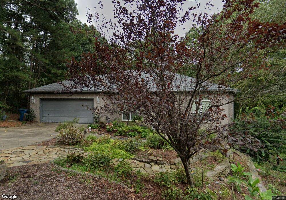
2114 Westport Loop Little Rock, AR 72212
Hillsborough NeighborhoodEstimated Value: $360,458 - $387,000
--
Bed
2
Baths
2,730
Sq Ft
$137/Sq Ft
Est. Value
About This Home
This home is located at 2114 Westport Loop, Little Rock, AR 72212 and is currently estimated at $372,865, approximately $136 per square foot. 2114 Westport Loop is a home located in Pulaski County with nearby schools including Don Roberts Elementary School, Pinnacle View Middle School, and Pulaski Academy.
Ownership History
Date
Name
Owned For
Owner Type
Purchase Details
Closed on
Jul 16, 2021
Sold by
Margolis Michael H and Margolis Arlene G
Bought by
Entergy Arkansas Inc
Current Estimated Value
Purchase Details
Closed on
Nov 4, 2018
Sold by
Margolis Michael H and Margolis Arlene G
Bought by
Margolis Michael H and Margolis Arlene G
Purchase Details
Closed on
Aug 12, 2013
Sold by
Margolis Michael H and Margolis Arlene G
Bought by
Margolis Michael H and Margolis Arlene G
Purchase Details
Closed on
Jun 23, 1998
Sold by
Jnh Llc
Bought by
Margolis Michael H and Margolis Arlene G
Home Financials for this Owner
Home Financials are based on the most recent Mortgage that was taken out on this home.
Original Mortgage
$120,000
Interest Rate
9.25%
Mortgage Type
Construction
Purchase Details
Closed on
Feb 10, 1997
Sold by
Gregg Guy O and Gregg Verna Jean
Bought by
Jnh Llc
Create a Home Valuation Report for This Property
The Home Valuation Report is an in-depth analysis detailing your home's value as well as a comparison with similar homes in the area
Home Values in the Area
Average Home Value in this Area
Purchase History
| Date | Buyer | Sale Price | Title Company |
|---|---|---|---|
| Entergy Arkansas Inc | -- | None Available | |
| Margolis Michael H | -- | None Available | |
| Margolis Michael H | -- | None Available | |
| Margolis Michael H | $10,000 | First Security Title Company | |
| Jnh Llc | $6,000 | Beach Abstract & Guaranty Co |
Source: Public Records
Mortgage History
| Date | Status | Borrower | Loan Amount |
|---|---|---|---|
| Previous Owner | Margolis Michael H | $120,000 |
Source: Public Records
Tax History Compared to Growth
Tax History
| Year | Tax Paid | Tax Assessment Tax Assessment Total Assessment is a certain percentage of the fair market value that is determined by local assessors to be the total taxable value of land and additions on the property. | Land | Improvement |
|---|---|---|---|---|
| 2025 | $2,243 | $70,712 | $5,000 | $65,712 |
| 2024 | $2,243 | $70,712 | $5,000 | $65,712 |
| 2023 | $2,243 | $70,712 | $5,000 | $65,712 |
| 2022 | $2,243 | $70,712 | $5,000 | $65,712 |
| 2021 | $2,259 | $47,780 | $8,500 | $39,280 |
| 2020 | $1,868 | $47,780 | $8,500 | $39,280 |
| 2019 | $1,868 | $47,780 | $8,500 | $39,280 |
| 2018 | $1,893 | $47,780 | $8,500 | $39,280 |
| 2017 | $2,735 | $47,780 | $8,500 | $39,280 |
| 2016 | $2,588 | $52,230 | $9,600 | $42,630 |
| 2015 | $2,589 | $40,293 | $9,600 | $30,693 |
| 2014 | $2,589 | $36,933 | $9,600 | $27,333 |
Source: Public Records
Map
Nearby Homes
- 2110 Westport Loop
- 2201 Huntleigh Ct
- Lot 89 Beckenham Dr
- 11 Mountain View Ct
- 14 Pointe Clear Dr
- 13708 Abinger Ct
- Lot 93 Chelsea Rd
- 25 Windsor Ct
- 11 La Scala Ct
- 31 La Scala Ct
- 21 La Scala Ct
- 1508 Hillsborough Ln
- 2111 Hinson Rd
- 24 Wellington Colony Dr
- 13505 Saddle Hill Dr
- 1606 Wetherborne Dr
- 13208 Morrison Rd
- 1802 Jennifer Dr
- 63 Valley Estates Ct
- 75 Wellington Colony Dr
- 2116 Westport Loop
- 13816 Huntleigh Dr
- 13618 Huntleigh Dr
- 2103 Huntleigh Ct
- 13818 Huntleigh Dr
- 2115 Westport Loop
- 2112 Westport Loop
- Lot 13 Huntleigh Dr
- 2105 Huntleigh Ct
- 2101 Huntleigh Ct
- 2118 Westport Loop
- 2107 Westport Loop
- 2105 Westport Loop
- 0 Burnttree Ct
- 13815 Huntleigh Dr
- 13811 Huntleigh Dr
- 20 Burnttree Ct
- 2120 Westport Loop
- 2107 Huntleigh Ct
- 2119 Westport Loop