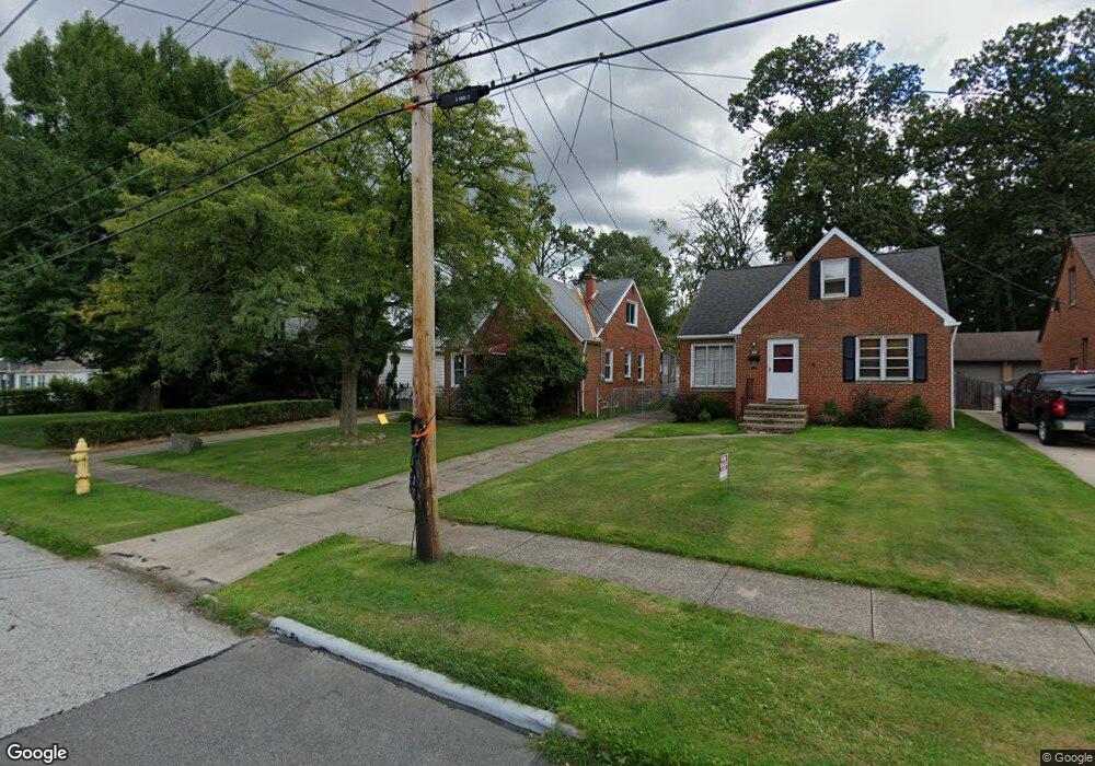
2115 Keystone Rd Cleveland, OH 44134
Estimated Value: $211,458 - $227,000
3
Beds
1
Bath
1,387
Sq Ft
$158/Sq Ft
Est. Value
About This Home
This home is located at 2115 Keystone Rd, Cleveland, OH 44134 and is currently estimated at $219,115, approximately $157 per square foot. 2115 Keystone Rd is a home located in Cuyahoga County with nearby schools including Shiloh Middle School, John Muir Elementary School, and Normandy High School.
Ownership History
Date
Name
Owned For
Owner Type
Purchase Details
Closed on
Sep 23, 1991
Sold by
Cotleur Thomas M
Bought by
Cotleur Thomas M
Current Estimated Value
Purchase Details
Closed on
Oct 18, 1989
Sold by
Rakovec Bryan T
Bought by
Cotleur Thomas M
Purchase Details
Closed on
Sep 13, 1984
Sold by
Kirsch David B
Bought by
Rakovec Bryan T
Purchase Details
Closed on
Jun 3, 1978
Sold by
Gilbert Martin W and Gilbert Cindy L
Bought by
Kirsch David B
Purchase Details
Closed on
Oct 10, 1975
Sold by
Zettl Susan
Bought by
Gilbert Martin W and Gilbert Cindy L
Purchase Details
Closed on
Jan 1, 1975
Bought by
Zettl Susan
Create a Home Valuation Report for This Property
The Home Valuation Report is an in-depth analysis detailing your home's value as well as a comparison with similar homes in the area
Home Values in the Area
Average Home Value in this Area
Purchase History
| Date | Buyer | Sale Price | Title Company |
|---|---|---|---|
| Cotleur Thomas M | -- | -- | |
| Cotleur Thomas M | $80,200 | -- | |
| Rakovec Bryan T | $62,500 | -- | |
| Kirsch David B | $46,500 | -- | |
| Gilbert Martin W | $37,000 | -- | |
| Zettl Susan | -- | -- |
Source: Public Records
Tax History
| Year | Tax Paid | Tax Assessment Tax Assessment Total Assessment is a certain percentage of the fair market value that is determined by local assessors to be the total taxable value of land and additions on the property. | Land | Improvement |
|---|---|---|---|---|
| 2024 | $3,604 | $59,220 | $13,230 | $45,990 |
| 2023 | $3,249 | $45,890 | $9,520 | $36,370 |
| 2022 | $3,219 | $45,890 | $9,520 | $36,370 |
| 2021 | $3,312 | $45,890 | $9,520 | $36,370 |
| 2020 | $3,071 | $37,630 | $7,810 | $29,820 |
| 2019 | $2,944 | $107,500 | $22,300 | $85,200 |
| 2018 | $2,825 | $37,630 | $7,810 | $29,820 |
| 2017 | $2,853 | $33,820 | $6,480 | $27,340 |
| 2016 | $2,837 | $33,820 | $6,480 | $27,340 |
| 2015 | $2,873 | $33,820 | $6,480 | $27,340 |
| 2014 | $2,873 | $36,370 | $6,970 | $29,400 |
Source: Public Records
Map
Nearby Homes
- 2207 Oaklawn Dr
- 6180 Jamestown Dr
- 2810 Grantwood Dr
- 3015 Parklane Dr
- 916 Clearview Ave
- 100 E Decker Dr
- 3109 George Ave
- 3255 Woodlawn Dr
- 3303 Ingleside Dr
- 5651 Broadview Rd Unit C1
- 3319 Norris Ave
- 3104 Liggett Dr
- 423 E Decker Dr
- 3214 Liggett Dr
- 3311 Priscilla Ave
- 872 E Dawnwood Dr
- 3323 Dellwood Dr
- 2619 Fortune Ave
- 2442 Fortune Ave
- 6258 Carlyle Dr
- 2117 Keystone Rd
- 2111 Keystone Rd
- 2121 Keystone Rd
- 2201 Keystone Rd
- 2105 Keystone Rd
- 2025 Keystone Rd
- 2209 Keystone Rd
- 2116 Keystone Rd
- 2019 Keystone Rd
- 2211 Keystone Rd
- 2118 Lorimer Dr
- 2114 Lorimer Dr
- 2122 Lorimer Dr
- 2150 Keystone Rd
- 2110 Lorimer Dr
- 2110 Lorimer Rd
- 2106 Lorimer Dr
- 2130 Lorimer Dr
- 2215 Keystone Rd
- 2015 Keystone Rd
Your Personal Tour Guide
Ask me questions while you tour the home.