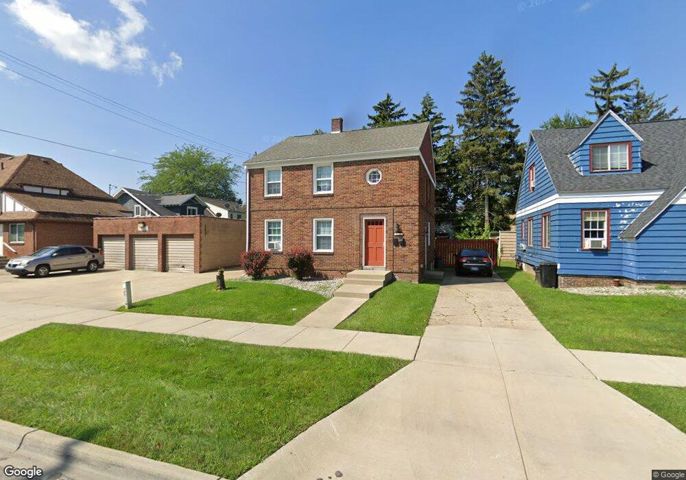
2115 N Woodbridge St Saginaw, MI 48602
Covenant NeighborhoodEstimated Value: $81,001 - $129,000
--
Bed
--
Bath
1,646
Sq Ft
$63/Sq Ft
Est. Value
About This Home
This home is located at 2115 N Woodbridge St, Saginaw, MI 48602 and is currently estimated at $103,750, approximately $63 per square foot. 2115 N Woodbridge St is a home located in Saginaw County with nearby schools including Stone School, Thompson Middle School, and Arthur Hill High School.
Ownership History
Date
Name
Owned For
Owner Type
Purchase Details
Closed on
Oct 26, 2022
Sold by
Foreman George Franklin
Bought by
Jil Housing Llc
Current Estimated Value
Purchase Details
Closed on
Jan 26, 2015
Sold by
Saginaw County Land Bank Authority
Bought by
Jll Housing Llc
Purchase Details
Closed on
Oct 30, 2014
Sold by
Novak Timothy
Bought by
Saginaw County Land Bank Authority
Purchase Details
Closed on
Jun 18, 1998
Sold by
Bender Aileen M Est
Bought by
Foreman George F
Purchase Details
Closed on
Jun 1, 1998
Purchase Details
Closed on
Dec 26, 1980
Sold by
Steele Verill A
Bought by
Steele Verill A and Bender Aileen M
Create a Home Valuation Report for This Property
The Home Valuation Report is an in-depth analysis detailing your home's value as well as a comparison with similar homes in the area
Home Values in the Area
Average Home Value in this Area
Purchase History
| Date | Buyer | Sale Price | Title Company |
|---|---|---|---|
| Jil Housing Llc | -- | -- | |
| Jll Housing Llc | $9,000 | -- | |
| Saginaw County Land Bank Authority | -- | -- | |
| Foreman George F | $64,900 | -- | |
| -- | $64,900 | -- | |
| Steele Verill A | -- | -- |
Source: Public Records
Tax History Compared to Growth
Tax History
| Year | Tax Paid | Tax Assessment Tax Assessment Total Assessment is a certain percentage of the fair market value that is determined by local assessors to be the total taxable value of land and additions on the property. | Land | Improvement |
|---|---|---|---|---|
| 2025 | $1,727 | $36,200 | $0 | $0 |
| 2024 | $1,412 | $33,900 | $0 | $0 |
| 2023 | $1,541 | $32,500 | $0 | $0 |
| 2022 | $1,801 | $28,200 | $0 | $0 |
| 2021 | $1,738 | $26,200 | $0 | $0 |
| 2020 | $1,989 | $24,000 | $0 | $0 |
| 2019 | $1,972 | $22,300 | $900 | $21,400 |
| 2018 | $1,354 | $23,801 | $0 | $0 |
| 2017 | $2,072 | $25,250 | $0 | $0 |
| 2016 | $2,050 | $25,748 | $0 | $0 |
| 2014 | -- | $29,547 | $0 | $28,554 |
| 2013 | -- | $30,836 | $0 | $0 |
Source: Public Records
Map
Nearby Homes
- 1616 State St
- 2104 Delaware Blvd
- 1710 State St
- 2004 Delaware St
- 2015 Delaware St
- 2207 Delaware Blvd
- 2105 Mershon St
- 2220 Mershon St
- 2250 Mershon St
- 1827 Delaware St
- 1818 N Woodbridge St
- 2132 N Clinton St
- 1920 N Clinton St
- 1608 Congress Ave
- 2263 Barnard St
- 2129 N Clinton St
- 2206 N Bond St
- 2332 Mershon St
- 2015 W Genesee Ave
- 1739 N Woodbridge St
- 2119 N Woodbridge St
- 1602 State St
- 1608 State St
- 1612 State St
- 2118 Delaware Blvd
- 2114 Delaware Blvd
- 2118 N Woodbridge St
- 2203 N Woodbridge St
- 1516 State St
- 2202 N Woodbridge St
- 2202 Delaware Blvd
- 2207 N Woodbridge St
- 1611 State St
- 1603 State St
- 1510 State St
- 1607 State St
- 2206 N Woodbridge St
- 1615 State St
- 1521 State St
- 1511 Davenport Ave