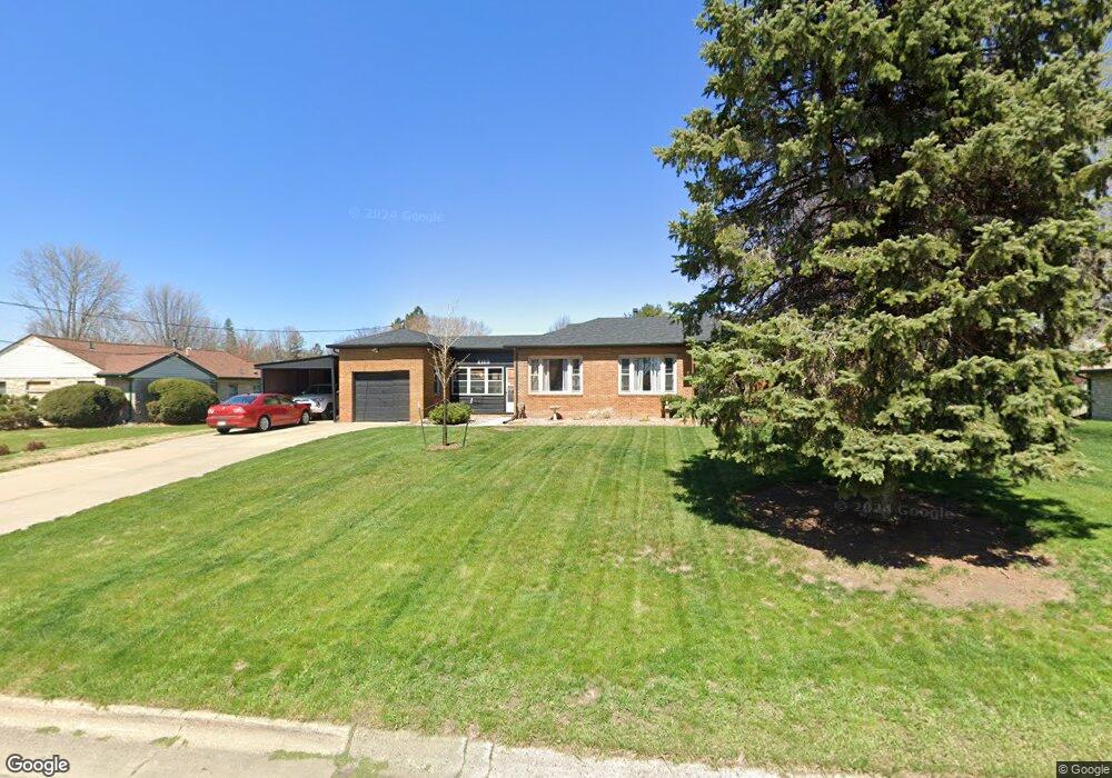
2115 Thornton Dr Des Moines, IA 50321
Southwestern Hills NeighborhoodEstimated Value: $235,000 - $285,000
3
Beds
1
Bath
1,190
Sq Ft
$216/Sq Ft
Est. Value
About This Home
This home is located at 2115 Thornton Dr, Des Moines, IA 50321 and is currently estimated at $256,896, approximately $215 per square foot. 2115 Thornton Dr is a home located in Polk County with nearby schools including Jefferson Elementary School, Brody Middle School, and Lincoln High School.
Ownership History
Date
Name
Owned For
Owner Type
Purchase Details
Closed on
Dec 15, 2011
Sold by
Anderson Floy E
Bought by
Durham Dwight A
Current Estimated Value
Home Financials for this Owner
Home Financials are based on the most recent Mortgage that was taken out on this home.
Original Mortgage
$94,500
Outstanding Balance
$64,675
Interest Rate
4.02%
Mortgage Type
New Conventional
Estimated Equity
$192,221
Purchase Details
Closed on
Oct 8, 2004
Sold by
Anderson Floy E
Bought by
Anderson Floy E
Create a Home Valuation Report for This Property
The Home Valuation Report is an in-depth analysis detailing your home's value as well as a comparison with similar homes in the area
Home Values in the Area
Average Home Value in this Area
Purchase History
| Date | Buyer | Sale Price | Title Company |
|---|---|---|---|
| Durham Dwight A | $104,500 | None Available | |
| Anderson Floy E | -- | -- |
Source: Public Records
Mortgage History
| Date | Status | Borrower | Loan Amount |
|---|---|---|---|
| Open | Durham Dwight A | $94,500 |
Source: Public Records
Tax History Compared to Growth
Tax History
| Year | Tax Paid | Tax Assessment Tax Assessment Total Assessment is a certain percentage of the fair market value that is determined by local assessors to be the total taxable value of land and additions on the property. | Land | Improvement |
|---|---|---|---|---|
| 2025 | $3,598 | $219,300 | $61,600 | $157,700 |
| 2024 | $3,598 | $209,000 | $57,900 | $151,100 |
| 2023 | $3,534 | $209,000 | $57,900 | $151,100 |
| 2022 | $3,504 | $162,200 | $46,500 | $115,700 |
| 2021 | $3,542 | $162,200 | $46,500 | $115,700 |
| 2020 | $3,672 | $153,800 | $43,900 | $109,900 |
| 2019 | $3,350 | $153,800 | $43,900 | $109,900 |
| 2018 | $3,308 | $136,400 | $38,200 | $98,200 |
| 2017 | $3,008 | $136,400 | $38,200 | $98,200 |
| 2016 | $2,924 | $123,000 | $33,800 | $89,200 |
| 2015 | $2,924 | $123,000 | $33,800 | $89,200 |
| 2014 | $2,718 | $118,500 | $32,200 | $86,300 |
Source: Public Records
Map
Nearby Homes
- 3901 Wakonda Dr
- 5815 Rose Cir
- 5821 Rose Cir
- 5817 Rose Cir
- 5822 Rose Cir
- 5813 Rose Cir
- 3212 Wauwatosa Dr
- 1914 Park Ave
- 1902 Park Ave
- 4440 SW 23rd St
- 2209 Park Ave
- 3131 Fleur Dr Unit 206 & 208
- 2614 Caulder Ave
- 1720 Park Ave
- 1616 Park Ave
- 3500 SW 28th St
- 1518 Park Ave
- 2401 Emma Ave
- 4400 SW 23rd St
- 4420 SW 23rd St
- 3719 Wakonda Dr
- 3716 Fleur Dr
- 3709 Wakonda Dr
- 3724 Fleur Dr
- 3710 Fleur Dr
- 3703 Wakonda Dr
- 3800 Fleur Dr
- 2114 Thornton Dr
- 3700 Fleur Dr
- 2120 Thornton Dr
- 2201 Thornton Dr
- 3716 Wakonda Dr
- 3612 Fleur Dr
- 3800 Wakonda Dr
- 3807 Wakonda Dr
- 3706 Wakonda Dr
- 2205 Thornton Dr
- 3613 Wakonda Dr
- 3700 Wakonda Dr
- 3610 Fleur Dr