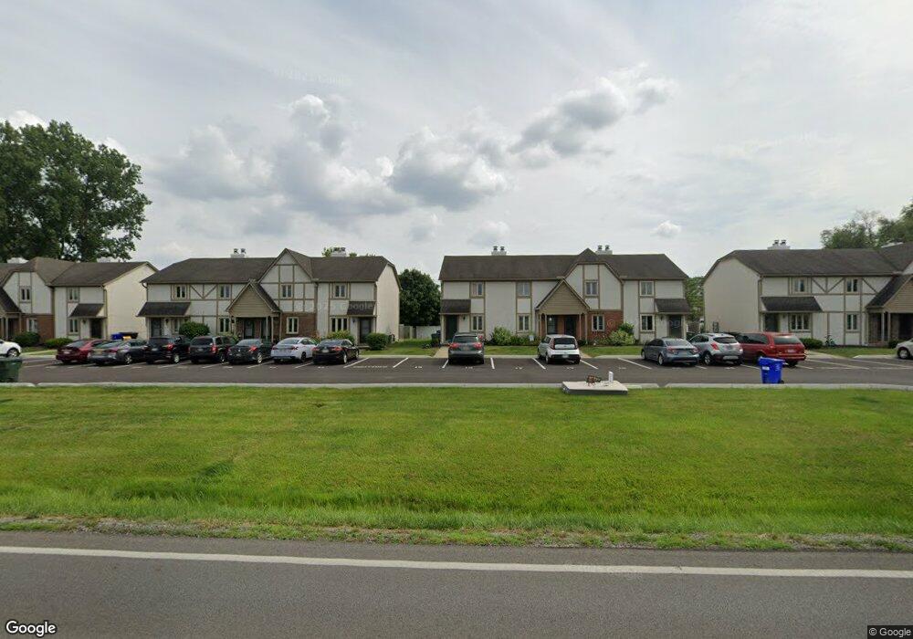
2115 West Case Rd Unit 2115 Columbus, OH 43235
The Gables NeighborhoodEstimated Value: $169,000 - $238,000
2
Beds
2
Baths
1,056
Sq Ft
$193/Sq Ft
Est. Value
About This Home
This home is located at 2115 West Case Rd Unit 2115, Columbus, OH 43235 and is currently estimated at $203,934, approximately $193 per square foot. 2115 West Case Rd Unit 2115 is a home located in Franklin County with nearby schools including Daniel Wright Elementary School, Ann Simpson Davis Middle School, and Dublin Scioto High School.
Ownership History
Date
Name
Owned For
Owner Type
Purchase Details
Closed on
Jan 12, 2017
Sold by
Vernon D Reynolds 2007 Revocable Trus
Bought by
High Flying 15 Llc
Current Estimated Value
Purchase Details
Closed on
Jul 27, 2009
Sold by
Kearns William and Kearns Rhoda
Bought by
Revocab Reynolds Vernon D and Revocab Vernon D Reynolds 2007
Purchase Details
Closed on
Feb 3, 2000
Sold by
Dragoni Mary C
Bought by
Kearns William and Kearns Rhoda
Home Financials for this Owner
Home Financials are based on the most recent Mortgage that was taken out on this home.
Original Mortgage
$40,800
Interest Rate
11.29%
Purchase Details
Closed on
May 18, 1982
Bought by
Dragoni Mary C
Create a Home Valuation Report for This Property
The Home Valuation Report is an in-depth analysis detailing your home's value as well as a comparison with similar homes in the area
Home Values in the Area
Average Home Value in this Area
Purchase History
| Date | Buyer | Sale Price | Title Company |
|---|---|---|---|
| High Flying 15 Llc | -- | None Available | |
| Revocab Reynolds Vernon D | $65,000 | Talon Group | |
| Kearns William | $48,000 | Lawyers Title | |
| Dragoni Mary C | -- | -- |
Source: Public Records
Mortgage History
| Date | Status | Borrower | Loan Amount |
|---|---|---|---|
| Previous Owner | Kearns William | $40,800 |
Source: Public Records
Tax History
| Year | Tax Paid | Tax Assessment Tax Assessment Total Assessment is a certain percentage of the fair market value that is determined by local assessors to be the total taxable value of land and additions on the property. | Land | Improvement |
|---|---|---|---|---|
| 2025 | $2,571 | $41,650 | $10,500 | $31,150 |
| 2024 | $2,571 | $41,650 | $10,500 | $31,150 |
| 2023 | $2,536 | $41,650 | $10,500 | $31,150 |
| 2022 | $1,504 | $22,890 | $3,220 | $19,670 |
| 2021 | $1,529 | $22,890 | $3,220 | $19,670 |
| 2020 | $1,520 | $22,890 | $3,220 | $19,670 |
| 2019 | $1,494 | $19,920 | $2,800 | $17,120 |
| 2018 | $751 | $19,920 | $2,800 | $17,120 |
| 2017 | $1,385 | $19,920 | $2,800 | $17,120 |
| 2016 | $1,357 | $18,340 | $3,430 | $14,910 |
| 2015 | $683 | $18,340 | $3,430 | $14,910 |
| 2014 | $1,367 | $18,340 | $3,430 | $14,910 |
| 2013 | $694 | $18,340 | $3,430 | $14,910 |
Source: Public Records
Map
Nearby Homes
- 2202 Sandman Dr Unit 56E
- 5624 Wigmore Dr Unit 50B
- 2260 Lila Way Unit 62D
- 2071 Tamarin Dr Unit 9C
- 2544 Maxim Ln Unit 37C
- 1685 Becket Ave
- 2515 Dahlia Way Unit 64C
- 2176 Hedgerow Rd Unit 2176D
- 2542 Hyacinth Ln Unit 32C
- 5354 Shannon Ln Unit 71
- 5348 Shannon Ln Unit 68
- 5258 Captains Ct Unit E
- 2540 Dahlia Way Unit 26D
- 5354 Coral Berry Dr Unit 79C
- 5268 Captains Ct
- 2579 Trotterslane Dr
- 5273 Berrywood Dr Unit 5273
- 5285 Portland St Unit 104
- 5275 Portland St Unit 202
- 5294 Brandy Oaks Ln
- 2115 W Case Rd
- 2117 West Case Rd Unit 2117
- 2117 W Case Rd
- 2111 West Case Rd
- 2119 West Case Rd
- 2119 W Case Rd
- 2109 West Case Rd
- 2121 W Case Rd
- 2121 West Case Rd
- 2107 West Case Rd
- 2105 West Case Rd
- 2127 West Case Rd Unit 2127
- 2127 W Case Rd
- 2129 West Case Rd Unit 2127
- 2099 West Case Rd
- 2131 West Case Rd Unit 2127
- 2097 West Case Rd
- 2133 West Case Rd Unit 2127
- 2095 W Case Rd
- 2095 West Case Rd
Your Personal Tour Guide
Ask me questions while you tour the home.