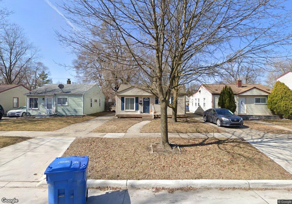
21151 Atlantic Ave Warren, MI 48091
Southwest Warren NeighborhoodEstimated Value: $92,000 - $135,000
2
Beds
1
Bath
1,096
Sq Ft
$105/Sq Ft
Est. Value
About This Home
This home is located at 21151 Atlantic Ave, Warren, MI 48091 and is currently estimated at $114,639, approximately $104 per square foot. 21151 Atlantic Ave is a home located in Macomb County with nearby schools including Mound Park Elementary School, Schofield Elementary School, and Westview Elementary School.
Ownership History
Date
Name
Owned For
Owner Type
Purchase Details
Closed on
Feb 22, 2011
Sold by
Secretary Of Housing & Urban Development
Bought by
Ross James W
Current Estimated Value
Purchase Details
Closed on
Sep 29, 2010
Sold by
Everbank
Bought by
The Secretary Of Housing & Urban Develop
Purchase Details
Closed on
Mar 26, 2010
Sold by
Hardesty Rhonda L
Bought by
Everbank
Purchase Details
Closed on
Aug 27, 1999
Sold by
Rangel Kelley M
Bought by
Hardesty Rhonda L
Home Financials for this Owner
Home Financials are based on the most recent Mortgage that was taken out on this home.
Original Mortgage
$69,000
Interest Rate
7.91%
Mortgage Type
Purchase Money Mortgage
Create a Home Valuation Report for This Property
The Home Valuation Report is an in-depth analysis detailing your home's value as well as a comparison with similar homes in the area
Home Values in the Area
Average Home Value in this Area
Purchase History
| Date | Buyer | Sale Price | Title Company |
|---|---|---|---|
| Ross James W | $13,000 | None Available | |
| The Secretary Of Housing & Urban Develop | -- | None Available | |
| Everbank | $68,233 | None Available | |
| Hardesty Rhonda L | $70,000 | -- |
Source: Public Records
Mortgage History
| Date | Status | Borrower | Loan Amount |
|---|---|---|---|
| Previous Owner | Hardesty Rhonda L | $69,000 |
Source: Public Records
Tax History
| Year | Tax Paid | Tax Assessment Tax Assessment Total Assessment is a certain percentage of the fair market value that is determined by local assessors to be the total taxable value of land and additions on the property. | Land | Improvement |
|---|---|---|---|---|
| 2025 | $1,064 | $41,910 | $0 | $0 |
| 2024 | $10 | $37,590 | $0 | $0 |
| 2023 | $985 | $26,760 | $0 | $0 |
| 2022 | $932 | $22,710 | $0 | $0 |
| 2021 | $956 | $21,400 | $0 | $0 |
| 2020 | $919 | $19,030 | $0 | $0 |
| 2019 | $878 | $18,510 | $0 | $0 |
| 2018 | $844 | $14,820 | $0 | $0 |
| 2017 | $836 | $14,500 | $2,030 | $12,470 |
| 2016 | $820 | $14,500 | $0 | $0 |
| 2015 | -- | $13,450 | $0 | $0 |
| 2012 | -- | $13,590 | $0 | $0 |
Source: Public Records
Map
Nearby Homes
- 21222 Audrey Ave
- 21137 Curie Ave
- 21441 Atlantic Ave
- 20870 Curie Ave
- 21116 Cyman Ave
- 21505 Audrey Ave
- 21548 Doepfer Rd
- 21410 Panama St
- 21004 Syracuse Ave
- 21771 Cunningham Ave
- 21840 Cunningham Ave
- 21044 Sunset Ave
- 20511 Caldwell St
- 20300 Bloom St
- 20251 Keystone St
- 21857 Le Fever Ave
- 20203 Moenart St
- 22355 Curie Ave
- 22373 Cyman Ave
- 22200 Le Fever Ave
- 21125 Atlantic Ave
- 21171 Atlantic Ave
- 21115 Atlantic Ave
- 21195 Atlantic Ave
- 0 Atlantic Ave
- 21221 Atlantic Ave
- 21105 Atlantic Ave
- 21126 Audrey Ave
- 21172 Audrey Ave
- 21116 Audrey Ave Unit Bldg-Unit
- 21116 Audrey Ave
- 21196 Audrey Ave
- 21097 Atlantic Ave
- 21245 Atlantic Ave
- 21152 Atlantic Ave
- 21085 Atlantic Ave
- 21263 Atlantic Ave
- 21172 Atlantic Ave
- 21126 Atlantic Ave Unit Bldg-Unit
- 21126 Atlantic Ave
Your Personal Tour Guide
Ask me questions while you tour the home.