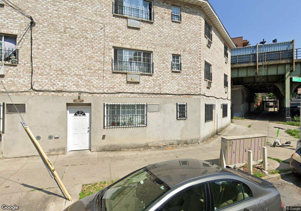
2116 Bogart Ave Bronx, NY 10462
Pelham Parkway NeighborhoodEstimated Value: $1,041,000 - $1,286,000
--
Bed
--
Bath
3,441
Sq Ft
$335/Sq Ft
Est. Value
About This Home
This home is located at 2116 Bogart Ave, Bronx, NY 10462 and is currently estimated at $1,151,333, approximately $334 per square foot. 2116 Bogart Ave is a home located in Bronx County with nearby schools including Pelham Academy, Bronx Green Middle School, and Children's Aid College Preparatory Charter School.
Ownership History
Date
Name
Owned For
Owner Type
Purchase Details
Closed on
Jul 7, 2017
Sold by
Lumaj Paulin and Lumaj Vera
Bought by
Pl 9 Properties Llc
Current Estimated Value
Purchase Details
Closed on
Nov 17, 2009
Sold by
Lumaj Paulin
Bought by
Lumaj Paulin and Lumaj Vera
Home Financials for this Owner
Home Financials are based on the most recent Mortgage that was taken out on this home.
Original Mortgage
$499,000
Interest Rate
4.79%
Mortgage Type
Purchase Money Mortgage
Create a Home Valuation Report for This Property
The Home Valuation Report is an in-depth analysis detailing your home's value as well as a comparison with similar homes in the area
Home Values in the Area
Average Home Value in this Area
Purchase History
| Date | Buyer | Sale Price | Title Company |
|---|---|---|---|
| Pl 9 Properties Llc | -- | -- | |
| Lumaj Paulin | -- | -- | |
| Lumaj Paulin | -- | -- |
Source: Public Records
Mortgage History
| Date | Status | Borrower | Loan Amount |
|---|---|---|---|
| Previous Owner | Lumaj Paulin | $499,000 |
Source: Public Records
Tax History Compared to Growth
Tax History
| Year | Tax Paid | Tax Assessment Tax Assessment Total Assessment is a certain percentage of the fair market value that is determined by local assessors to be the total taxable value of land and additions on the property. | Land | Improvement |
|---|---|---|---|---|
| 2025 | $8,689 | $45,533 | $5,437 | $40,096 |
| 2024 | $8,689 | $43,262 | $5,176 | $38,086 |
| 2023 | $8,731 | $42,991 | $5,950 | $37,041 |
| 2022 | $8,511 | $54,900 | $7,200 | $47,700 |
| 2021 | $8,464 | $52,560 | $7,200 | $45,360 |
| 2020 | $8,032 | $47,700 | $7,200 | $40,500 |
| 2019 | $7,542 | $41,760 | $7,200 | $34,560 |
| 2018 | $7,303 | $35,826 | $6,046 | $29,780 |
| 2017 | $7,242 | $35,528 | $5,761 | $29,767 |
| 2016 | $6,700 | $33,517 | $6,583 | $26,934 |
| 2015 | $4,052 | $31,620 | $6,000 | $25,620 |
| 2014 | $4,052 | $30,044 | $5,800 | $24,244 |
Source: Public Records
Map
Nearby Homes
- - Lydig Ave
- 2129 Muliner Ave
- 2116 Paulding Ave
- 2080 Matthews Ave
- 2037 Radcliff Ave
- 2166 Paulding Ave
- 2080 Barnes Ave Unit 5C
- 2080 Barnes Ave Unit 3H
- 2080 Barnes Ave Unit 4A
- 2080 Barnes Ave Unit 5B
- 2090 Barnes Ave Unit 6A
- 2090 Barnes Ave Unit 4D
- 2090 Barnes Ave Unit 2H
- 2165 Matthews Ave Unit 4B
- 2165 Matthews Ave Unit 2G
- 2165 Matthews Ave Unit 1G
- 2165 Mathews Ave Unit 5H
- 1054 Lydig Ave
- 1059 Neill Ave
- 1958 Colden Ave
- 2118 Bogart Ave
- 2122 Bogart Ave
- 0 Lydig Ave
- 2120 Bogart Ave
- 2124A Bogart Ave
- 2124B Bogart Ave
- 2126 Bogart Ave
- 2115 Bogart Ave
- 2117 Bogart Ave
- 2069 Bogart Ave
- 2071 Bogart Ave
- 2119 Bogart Ave
- 2128 Bogart Ave
- 2121 Bogart Ave
- 2123 Bogart Ave
- 2125 Bogart Ave
- 2127 Bogart Ave
- 2121 Paulding Ave Unit 6F
- 2121 Paulding Ave Unit 2
- 2121 Paulding Ave