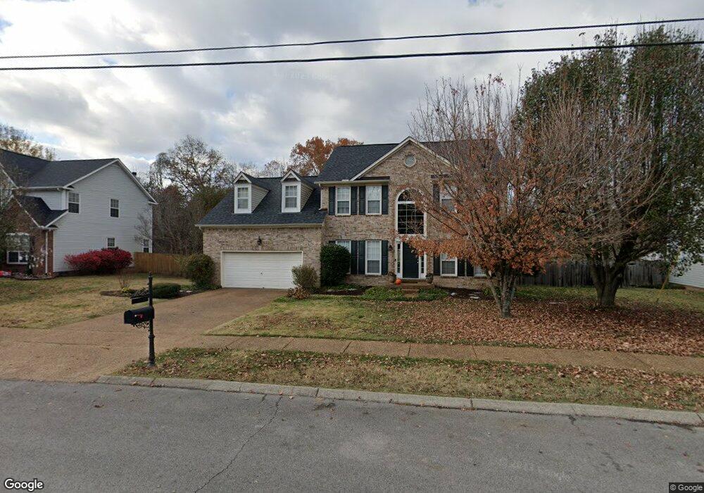
2116 Brookstone Dr Mount Juliet, TN 37122
Estimated Value: $517,211 - $577,000
--
Bed
3
Baths
3,190
Sq Ft
$173/Sq Ft
Est. Value
About This Home
This home is located at 2116 Brookstone Dr, Mount Juliet, TN 37122 and is currently estimated at $551,803, approximately $172 per square foot. 2116 Brookstone Dr is a home located in Wilson County with nearby schools including Mt. Juliet Elementary School, Mt. Juliet Middle School, and Green Hill High School.
Ownership History
Date
Name
Owned For
Owner Type
Purchase Details
Closed on
Oct 17, 2001
Sold by
Hughes Thomas A
Bought by
Thomas Timothy L
Current Estimated Value
Home Financials for this Owner
Home Financials are based on the most recent Mortgage that was taken out on this home.
Original Mortgage
$163,706
Outstanding Balance
$63,893
Interest Rate
6.85%
Estimated Equity
$487,910
Purchase Details
Closed on
Nov 30, 1990
Bought by
Hughes Thomas Alan
Purchase Details
Closed on
Jul 13, 1990
Bought by
Centex Real Estate Corp
Purchase Details
Closed on
Apr 4, 1904
Bought by
Brookstone Ltd Two Brentwood Commons
Create a Home Valuation Report for This Property
The Home Valuation Report is an in-depth analysis detailing your home's value as well as a comparison with similar homes in the area
Home Values in the Area
Average Home Value in this Area
Purchase History
| Date | Buyer | Sale Price | Title Company |
|---|---|---|---|
| Thomas Timothy L | $165,000 | -- | |
| Hughes Thomas Alan | $130,100 | -- | |
| Centex Real Estate Corp | -- | -- | |
| Brookstone Ltd Two Brentwood Commons | -- | -- |
Source: Public Records
Mortgage History
| Date | Status | Borrower | Loan Amount |
|---|---|---|---|
| Open | Brookstone Ltd Two Brentwood Commons | $163,706 |
Source: Public Records
Tax History Compared to Growth
Tax History
| Year | Tax Paid | Tax Assessment Tax Assessment Total Assessment is a certain percentage of the fair market value that is determined by local assessors to be the total taxable value of land and additions on the property. | Land | Improvement |
|---|---|---|---|---|
| 2024 | $1,814 | $95,050 | $21,250 | $73,800 |
| 2022 | $1,806 | $94,600 | $21,250 | $73,350 |
| 2021 | $1,910 | $94,600 | $21,250 | $73,350 |
| 2020 | $1,733 | $94,600 | $21,250 | $73,350 |
| 2019 | $214 | $64,550 | $18,750 | $45,800 |
| 2018 | $1,725 | $64,250 | $18,750 | $45,500 |
| 2017 | $1,725 | $64,250 | $18,750 | $45,500 |
| 2016 | $1,725 | $64,250 | $18,750 | $45,500 |
| 2015 | $1,780 | $64,250 | $18,750 | $45,500 |
| 2014 | $1,520 | $54,882 | $0 | $0 |
Source: Public Records
Map
Nearby Homes
- 1520 Brookstone Cir
- 1013 Brookstone Blvd
- 493 Page Dr
- 288 Page Dr
- 506 Page Dr
- 2202 Dinah Ct
- 271 Page Dr
- 1120 Brookstone Blvd
- 3890 W Division St
- 1105 Camden Cir
- 1202 Mount Vernon Ln
- 604 Georgian Way
- 1229 Mount Vernon Ln
- 2001 Lynnhaven Ct
- 2006 Lynnhaven Ct
- 222 Jackson Trail
- 205 Channell Ct
- 203 Channell Ct
- 201 Channell Ct
- 102 Crosby Dr
- 2114 Brookstone Dr
- 2118 Brookstone Dr
- 2300 Brookstone Ct
- 2112 Brookstone Dr
- 2120 Brookstone Dr
- 2117 Brookstone Dr
- 2301 Brookstone Ct
- 2302 Brookstone Ct
- 2119 Brookstone Dr
- 2110 Brookstone Dr
- 109 Pascal Dr
- 2303 Brookstone Ct
- 1500 Brookstone Cir
- 2304 Brookstone Ct
- 2108 Brookstone Dr
- 2400 Brookstone Place
- 107 Pascal Dr
- 2305 Brookstone Ct
- 1502 Brookstone Cir
- 2306 Brookstone Ct