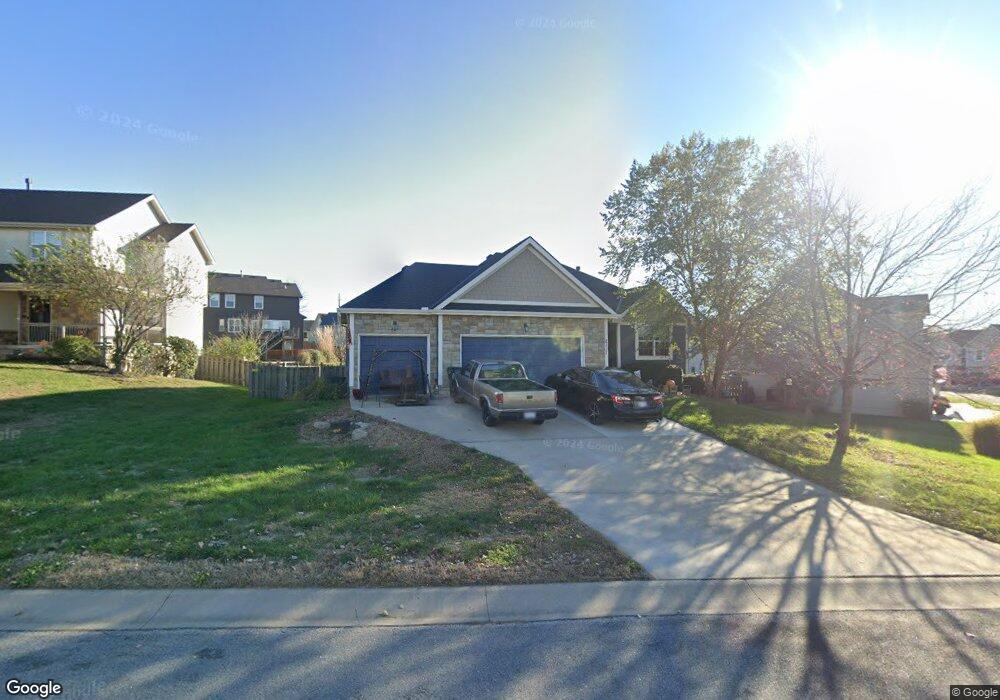
2117 Alder St Leavenworth, KS 66048
Estimated Value: $397,000 - $416,000
4
Beds
3
Baths
1,485
Sq Ft
$272/Sq Ft
Est. Value
About This Home
This home is located at 2117 Alder St, Leavenworth, KS 66048 and is currently estimated at $404,412, approximately $272 per square foot. 2117 Alder St is a home located in Leavenworth County with nearby schools including Lansing Elementary School, Lansing Middle 6-8, and Lansing High 9-12.
Ownership History
Date
Name
Owned For
Owner Type
Purchase Details
Closed on
Dec 28, 2009
Sold by
Larkin Construction Llc
Bought by
Robert Henry J and Henry Barbara J
Current Estimated Value
Home Financials for this Owner
Home Financials are based on the most recent Mortgage that was taken out on this home.
Original Mortgage
$244,821
Outstanding Balance
$160,331
Interest Rate
4.9%
Mortgage Type
VA
Estimated Equity
$244,081
Create a Home Valuation Report for This Property
The Home Valuation Report is an in-depth analysis detailing your home's value as well as a comparison with similar homes in the area
Home Values in the Area
Average Home Value in this Area
Purchase History
| Date | Buyer | Sale Price | Title Company |
|---|---|---|---|
| Robert Henry J | $239,924 | Tri-County Title & Abstract Ll |
Source: Public Records
Mortgage History
| Date | Status | Borrower | Loan Amount |
|---|---|---|---|
| Open | Robert Henry J | $244,821 |
Source: Public Records
Tax History Compared to Growth
Tax History
| Year | Tax Paid | Tax Assessment Tax Assessment Total Assessment is a certain percentage of the fair market value that is determined by local assessors to be the total taxable value of land and additions on the property. | Land | Improvement |
|---|---|---|---|---|
| 2025 | $5,274 | $45,330 | $5,837 | $39,493 |
| 2024 | $5,018 | $43,172 | $5,837 | $37,335 |
| 2023 | $5,018 | $42,745 | $4,989 | $37,756 |
| 2022 | $4,729 | $37,916 | $4,906 | $33,010 |
| 2021 | $4,246 | $33,212 | $4,906 | $28,306 |
| 2020 | $3,878 | $29,716 | $4,906 | $24,810 |
| 2019 | $3,739 | $28,601 | $4,906 | $23,695 |
| 2018 | $3,666 | $28,059 | $4,906 | $23,153 |
| 2017 | $3,440 | $26,984 | $4,906 | $22,078 |
| 2016 | $3,447 | $26,984 | $4,906 | $22,078 |
| 2015 | $3,448 | $26,984 | $4,906 | $22,078 |
| 2014 | $3,325 | $26,455 | $4,906 | $21,549 |
Source: Public Records
Map
Nearby Homes
- 0000 Eisenhower Rd
- 16055 W Eisenhower Rd
- 15915 Eisenhower Rd
- 2151 Shenandoah Dr
- 2150 Shenandoah Dr
- 1605 Shadow Dr
- 3703 Clayton Dr
- 17096 Eisenhower Rd
- 4421 Grand Ct
- 00000 Michals Rd
- 1023 Ironwood Ct
- 2100 Limit St
- 2105 Vilas St
- 4301 Ironwood Dr
- 1320 Independence Ct
- 2248 Vilas St
- 1601 Holman St
- 2516 Kensington Place
- 1621 Vilas St
- 3903 S 20th St