Estimated Value: $353,000 - $427,000
3
Beds
1
Bath
1,160
Sq Ft
$331/Sq Ft
Est. Value
About This Home
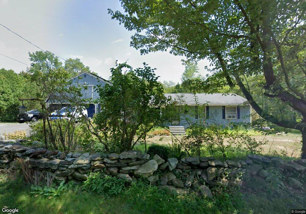
This home is located at 2117 Chestnut Hill Ave, Athol, MA 01331 and is currently estimated at $383,423, approximately $330 per square foot. 2117 Chestnut Hill Ave is a home located in Worcester County with nearby schools including Athol High School.
Ownership History
Date
Name
Owned For
Owner Type
Purchase Details
Closed on
Jul 14, 2025
Sold by
Salisbury Mark S and Salisbury Christine D
Bought by
Salisbury Lt and Salisbury
Current Estimated Value
Purchase Details
Closed on
Feb 24, 2010
Sold by
Covino Robert M and Conrad Lori
Bought by
Salisbury Mark S and Salisbury Christine D
Home Financials for this Owner
Home Financials are based on the most recent Mortgage that was taken out on this home.
Original Mortgage
$84,000
Interest Rate
5.11%
Mortgage Type
Purchase Money Mortgage
Purchase Details
Closed on
Jul 1, 2002
Sold by
Cromwell Joseph H and Cromwell Margaret A
Bought by
Covino Robert M
Create a Home Valuation Report for This Property
The Home Valuation Report is an in-depth analysis detailing your home's value as well as a comparison with similar homes in the area
Home Values in the Area
Average Home Value in this Area
Purchase History
| Date | Buyer | Sale Price | Title Company |
|---|---|---|---|
| Salisbury Lt | -- | -- | |
| Salisbury Lt | -- | -- | |
| Salisbury Mark S | $84,000 | -- | |
| Salisbury Mark S | $84,000 | -- | |
| Salisbury Mark S | $84,000 | -- | |
| Covino Robert M | $189,900 | -- | |
| Covino Robert M | $189,900 | -- |
Source: Public Records
Mortgage History
| Date | Status | Borrower | Loan Amount |
|---|---|---|---|
| Previous Owner | Salisbury Mark S | $84,000 |
Source: Public Records
Tax History
| Year | Tax Paid | Tax Assessment Tax Assessment Total Assessment is a certain percentage of the fair market value that is determined by local assessors to be the total taxable value of land and additions on the property. | Land | Improvement |
|---|---|---|---|---|
| 2025 | $4,163 | $327,500 | $83,900 | $243,600 |
| 2024 | $4,456 | $347,300 | $80,800 | $266,500 |
| 2023 | $4,282 | $305,000 | $59,000 | $246,000 |
| 2022 | $4,155 | $258,900 | $56,300 | $202,600 |
| 2021 | $53 | $238,000 | $51,200 | $186,800 |
| 2020 | $31 | $238,000 | $46,800 | $191,200 |
| 2019 | $4,116 | $235,900 | $44,000 | $191,900 |
| 2018 | $4,208 | $215,000 | $39,900 | $175,100 |
| 2017 | $3,852 | $188,800 | $39,900 | $148,900 |
| 2016 | $3,556 | $179,300 | $39,900 | $139,400 |
| 2015 | $3,412 | $179,300 | $39,900 | $139,400 |
| 2014 | $3,304 | $179,300 | $39,900 | $139,400 |
Source: Public Records
Map
Nearby Homes
- 3327 Chestnut Hill Ave
- 0 Adams Dr
- 77 Old Keene Rd
- 0 W Royalston Rd
- 65 Lakeview Ave
- 1495 W Royalston Rd
- 87 Bellevue Dr E
- 15 Wilson Ave
- 2791 Old Keene Rd
- 31 Locke Ave
- 660 Pinedale Ave
- 15 Tully Rd
- 1179 Main St
- 133 Green St Unit 3
- 225 Wallingford Ave
- 503 School St
- 86 Highland St
- 128 Allen St
- 38 Twichell St
- 46 Auburn Place
- Lot B Chestnut Hill Ave
- 2157 Chestnut Hill Ave
- 2086 Chestnut Hill Ave
- 2239 Chestnut Hill Ave
- 1978 Chestnut Hill Ave
- 1952 Chestnut Hill Ave
- 1939 Chestnut Hill Ave
- 1920 Chestnut Hill Ave
- 2351 Chestnut Hill Ave
- 1890 Chestnut Hill Ave
- 2386 Chestnut Hill Ave
- 2414 Chestnut Hill Ave
- 1777 Chestnut Hill Ave
- 41 Gulf Rd
- 586 Townsend Rd
- 2480 Chestnut Hill Ave
- 2518 Chestnut Hill Ave
- 2550 Chestnut Hill Ave
- 2576 Chestnut Hill Ave
- 1676 Chestnut Hill Ave
Your Personal Tour Guide
Ask me questions while you tour the home.