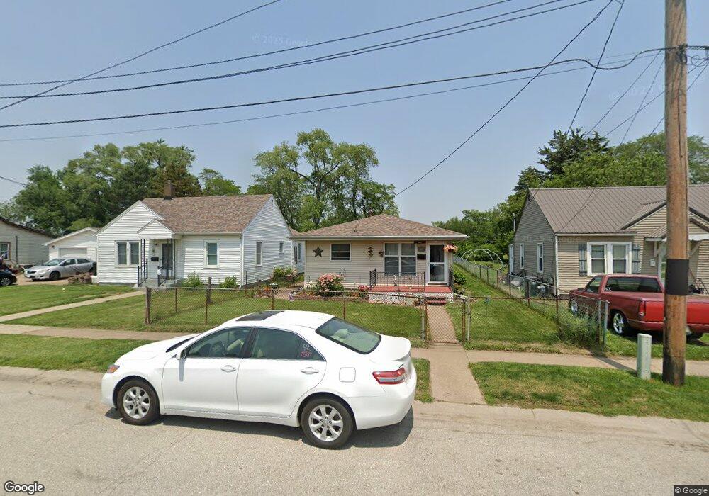
2117 Demorest Ave Muscatine, IA 52761
Estimated Value: $57,000 - $94,000
3
Beds
1
Bath
960
Sq Ft
$76/Sq Ft
Est. Value
About This Home
This home is located at 2117 Demorest Ave, Muscatine, IA 52761 and is currently estimated at $72,719, approximately $75 per square foot. 2117 Demorest Ave is a home located in Muscatine County with nearby schools including Franklin Elementary School, Susan Clark Junior High School, and Muscatine High School.
Ownership History
Date
Name
Owned For
Owner Type
Purchase Details
Closed on
Jan 5, 2016
Sold by
Leza Ricardo and Leza Tiffany
Bought by
Heuer Tracy
Current Estimated Value
Purchase Details
Closed on
Aug 27, 2013
Sold by
The Estate Of Maria L Vasquez
Bought by
Zamora Sergio A
Purchase Details
Closed on
Mar 3, 2009
Sold by
Hatfield Patricia A
Bought by
Lissy Timothy S and Lissy Todd A
Create a Home Valuation Report for This Property
The Home Valuation Report is an in-depth analysis detailing your home's value as well as a comparison with similar homes in the area
Home Values in the Area
Average Home Value in this Area
Purchase History
| Date | Buyer | Sale Price | Title Company |
|---|---|---|---|
| Heuer Tracy | $51,500 | None Available | |
| Zamora Sergio A | $27,000 | None Available | |
| Lissy Timothy S | -- | None Available |
Source: Public Records
Tax History Compared to Growth
Tax History
| Year | Tax Paid | Tax Assessment Tax Assessment Total Assessment is a certain percentage of the fair market value that is determined by local assessors to be the total taxable value of land and additions on the property. | Land | Improvement |
|---|---|---|---|---|
| 2025 | $724 | $80,720 | $8,070 | $72,650 |
| 2024 | $724 | $75,360 | $8,070 | $67,290 |
| 2023 | $1,172 | $75,790 | $8,088 | $67,702 |
| 2022 | $1,008 | $70,500 | $7,630 | $62,870 |
| 2021 | $1,008 | $61,800 | $7,630 | $54,170 |
| 2020 | $934 | $56,630 | $6,540 | $50,090 |
| 2019 | $942 | $54,410 | $0 | $0 |
| 2018 | $876 | $52,250 | $0 | $0 |
| 2017 | $876 | $48,730 | $0 | $0 |
| 2016 | $830 | $48,730 | $0 | $0 |
| 2015 | $830 | $51,650 | $0 | $0 |
| 2014 | $902 | $51,650 | $0 | $0 |
Source: Public Records
Map
Nearby Homes
- 1908 Sampson St
- 1909 Wallace St
- 1708 Schley Ave
- 2108 Breese Ave
- 609 Liberty St
- 0 Towhead Island Unit 23-716
- LOTS 30-34 Evans St
- 111 Gilbert St
- 1903 Hershey Ave
- 1827 Hershey Ave
- LOT 17 Briman Prairie
- LOT 5 Pine Ridge
- LOT 4 Pine Ridge
- LOT 6 Pine Ridge
- 0 Parcel 1302108019 (Busch St)
- 900 W 3rd St
- 1603 Lucas St
- 701 W Mississippi Dr
- 0 High Street Parcel
- 208 Fletcher Ave
- 2115 Demorest Ave
- 2121 Demorest Ave
- 2111 Demorest Ave
- 2203 Demorest Ave
- 2109 Demorest Ave
- 2207 Demorest Ave
- 2107 Demorest Ave
- 2116 Demorest Ave
- 2110 Demorest Ave
- 2211 Demorest Ave
- 2204 Demorest Ave
- 1603 Indiana St
- 2021 Demorest Ave
- 1610 Ohio St
- 2206 Demorest Ave
- 2115 Sampson St
- 2017 Demorest Ave
- 2210 Demorest Ave
- 1609 Indiana St
- 1611 Ohio St