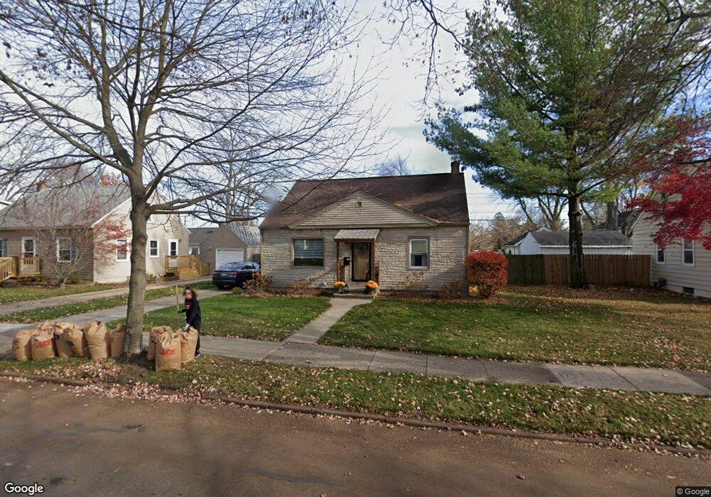
2117 Devonshire Ave Lansing, MI 48910
Clifford Park NeighborhoodEstimated Value: $151,057 - $211,000
3
Beds
2
Baths
1,339
Sq Ft
$133/Sq Ft
Est. Value
About This Home
This home is located at 2117 Devonshire Ave, Lansing, MI 48910 and is currently estimated at $177,514, approximately $132 per square foot. 2117 Devonshire Ave is a home located in Ingham County with nearby schools including Lyons Elementary School, Pattengill Academy, and Eastern High School.
Ownership History
Date
Name
Owned For
Owner Type
Purchase Details
Closed on
Jul 19, 2007
Sold by
Phillips Thomas M and Phillips Amy E
Bought by
Wawro Leah
Current Estimated Value
Home Financials for this Owner
Home Financials are based on the most recent Mortgage that was taken out on this home.
Original Mortgage
$101,600
Outstanding Balance
$64,262
Interest Rate
6.73%
Mortgage Type
Purchase Money Mortgage
Estimated Equity
$113,252
Purchase Details
Closed on
Aug 4, 1999
Sold by
Miller Carl K and Miller Joyce A
Bought by
Phillips Thomas M and Phillips Amy E
Home Financials for this Owner
Home Financials are based on the most recent Mortgage that was taken out on this home.
Original Mortgage
$86,550
Interest Rate
7.77%
Mortgage Type
Purchase Money Mortgage
Create a Home Valuation Report for This Property
The Home Valuation Report is an in-depth analysis detailing your home's value as well as a comparison with similar homes in the area
Home Values in the Area
Average Home Value in this Area
Purchase History
| Date | Buyer | Sale Price | Title Company |
|---|---|---|---|
| Wawro Leah | $127,000 | Multiple | |
| Phillips Thomas M | $86,600 | -- |
Source: Public Records
Mortgage History
| Date | Status | Borrower | Loan Amount |
|---|---|---|---|
| Open | Wawro Leah | $101,600 | |
| Previous Owner | Phillips Thomas M | $86,550 |
Source: Public Records
Tax History
| Year | Tax Paid | Tax Assessment Tax Assessment Total Assessment is a certain percentage of the fair market value that is determined by local assessors to be the total taxable value of land and additions on the property. | Land | Improvement |
|---|---|---|---|---|
| 2025 | $3,012 | $71,400 | $10,000 | $61,400 |
| 2024 | $2,824 | $65,400 | $10,000 | $55,400 |
| 2023 | $2,824 | $58,200 | $10,000 | $48,200 |
| 2022 | $2,546 | $51,000 | $10,100 | $40,900 |
| 2021 | $2,493 | $47,800 | $8,100 | $39,700 |
| 2020 | $2,478 | $47,200 | $8,100 | $39,100 |
| 2019 | $2,375 | $44,100 | $8,100 | $36,000 |
| 2018 | $2,226 | $41,000 | $8,100 | $32,900 |
| 2017 | $2,131 | $41,000 | $8,100 | $32,900 |
| 2016 | $2,038 | $38,600 | $8,100 | $30,500 |
| 2015 | $2,038 | $37,000 | $16,181 | $20,819 |
| 2014 | $2,038 | $36,100 | $18,878 | $17,222 |
Source: Public Records
Map
Nearby Homes
- 2215 Alpha St
- 2201 S Pennsylvania Ave
- 2237 Sunnyside Ave
- 2309 S Pennsylvania Ave
- 2340 S Pennsylvania Ave
- 0 E Mount Hope Ave
- 704 Mckim Ave
- 1731 Lyons Ave
- 2118 Roberts Ln
- 1501 Shubel Ave
- 616 Isbell St
- 1601 Bailey St
- 1423 Pontiac St
- 1437 Ada St
- 1535 Linval St
- 3149 Plymouth Dr
- 2015 Forest Rd
- 534 Isbell St
- 1515 Linval St
- 1731 Herbert St
- 2111 Devonshire Ave
- 2129 Devonshire Ave
- 2202 Harding Ave
- 2208 Harding Ave
- 2112 Harding Ave
- 2107 Devonshire Ave
- 2211 Devonshire Ave
- 2202 Devonshire Ave
- 2110 Devonshire Ave
- 2214 Harding Ave
- 2110 Harding Ave
- 2210 Devonshire Ave
- 1213 Pacific Ave
- 2104 Harding Ave
- 2101 Devonshire Ave
- 2100 Devonshire Ave
- 1135 Pacific Ave
- 1134 Riley St
- 2100 Harding Ave
- 1131 Pacific Ave
Your Personal Tour Guide
Ask me questions while you tour the home.