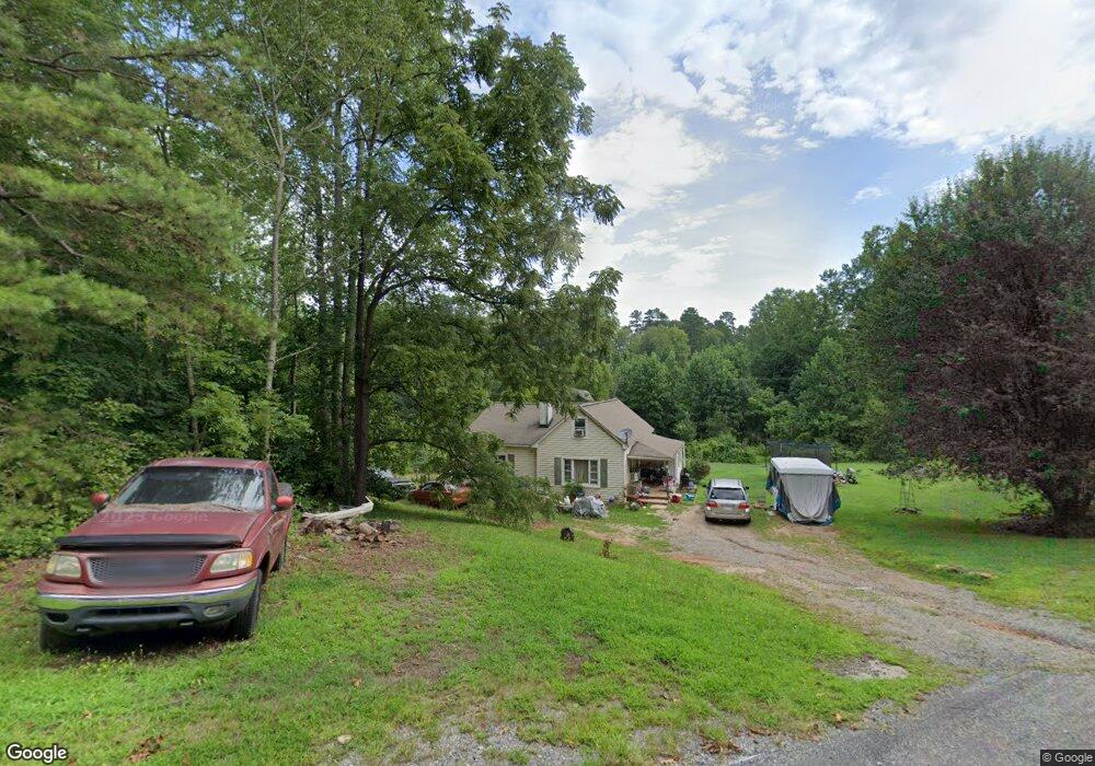
2117 Poarch Rd Lincolnton, NC 28092
Estimated Value: $259,000 - $378,000
4
Beds
2
Baths
1,650
Sq Ft
$182/Sq Ft
Est. Value
About This Home
This home is located at 2117 Poarch Rd, Lincolnton, NC 28092 and is currently estimated at $300,561, approximately $182 per square foot. 2117 Poarch Rd is a home located in Lincoln County with nearby schools including Pumpkin Center Primary, Pumpkin Center Intermediate, and Lincolnton Middle School.
Ownership History
Date
Name
Owned For
Owner Type
Purchase Details
Closed on
May 20, 2013
Sold by
Watson Danny and Watson Debora
Bought by
Watson Danny and Watson Debora
Current Estimated Value
Purchase Details
Closed on
Apr 22, 2013
Sold by
Deutsche Bank National Trust Co
Bought by
Watson Danny
Purchase Details
Closed on
Dec 20, 2012
Sold by
Glance Timothy P and Glance Sarah P
Bought by
Deutsche Bank National Trust Company
Purchase Details
Closed on
Mar 7, 1997
Bought by
Glance Timothy P and Glance Sarah P
Create a Home Valuation Report for This Property
The Home Valuation Report is an in-depth analysis detailing your home's value as well as a comparison with similar homes in the area
Home Values in the Area
Average Home Value in this Area
Purchase History
| Date | Buyer | Sale Price | Title Company |
|---|---|---|---|
| Watson Danny | -- | None Available | |
| Watson Danny | $31,500 | None Available | |
| Deutsche Bank National Trust Company | $97,000 | None Available | |
| Glance Timothy P | $69,000 | -- |
Source: Public Records
Tax History Compared to Growth
Tax History
| Year | Tax Paid | Tax Assessment Tax Assessment Total Assessment is a certain percentage of the fair market value that is determined by local assessors to be the total taxable value of land and additions on the property. | Land | Improvement |
|---|---|---|---|---|
| 2025 | $1,023 | $146,227 | $44,177 | $102,050 |
| 2024 | $1,003 | $146,227 | $44,177 | $102,050 |
| 2023 | $976 | $146,227 | $44,177 | $102,050 |
| 2022 | $757 | $90,526 | $36,027 | $54,499 |
| 2021 | $739 | $90,526 | $36,027 | $54,499 |
| 2020 | $606 | $90,526 | $36,027 | $54,499 |
| 2019 | $606 | $90,526 | $36,027 | $54,499 |
| 2018 | $677 | $84,512 | $34,384 | $50,128 |
| 2017 | $550 | $84,512 | $34,384 | $50,128 |
| 2016 | $550 | $84,512 | $34,384 | $50,128 |
| 2015 | $625 | $84,512 | $34,384 | $50,128 |
| 2014 | $771 | $108,799 | $34,384 | $74,415 |
Source: Public Records
Map
Nearby Homes
- 1 Clearview Ln
- 00 Clearview Ln
- 1410 Hickory Nut Ln
- 772 Car Farm Rd
- 2206 Carpenter Farms Dr
- 2202 Carpenter Farms Dr
- 1723 Ivey Ct
- 3 Old Village Dr Unit 3
- 1471 Arden Dr
- 1670 Buck Oak Rd
- 1335 Huckleberry Dr
- 2911 Weatherfield Dr
- 3249 Ivey Creek Rd
- 2914 Weatherfield Dr
- 1426 John Lutz Cir
- 00 Sunrise Trail
- lot 22 Weatherwood Dr
- 2012 Bison Trail
- 1681 Woolie Rd
- 4465 Brancer Ln
- 2141 Poarch Rd
- 2091 Poarch Rd
- 2131 Poarch Rd
- 2174 Poarch Rd
- 2169 Poarch Rd
- 2066 Poarch Rd
- 2067 Poarch Rd
- 2073 Poarch Rd
- 2184 Poarch Rd
- 2853 Stamey Ln
- 2052 Poarch Rd
- 2156 Poarch Rd
- 2038 Poarch Rd
- 2411 Kettle Creek Ct
- 2063 Poarch Rd
- 2024 Poarch Rd
- 2371 Kettle Creek Ct
- 2012 Poarch Rd
- 2891 Stamey Ln
- 2928 Stamey Ln