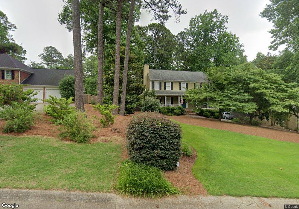
2117 Rockland Ct Unit 2 Marietta, GA 30062
East Cobb NeighborhoodEstimated Value: $620,527 - $734,000
4
Beds
3
Baths
2,182
Sq Ft
$305/Sq Ft
Est. Value
About This Home
This home is located at 2117 Rockland Ct Unit 2, Marietta, GA 30062 and is currently estimated at $665,382, approximately $304 per square foot. 2117 Rockland Ct Unit 2 is a home located in Cobb County with nearby schools including Timber Ridge Elementary School, Dodgen Middle School, and Pope High School.
Ownership History
Date
Name
Owned For
Owner Type
Purchase Details
Closed on
Mar 29, 2001
Sold by
Schultz Mark E and Schultz Nancy V
Bought by
Shelton John and Shelton Monica
Current Estimated Value
Home Financials for this Owner
Home Financials are based on the most recent Mortgage that was taken out on this home.
Original Mortgage
$210,400
Outstanding Balance
$76,441
Interest Rate
6.99%
Mortgage Type
FHA
Estimated Equity
$588,941
Create a Home Valuation Report for This Property
The Home Valuation Report is an in-depth analysis detailing your home's value as well as a comparison with similar homes in the area
Home Values in the Area
Average Home Value in this Area
Purchase History
| Date | Buyer | Sale Price | Title Company |
|---|---|---|---|
| Shelton John | $221,500 | -- |
Source: Public Records
Mortgage History
| Date | Status | Borrower | Loan Amount |
|---|---|---|---|
| Open | Shelton John | $210,400 |
Source: Public Records
Tax History Compared to Growth
Tax History
| Year | Tax Paid | Tax Assessment Tax Assessment Total Assessment is a certain percentage of the fair market value that is determined by local assessors to be the total taxable value of land and additions on the property. | Land | Improvement |
|---|---|---|---|---|
| 2025 | $5,220 | $224,868 | $60,000 | $164,868 |
| 2024 | $5,224 | $224,868 | $60,000 | $164,868 |
| 2023 | $4,377 | $210,848 | $50,000 | $160,848 |
| 2022 | $4,220 | $177,012 | $40,000 | $137,012 |
| 2021 | $4,220 | $177,012 | $40,000 | $137,012 |
| 2020 | $4,220 | $177,012 | $40,000 | $137,012 |
| 2019 | $4,220 | $177,012 | $40,000 | $137,012 |
| 2018 | $3,558 | $146,788 | $34,800 | $111,988 |
| 2017 | $3,185 | $134,044 | $29,200 | $104,844 |
| 2016 | $2,602 | $107,308 | $29,200 | $78,108 |
| 2015 | $2,657 | $107,308 | $29,200 | $78,108 |
| 2014 | $2,675 | $107,308 | $0 | $0 |
Source: Public Records
Map
Nearby Homes
- 3917 Brintons Mill
- 2237 Chadds Creek Dr
- 2225 Johnson Ferry Rd
- 2259 Edgemere Lake Cir
- 4013 Chelsea Ln
- 4031 Oak Forest Cir
- 3761 Oak Ln
- 2249 Smoke Stone Cir
- 2503 Regency Lake Dr
- 4255 Green Ridge Dr
- 4035 Willows Way Unit 1
- 4039 Tall Pine Dr
- 3741 Bays Ferry Way
- 2567 Kingsley Dr NE
- 4226 Vienna Way Unit 1
- 2269 Chimney Springs Dr
- 1942 Hunters Bend Ct
- 2121 Rockland Ct
- 0 Rockland Ct Unit 7488428
- 2113 Rockland Ct Unit 2
- 2116 Rockland Ct
- 3958 Brintons Mill Unit 2B
- 2109 Rockland Ct
- 2123 Hawthorne Point
- 2111 Hawthorne Point
- 2124 Rockland Ct
- 2105 Hawthorne Point
- 2112 Rockland Ct
- 2127 Hawthorne Point
- 0 Hawthorne Point Unit 8354855
- 0 Hawthorne Point
- 2104 Rockland Ct
- 0 Brinton Mill Rd
- 2108 Rockland Ct Unit 11
- 2101 Hawthorne Point
- 3926 Brintons Mill
- 3937 Brintons Mill Unit IIB