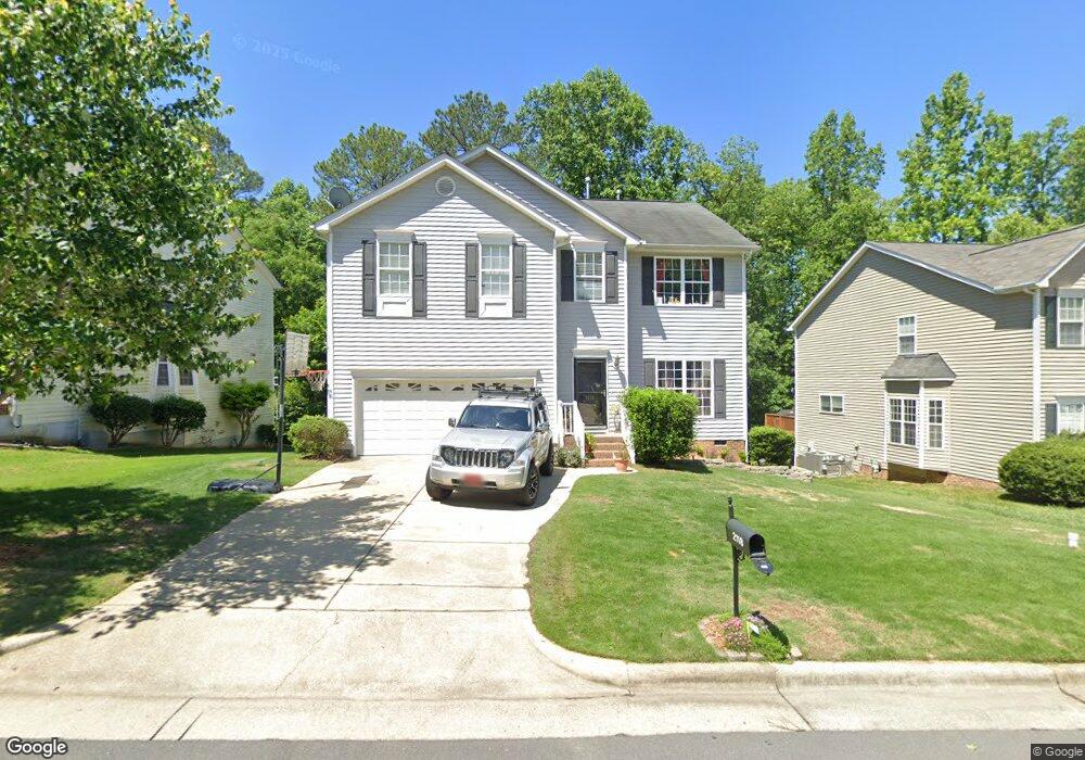
2118 Pilot Mountain Ct Apex, NC 27502
West Apex NeighborhoodEstimated Value: $506,586 - $586,000
Studio
3
Baths
2,328
Sq Ft
$228/Sq Ft
Est. Value
About This Home
This home is located at 2118 Pilot Mountain Ct, Apex, NC 27502 and is currently estimated at $531,147, approximately $228 per square foot. 2118 Pilot Mountain Ct is a home located in Wake County with nearby schools including Scotts Ridge Elementary School, Apex Friendship Middle School, and Apex Friendship High School.
Ownership History
Date
Name
Owned For
Owner Type
Purchase Details
Closed on
Oct 31, 2003
Sold by
The New Fortis Corp
Bought by
Valder Michael and Valder Kirsten
Current Estimated Value
Home Financials for this Owner
Home Financials are based on the most recent Mortgage that was taken out on this home.
Original Mortgage
$163,150
Outstanding Balance
$75,794
Interest Rate
6.03%
Mortgage Type
Purchase Money Mortgage
Estimated Equity
$455,353
Create a Home Valuation Report for This Property
The Home Valuation Report is an in-depth analysis detailing your home's value as well as a comparison with similar homes in the area
Home Values in the Area
Average Home Value in this Area
Purchase History
| Date | Buyer | Sale Price | Title Company |
|---|---|---|---|
| Valder Michael | $204,000 | -- |
Source: Public Records
Mortgage History
| Date | Status | Borrower | Loan Amount |
|---|---|---|---|
| Open | Valder Michael | $163,150 | |
| Closed | Valder Michael | $20,350 |
Source: Public Records
Tax History
| Year | Tax Paid | Tax Assessment Tax Assessment Total Assessment is a certain percentage of the fair market value that is determined by local assessors to be the total taxable value of land and additions on the property. | Land | Improvement |
|---|---|---|---|---|
| 2025 | -- | $489,067 | $145,000 | $344,067 |
| 2024 | $4,194 | $489,067 | $145,000 | $344,067 |
Source: Public Records
Map
Nearby Homes
- 1124 Woodlands Creek Way
- 7104 Camp Branch Ln
- 2129 Kelly Rd
- 2006 Leo Dr
- 2011 Becca Ct
- 2516 Maroni Dr
- 1809 Barrett Run Trail
- 1701 Melbry Ct
- 106 Forestcrest Ct
- 1702 Melbry Ct
- 113 Country Valley Ct
- 1216 Scotts Ridge Trail
- 1701 Grand Barton Ct
- 1811 Aspen River Ln
- 2805 Evans Rd
- 2801 Evans Rd
- 301 Kinship Ln
- 1936 Rabbit Hop Trail
- 1512 Piazzo Ct
- 2095 Maggie Valley Dr
- 2116 Pilot Mountain Ct
- 2120 Pilot Mountain Ct
- 2202 Pilot Mountain Ct
- 2313 Brasstown Ln
- 2204 Pilot Mountain Ct
- 2315 Brasstown Ln
- 2119 Pilot Mountain Ct
- 2117 Pilot Mountain Ct
- 2311 Brasstown Ln
- 2115 Pilot Mountain Ct
- 2201 Pilot Mountain Ct
- 2300 Pilot Mountain Ct
- 2317 Brasstown Ln
- 2113 Pilot Mountain Ct
- 2309 Brasstown Ln
- 2110 Pilot Mountain Ct
- 2203 Pilot Mountain Ct
- 2304 Pilot Mountain Ct
- 2001 Himalaya Way
- 2111 Pilot Mountain Ct
Your Personal Tour Guide
Ask me questions while you tour the home.