Estimated Value: $360,376 - $380,000
3
Beds
2
Baths
1,934
Sq Ft
$190/Sq Ft
Est. Value
About This Home
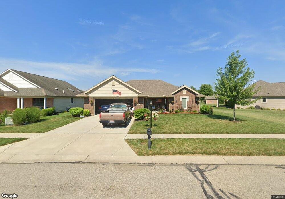
This home is located at 2118 Tandem Dr, Xenia, OH 45385 and is currently estimated at $368,344, approximately $190 per square foot. 2118 Tandem Dr is a home located in Greene County with nearby schools including Xenia High School, Summit Academy Community School for Alternative Learners - Xenia, and Legacy Christian Academy.
Ownership History
Date
Name
Owned For
Owner Type
Purchase Details
Closed on
Jul 21, 2016
Sold by
Sibco Ltd
Bought by
Charles Chester A and Charles Mary C
Current Estimated Value
Home Financials for this Owner
Home Financials are based on the most recent Mortgage that was taken out on this home.
Original Mortgage
$155,340
Outstanding Balance
$73,923
Interest Rate
3.56%
Mortgage Type
Purchase Money Mortgage
Estimated Equity
$294,421
Purchase Details
Closed on
Jul 9, 2008
Sold by
P F D Development P L L
Bought by
Sibco Ltd
Create a Home Valuation Report for This Property
The Home Valuation Report is an in-depth analysis detailing your home's value as well as a comparison with similar homes in the area
Home Values in the Area
Average Home Value in this Area
Purchase History
| Date | Buyer | Sale Price | Title Company |
|---|---|---|---|
| Charles Chester A | $34,700 | None Available | |
| Sibco Ltd | -- | None Available |
Source: Public Records
Mortgage History
| Date | Status | Borrower | Loan Amount |
|---|---|---|---|
| Open | Charles Chester A | $155,340 |
Source: Public Records
Tax History Compared to Growth
Tax History
| Year | Tax Paid | Tax Assessment Tax Assessment Total Assessment is a certain percentage of the fair market value that is determined by local assessors to be the total taxable value of land and additions on the property. | Land | Improvement |
|---|---|---|---|---|
| 2024 | $3,632 | $96,900 | $19,740 | $77,160 |
| 2023 | $3,632 | $96,900 | $19,740 | $77,160 |
| 2022 | $3,141 | $72,980 | $13,160 | $59,820 |
| 2021 | $3,184 | $72,980 | $13,160 | $59,820 |
| 2020 | $3,047 | $72,980 | $13,160 | $59,820 |
| 2019 | $3,242 | $73,080 | $12,110 | $60,970 |
| 2018 | $3,255 | $73,080 | $12,110 | $60,970 |
| 2017 | $641 | $73,080 | $12,110 | $60,970 |
| 2016 | $641 | $12,110 | $12,110 | $0 |
| 2015 | $643 | $12,110 | $12,110 | $0 |
| 2014 | $616 | $12,110 | $12,110 | $0 |
Source: Public Records
Map
Nearby Homes
- 2144 Tandem Dr
- 2223 Tandem Dr
- 2096 High Wheel Dr
- 2540 Cornwall Dr
- 2499 Jenny Marie Dr
- 2540 Jenny Marie Dr
- 1881 Commonwealth Dr
- 0 Berkshire Dr Unit 942854
- 2421 Louisiana Dr
- 1255 Colorado Dr
- 2187 Minnesota Dr
- 2265 Minnesota Dr
- 1908 Whitt St
- 2189 Mississippi Dr
- 2852 Raxit Ct
- 2685 Childers Dr
- 1766 Gayhart Dr
- 1068 Hedges Rd
- 2705 Tennessee Dr
- 1272 Bellbrook Ave
- 2124 Tandem Dr
- 959 Wright Ave
- 2134 Tandem Dr
- 969 Wright Ave
- 2147 Schwinn Ave
- 2153 Schwinn Ave
- 2140 Schwinn Ave
- 949 Wright Ave
- lot #173 Tandem Dr
- lot #172 Wright Ave
- lot #170 Wright Ave
- 948 Cannondale Ave
- 2154 Tandem Dr
- 1927 Lakeview Dr
- 943 Wright Ave
- 2159 Schwinn Ave
- 942 Cannondale Ave
- 1911 Lakeview Dr
- 2010 Tandem Dr
- 1935 Lakeview Dr