Estimated Value: $207,000 - $216,000
3
Beds
2
Baths
1,488
Sq Ft
$142/Sq Ft
Est. Value
About This Home
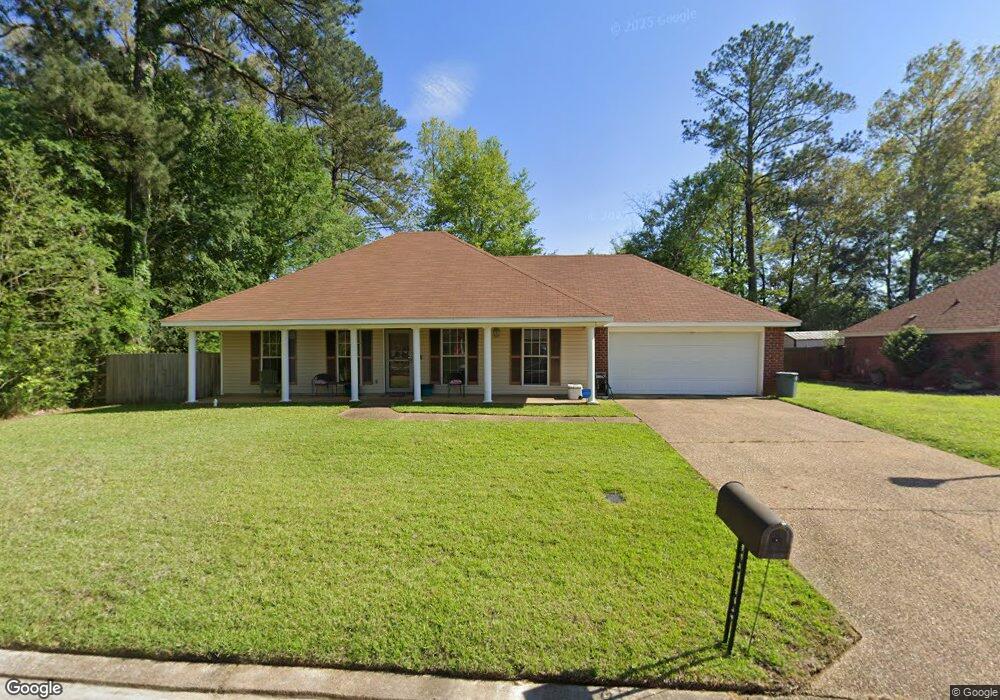
This home is located at 2119 Branch Creek Dr, Byram, MS 39272 and is currently estimated at $211,224, approximately $141 per square foot. 2119 Branch Creek Dr is a home located in Hinds County with nearby schools including Gary Road Elementary School, Gary Road Intermediate School, and Byram Middle School.
Ownership History
Date
Name
Owned For
Owner Type
Purchase Details
Closed on
Jul 12, 2012
Sold by
Robinson Michael E
Bought by
Robinson Mcihael E and Robinson Deborah H
Current Estimated Value
Purchase Details
Closed on
Jun 6, 2011
Sold by
Sec Of Hud Of Washingtn Dc
Bought by
Robinson Michael R
Home Financials for this Owner
Home Financials are based on the most recent Mortgage that was taken out on this home.
Original Mortgage
$125,181
Interest Rate
4.79%
Create a Home Valuation Report for This Property
The Home Valuation Report is an in-depth analysis detailing your home's value as well as a comparison with similar homes in the area
Home Values in the Area
Average Home Value in this Area
Purchase History
| Date | Buyer | Sale Price | Title Company |
|---|---|---|---|
| Robinson Mcihael E | -- | -- | |
| Robinson Michael R | -- | -- |
Source: Public Records
Mortgage History
| Date | Status | Borrower | Loan Amount |
|---|---|---|---|
| Previous Owner | Robinson Michael R | $125,181 |
Source: Public Records
Tax History Compared to Growth
Tax History
| Year | Tax Paid | Tax Assessment Tax Assessment Total Assessment is a certain percentage of the fair market value that is determined by local assessors to be the total taxable value of land and additions on the property. | Land | Improvement |
|---|---|---|---|---|
| 2025 | $1,438 | $11,110 | $3,000 | $8,110 |
| 2024 | $1,438 | $11,110 | $3,000 | $8,110 |
| 2023 | $1,438 | $11,110 | $3,000 | $8,110 |
| 2022 | $1,709 | $11,110 | $3,000 | $8,110 |
| 2021 | $1,387 | $11,110 | $3,000 | $8,110 |
| 2020 | $1,343 | $10,964 | $3,000 | $7,964 |
| 2019 | $1,335 | $10,964 | $3,000 | $7,964 |
| 2018 | $1,335 | $10,964 | $3,000 | $7,964 |
| 2017 | $1,305 | $10,964 | $3,000 | $7,964 |
| 2016 | $1,305 | $10,964 | $3,000 | $7,964 |
| 2015 | $1,277 | $10,777 | $3,000 | $7,777 |
| 2014 | $1,255 | $10,777 | $3,000 | $7,777 |
Source: Public Records
Map
Nearby Homes
- 909 Eagles Nest Dr
- 505 Golden Eagle Dr
- 2120 Meagan Dr
- CALI Plan at Cedars of Byram Estates
- ARIA Plan at Cedars of Byram Estates
- 2149 S Ridge Rd
- 536 Fairway Ave
- 0 Terry Rd Unit 21325508
- 0 Terry Rd Unit 24270230
- 0 Terry Rd Unit 4130083
- 1213 Lake Shore Dr
- 109 Lucas Ct
- 104 Lucas Ct
- 0 Byram Pkwy
- 313 Brannan Ave
- 344 Brannan Ave
- 368 Brannon Ave
- 2239 W Ridge Rd
- 4311 Blaine Cir
- 213 Longfellow Cove
- 2115 Branch Creek Dr
- 2108 Branch Creek Dr
- 2111 Branch Creek Dr
- 910 Redwood Cove
- 913 Eagles Nest Dr
- 915 Eagles Nest Dr
- 911 Eagles Nest Dr
- 917 Eagles Nest Dr
- 2098 Branch Creek Dr
- 2103 Branch Creek Dr
- 500 Golden Eagle Dr
- 908 Eagles Nest Dr
- 890 Redwood Cove
- 2094 Branch Creek Dr
- 910 Eagles Nest Dr
- 907 Eagles Nest Dr
- 810 Redwood Cove
- 0 Redwood Cove Unit Lot 85 1147784
- 0 Redwood Cove Unit Lot 89 1147785
- 0 Redwood Cove Unit Lot 81