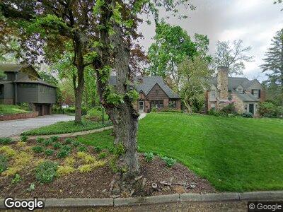
2119 Devonshire Rd Ann Arbor, MI 48104
Tuomy Hills NeighborhoodEstimated Value: $999,000 - $1,082,759
3
Beds
3
Baths
2,058
Sq Ft
$504/Sq Ft
Est. Value
About This Home
This home is located at 2119 Devonshire Rd, Ann Arbor, MI 48104 and is currently estimated at $1,036,690, approximately $503 per square foot. 2119 Devonshire Rd is a home located in Washtenaw County with nearby schools including Angell School, Tappan Middle School, and Huron High School.
Ownership History
Date
Name
Owned For
Owner Type
Purchase Details
Closed on
Apr 22, 2004
Sold by
Petersen Timothy B and Petersen Sarah Hart
Bought by
Kaul Daniel Richard and Kaul Bridgette Marie
Current Estimated Value
Home Financials for this Owner
Home Financials are based on the most recent Mortgage that was taken out on this home.
Original Mortgage
$320,000
Interest Rate
5.46%
Mortgage Type
Unknown
Purchase Details
Closed on
Feb 11, 1997
Sold by
Forsyth John D
Bought by
Petersen Timothy B and Petersen Sarah
Home Financials for this Owner
Home Financials are based on the most recent Mortgage that was taken out on this home.
Original Mortgage
$307,700
Interest Rate
6.63%
Mortgage Type
New Conventional
Create a Home Valuation Report for This Property
The Home Valuation Report is an in-depth analysis detailing your home's value as well as a comparison with similar homes in the area
Home Values in the Area
Average Home Value in this Area
Purchase History
| Date | Buyer | Sale Price | Title Company |
|---|---|---|---|
| Kaul Daniel Richard | $550,000 | -- | |
| Petersen Timothy B | $362,000 | -- |
Source: Public Records
Mortgage History
| Date | Status | Borrower | Loan Amount |
|---|---|---|---|
| Open | Kaul Daniel Richard | $50,000 | |
| Open | Kaul Daniel R | $309,000 | |
| Closed | Kaul Daniel Richard | $52,000 | |
| Closed | Kaul Daniel Richard | $320,000 | |
| Previous Owner | Petersen Timothy B | $165,000 | |
| Previous Owner | Petersen Timothy B | $307,700 |
Source: Public Records
Tax History Compared to Growth
Tax History
| Year | Tax Paid | Tax Assessment Tax Assessment Total Assessment is a certain percentage of the fair market value that is determined by local assessors to be the total taxable value of land and additions on the property. | Land | Improvement |
|---|---|---|---|---|
| 2024 | $15,316 | $387,600 | $0 | $0 |
| 2023 | $16,448 | $375,600 | $0 | $0 |
| 2022 | $15,389 | $353,100 | $0 | $0 |
| 2021 | $15,027 | $339,800 | $0 | $0 |
| 2020 | $14,723 | $321,400 | $0 | $0 |
| 2019 | $14,012 | $330,000 | $330,000 | $0 |
| 2018 | $13,815 | $322,100 | $0 | $0 |
| 2017 | $13,438 | $316,600 | $0 | $0 |
| 2016 | $12,965 | $268,722 | $0 | $0 |
| 2015 | $12,347 | $267,919 | $0 | $0 |
| 2014 | $12,347 | $259,757 | $0 | $0 |
| 2013 | -- | $259,757 | $0 | $0 |
Source: Public Records
Map
Nearby Homes
- 19 Heatheridge St
- 2010 Devonshire Rd
- 809 Berkshire Rd
- 2315 Adare Rd
- 1 Shipman Cir
- 515 Orchard Hills Dr
- 2124 Brockman Blvd
- 1054 Ferdon Rd
- 785 Arlington Blvd
- 2445 Adare Rd
- 805 Oxford Rd
- 2204 Lafayette Rd
- 2021 Geddes Ave
- 2316 Brockman Blvd
- 1614 Cambridge Rd
- 1711 Morton Ave
- 1421 Arlington Blvd
- 3122 Geddes Ave
- 1015 Olivia Ave
- 509 Linden St
- 2119 Devonshire Rd
- 2117 Devonshire Rd
- 2121 Devonshire Rd
- 2118 Vinewood Blvd
- 2125 Devonshire Rd
- 2115 Devonshire Rd
- 2116 Vinewood Blvd
- 2114 Vinewood Blvd
- 1006 Avon Rd
- 2116 Devonshire Rd
- 2113 Devonshire Rd
- 2120 Devonshire Rd
- 2112 Vinewood Blvd
- 2114 Devonshire Rd
- 2129 Devonshire Rd
- 2122 Devonshire Rd
- 2112 Devonshire Rd
- 2110 Vinewood Blvd
- 2111 Devonshire Rd
- 2124 Devonshire Rd