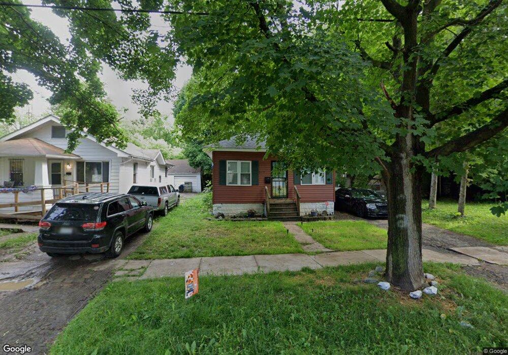
2119 Illinois Ave Flint, MI 48506
Eastside NeighborhoodEstimated Value: $32,000 - $47,000
2
Beds
1
Bath
704
Sq Ft
$56/Sq Ft
Est. Value
About This Home
This home is located at 2119 Illinois Ave, Flint, MI 48506 and is currently estimated at $39,146, approximately $55 per square foot. 2119 Illinois Ave is a home located in Genesee County with nearby schools including Potter School, Flint Cultural Center Academy, and WAY Academy of Flint.
Ownership History
Date
Name
Owned For
Owner Type
Purchase Details
Closed on
Sep 11, 2014
Sold by
The Pieters Family Trust
Bought by
Mcclain Terrence
Current Estimated Value
Purchase Details
Closed on
Oct 1, 2010
Sold by
Noel Caroline C and Pieters Pieters Family Revocab
Bought by
Mcclain Terrence
Home Financials for this Owner
Home Financials are based on the most recent Mortgage that was taken out on this home.
Original Mortgage
$6,000
Interest Rate
4%
Mortgage Type
Seller Take Back
Purchase Details
Closed on
Jul 18, 2006
Sold by
Pieters Noel C and Pieters Caroline A
Bought by
Pieters Noel C and Pieters Caroline A
Create a Home Valuation Report for This Property
The Home Valuation Report is an in-depth analysis detailing your home's value as well as a comparison with similar homes in the area
Home Values in the Area
Average Home Value in this Area
Purchase History
| Date | Buyer | Sale Price | Title Company |
|---|---|---|---|
| Mcclain Terrence | -- | None Available | |
| Mcclain Terrence | $7,700 | None Available | |
| Pieters Noel C | -- | None Available |
Source: Public Records
Mortgage History
| Date | Status | Borrower | Loan Amount |
|---|---|---|---|
| Previous Owner | Mcclain Terrence | $6,000 |
Source: Public Records
Tax History Compared to Growth
Tax History
| Year | Tax Paid | Tax Assessment Tax Assessment Total Assessment is a certain percentage of the fair market value that is determined by local assessors to be the total taxable value of land and additions on the property. | Land | Improvement |
|---|---|---|---|---|
| 2025 | $660 | $11,300 | $0 | $0 |
| 2024 | $521 | $10,400 | $0 | $0 |
| 2023 | $521 | $8,800 | $0 | $0 |
| 2022 | $0 | $7,100 | $0 | $0 |
| 2021 | $531 | $6,200 | $0 | $0 |
| 2020 | $494 | $6,000 | $0 | $0 |
| 2019 | $491 | $4,700 | $0 | $0 |
| 2018 | $500 | $5,400 | $0 | $0 |
| 2017 | $523 | $0 | $0 | $0 |
| 2016 | $521 | $0 | $0 | $0 |
| 2015 | -- | $0 | $0 | $0 |
| 2014 | -- | $0 | $0 | $0 |
| 2012 | -- | $8,000 | $0 | $0 |
Source: Public Records
Map
Nearby Homes
- 1622 Arlington Ave
- 1510 N Vernon Ave
- 1501 Arlington Ave
- 1405 Maplewood Ave
- 2301 Missouri Ave
- 1725 Indiana Ave
- 2221 Amos Dr
- 1318 Cronk Ave
- 2433 Missouri Ave
- 2426 Missouri Ave
- 2609 Pennsylvania Ave
- 2610 Pennsylvania Ave
- 2225 Arlington Ave
- 1220 Minnesota Ave
- 1624 Wisconsin Ave
- 1644 Pennsylvania Ave
- 1814 Mabel Ave
- 2506 Kentucky Ave
- 1612 Iowa Ave
- 1605 Kearsley Park Blvd
- 2115 Illinois Ave
- 1705 N Vernon Ave
- 1701 N Vernon Ave
- 2111 Illinois Ave
- 1709 N Vernon Ave
- 2116 Colladay Ct
- 1710 Arlington Ave
- 2114 Colladay Ct
- 2112 Illinois Ave
- 2126 Colladay Ct
- 1706 Arlington Ave
- 1702 Arlington Ave
- 2120 Illinois Ave
- 2116 Illinois Ave
- 2124 Illinois Ave
- 1714 Arlington Ave
- 2128 Illinois Ave
- 1718 Arlington Ave
- 1722 Arlington Ave
- 1618 Arlington Ave