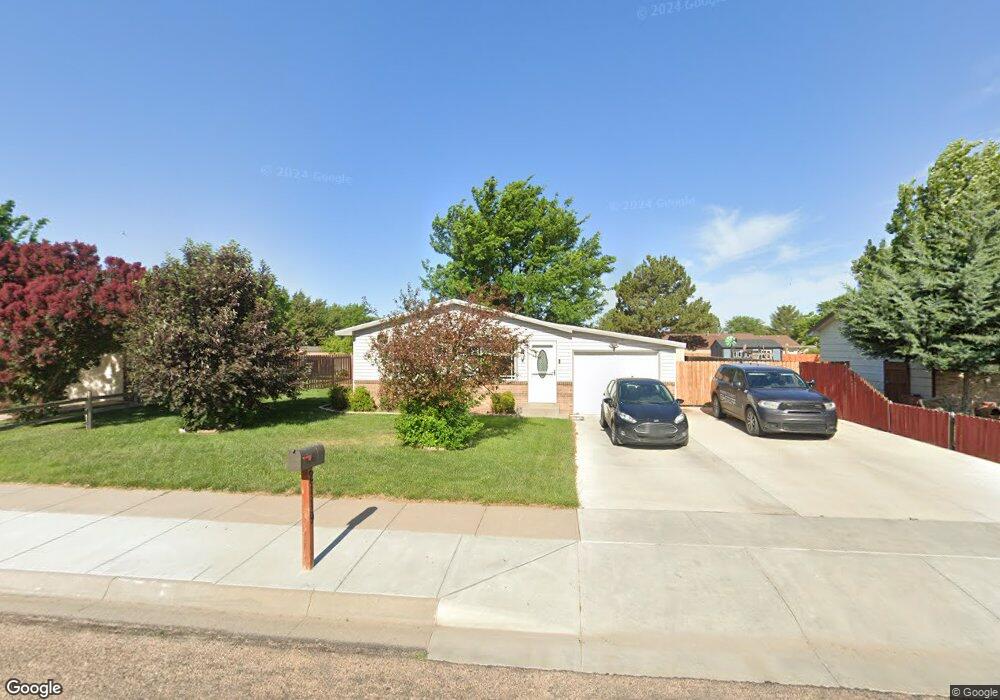
2119 N Mohawk Dr Garden City, KS 67846
Estimated Value: $132,000 - $206,000
2
Beds
1
Bath
864
Sq Ft
$208/Sq Ft
Est. Value
About This Home
This home is located at 2119 N Mohawk Dr, Garden City, KS 67846 and is currently estimated at $179,482, approximately $207 per square foot. 2119 N Mohawk Dr is a home located in Finney County with nearby schools including Florence Wilson Elementary School, Kenneth Henderson Middle School, and Charles O. Stones Intermediate Center.
Ownership History
Date
Name
Owned For
Owner Type
Purchase Details
Closed on
Jun 21, 2021
Sold by
Powers Daniel Lee and Powers Alyssa
Bought by
Powers Daniel Lee and Powers Alyssa
Current Estimated Value
Purchase Details
Closed on
May 15, 2007
Sold by
Engel Troy C and Engel Melody J
Bought by
Mendez Nancy E
Home Financials for this Owner
Home Financials are based on the most recent Mortgage that was taken out on this home.
Original Mortgage
$73,000
Outstanding Balance
$44,404
Interest Rate
6.17%
Mortgage Type
New Conventional
Estimated Equity
$135,078
Create a Home Valuation Report for This Property
The Home Valuation Report is an in-depth analysis detailing your home's value as well as a comparison with similar homes in the area
Home Values in the Area
Average Home Value in this Area
Purchase History
| Date | Buyer | Sale Price | Title Company |
|---|---|---|---|
| Powers Daniel Lee | -- | None Available | |
| Mendez Nancy E | -- | None Available |
Source: Public Records
Mortgage History
| Date | Status | Borrower | Loan Amount |
|---|---|---|---|
| Open | Mendez Nancy E | $73,000 |
Source: Public Records
Tax History Compared to Growth
Tax History
| Year | Tax Paid | Tax Assessment Tax Assessment Total Assessment is a certain percentage of the fair market value that is determined by local assessors to be the total taxable value of land and additions on the property. | Land | Improvement |
|---|---|---|---|---|
| 2024 | $3,105 | $19,294 | $1,824 | $17,470 |
| 2023 | $3,105 | $18,031 | $1,824 | $16,207 |
| 2022 | $2,709 | $16,797 | $1,824 | $14,973 |
| 2021 | $2,531 | $15,410 | $1,244 | $14,166 |
| 2020 | $2,334 | $14,481 | $1,244 | $13,237 |
| 2019 | $2,251 | $14,173 | $1,244 | $12,929 |
| 2018 | $2,123 | $13,441 | $1,036 | $12,405 |
| 2017 | $2,160 | $0 | $0 | $0 |
| 2016 | $1,656 | $0 | $0 | $0 |
| 2015 | $1,522 | $0 | $0 | $0 |
| 2012 | -- | $0 | $0 | $0 |
Source: Public Records
Map
Nearby Homes
- 2302 E Fair St
- 1810 N Koster St
- 2402 N Koster St
- 1605 Remington Place
- 1601 N Remington Place
- 1710 E Crestway Dr
- 2008 N Antler Ridge Dr
- 2143 Idlewild Way
- 1517 E Johnson St
- 2150 Idlewild Way
- 2142 Idlewild Way
- 2808 N Broadmoor Place
- 2001 Bison Dr
- 2201 Glenwood Dr
- 1505 E Melanie Ln
- 2320 Idlewild Way
- 1705 N Anderson St
- 2504 N Carriage Ln
- 1305 E Mary St
- 2505 N Carriage Ln
- 2115 N Mohawk Dr
- 2123 N Mohawk Dr
- 2120 N Commanche Dr
- 2111 N Mohawk Dr
- 2508 E Pawnee Rd
- 2116 N Commanche Dr
- 2124 N Commanche Dr
- 2120 N Mohawk Dr
- 2124 N Mohawk Dr
- 2116 N Mohawk Dr
- 2112 N Commanche Dr
- 2128 N Commanche Dr
- 2105 N Mohawk Dr
- 2112 N Mohawk Dr
- 2128 N Mohawk Dr
- 2108 N Commanche Dr
- 0 S Road 22 Unit 201981
- 0 S Rd Unit 201978
- 0 S Road 22 Unit 201977
- 2505 E Pawnee Rd