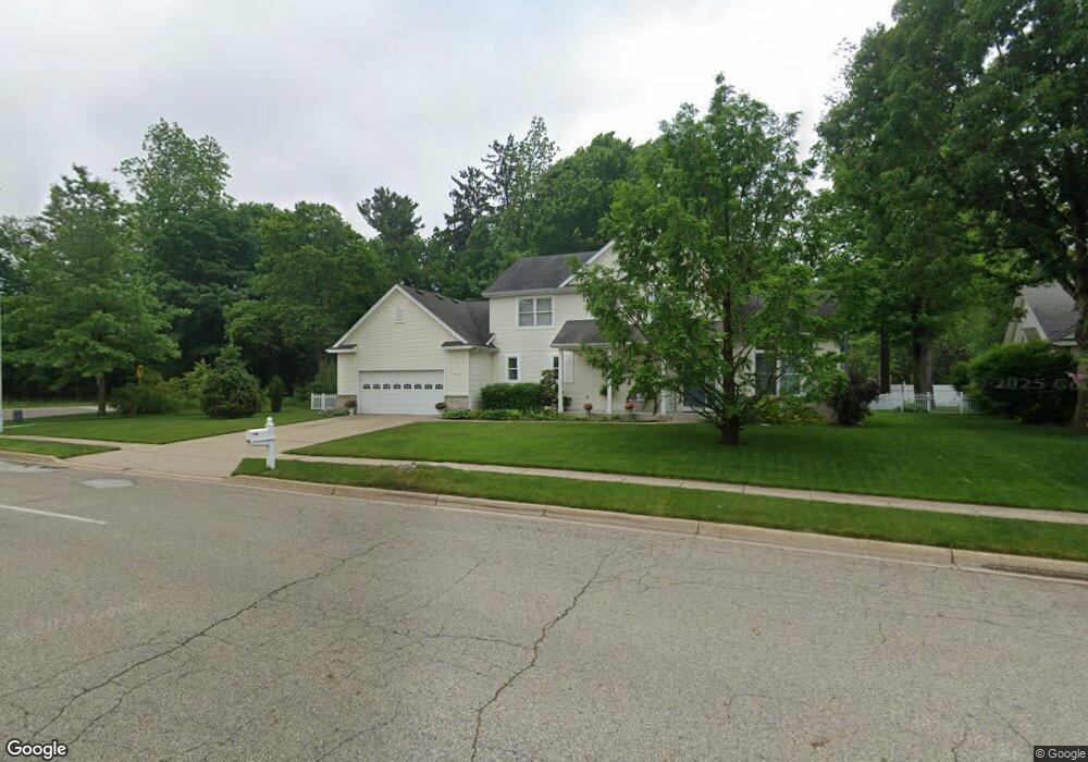
2119 Oak Leaf Trail Portage, MI 49024
Estimated Value: $382,430 - $508,000
4
Beds
3
Baths
2,050
Sq Ft
$209/Sq Ft
Est. Value
About This Home
This home is located at 2119 Oak Leaf Trail, Portage, MI 49024 and is currently estimated at $428,858, approximately $209 per square foot. 2119 Oak Leaf Trail is a home located in Kalamazoo County with nearby schools including Moorsbridge Elementary School, Portage Central Middle School, and Portage Central High School.
Ownership History
Date
Name
Owned For
Owner Type
Purchase Details
Closed on
Oct 21, 2014
Sold by
Runyon Stanley B and Runyon Sharon M
Bought by
Stanley B Runyon and Runyon Marit Sharon M
Current Estimated Value
Purchase Details
Closed on
Nov 13, 2003
Sold by
Gems Associates Lp
Bought by
Runyon Stanley B and Runyon Sharon M
Home Financials for this Owner
Home Financials are based on the most recent Mortgage that was taken out on this home.
Original Mortgage
$100,002
Interest Rate
4.25%
Mortgage Type
Purchase Money Mortgage
Create a Home Valuation Report for This Property
The Home Valuation Report is an in-depth analysis detailing your home's value as well as a comparison with similar homes in the area
Home Values in the Area
Average Home Value in this Area
Purchase History
| Date | Buyer | Sale Price | Title Company |
|---|---|---|---|
| Stanley B Runyon | -- | None Available | |
| Runyon Stanley B | -- | Metro |
Source: Public Records
Mortgage History
| Date | Status | Borrower | Loan Amount |
|---|---|---|---|
| Previous Owner | Runyon Stanley B | $100,002 |
Source: Public Records
Tax History Compared to Growth
Tax History
| Year | Tax Paid | Tax Assessment Tax Assessment Total Assessment is a certain percentage of the fair market value that is determined by local assessors to be the total taxable value of land and additions on the property. | Land | Improvement |
|---|---|---|---|---|
| 2025 | $5,543 | $188,700 | $0 | $0 |
| 2024 | $4,880 | $175,800 | $0 | $0 |
| 2023 | $4,652 | $152,200 | $0 | $0 |
| 2022 | $5,026 | $142,200 | $0 | $0 |
| 2021 | $4,858 | $135,200 | $0 | $0 |
| 2020 | $4,752 | $131,400 | $0 | $0 |
| 2019 | $428 | $127,400 | $0 | $0 |
| 2018 | $0 | $113,600 | $0 | $0 |
| 2017 | $0 | $117,000 | $0 | $0 |
| 2016 | -- | $110,400 | $0 | $0 |
| 2015 | -- | $106,300 | $0 | $0 |
| 2014 | -- | $100,300 | $0 | $0 |
Source: Public Records
Map
Nearby Homes
- 1817 Alder Ave
- 10381 Schrier Ln
- 10382 Pennridge Dr
- 2633 Rolling Hill Ave
- Integrity 1800 Plan at Pennridge Trail North
- Integrity 2085 Plan at Pennridge Trail North
- Integrity 1910 Plan at Pennridge Trail North
- 10197 Pennridge Dr
- 10187 Pennridge Dr
- 10565 Pierport Dr
- 10118 Pennridge Dr
- 10077 Kearns Ct
- 10025 Kearns Ct
- 10029 Kearns Ct
- 2223 Surry
- 10631 Gracie Ln Unit 6
- 821 Janelle Ct
- 10025 Shuman St
- 775 Chloe Jane Ave
- 10613 Sharon Lee Ln
- 2149 Oak Leaf Trail
- 10920 Oakland Dr
- 2120 Oak Leaf Trail
- 10839 Poplar Bluff Ct
- 10819 Poplar Bluff Ct
- 2150 Oak Leaf Trail
- 10859 Poplar Bluff Ct
- 10809 Oakland Dr
- 10879 Poplar Bluff Ct
- 10809 Schuur St
- 10752 Oakland Dr
- 10909 Poplar Bluff Ct
- 10785 Oakland Dr
- 10840 Poplar Bluff Ct
- 10860 Poplar Bluff Ct
- 10929 Poplar Bluff Ct
- 10735 Schuur St
- 10905 Oakland Dr
- 10880 Poplar Bluff Ct
- 10748 Oakland Dr