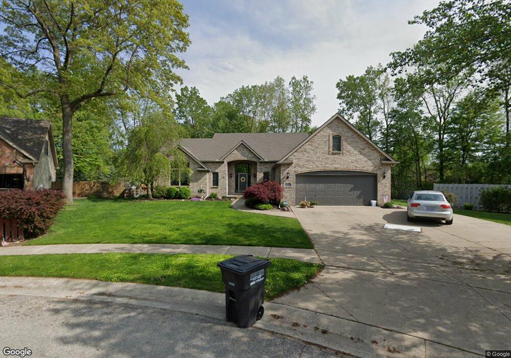
2119 Stirrup Dr Temperance, MI 48182
Estimated Value: $419,000 - $507,000
Studio
--
Bath
--
Sq Ft
23,958
Sq Ft Lot
About This Home
This home is located at 2119 Stirrup Dr, Temperance, MI 48182 and is currently estimated at $457,613. 2119 Stirrup Dr is a home located in Monroe County with nearby schools including Douglas Road Elementary School, Bedford Junior High School, and Bedford High School.
Ownership History
Date
Name
Owned For
Owner Type
Purchase Details
Closed on
Dec 15, 2016
Sold by
Kookoothe Julie R
Bought by
Fischer Nicholas A and Fischer Christine M
Current Estimated Value
Home Financials for this Owner
Home Financials are based on the most recent Mortgage that was taken out on this home.
Original Mortgage
$249,287
Outstanding Balance
$199,598
Interest Rate
3.25%
Mortgage Type
FHA
Estimated Equity
$258,015
Purchase Details
Closed on
Aug 16, 2001
Sold by
Withrow William
Bought by
Kookoothe Julie
Home Financials for this Owner
Home Financials are based on the most recent Mortgage that was taken out on this home.
Original Mortgage
$247,500
Interest Rate
7.23%
Mortgage Type
New Conventional
Create a Home Valuation Report for This Property
The Home Valuation Report is an in-depth analysis detailing your home's value as well as a comparison with similar homes in the area
Home Values in the Area
Average Home Value in this Area
Purchase History
| Date | Buyer | Sale Price | Title Company |
|---|---|---|---|
| Fischer Nicholas A | $275,000 | Midland Title | |
| Kookoothe Julie | $275,000 | -- |
Source: Public Records
Mortgage History
| Date | Status | Borrower | Loan Amount |
|---|---|---|---|
| Open | Fischer Nicholas A | $249,287 | |
| Previous Owner | Kookoothe Julie | $247,500 |
Source: Public Records
Tax History
| Year | Tax Paid | Tax Assessment Tax Assessment Total Assessment is a certain percentage of the fair market value that is determined by local assessors to be the total taxable value of land and additions on the property. | Land | Improvement |
|---|---|---|---|---|
| 2025 | $1,894 | $229,700 | $229,700 | $0 |
| 2024 | $1,837 | $212,000 | $0 | $0 |
| 2023 | $1,750 | $183,600 | $0 | $0 |
| 2022 | $4,438 | $183,600 | $0 | $0 |
| 2021 | $3,985 | $168,300 | $0 | $0 |
| 2020 | $3,821 | $143,900 | $0 | $0 |
| 2019 | $3,750 | $143,900 | $0 | $0 |
| 2018 | $3,422 | $138,300 | $0 | $0 |
| 2017 | $3,224 | $138,300 | $0 | $0 |
| 2016 | $2,749 | $130,100 | $0 | $0 |
| 2015 | $2,582 | $118,800 | $0 | $0 |
| 2014 | $2,582 | $118,800 | $0 | $0 |
| 2013 | $2,849 | $112,500 | $0 | $0 |
Source: Public Records
Map
Nearby Homes
- 2246 Camden Ln
- 7134 Maplewood Dr
- 7322 Silo Meadows Dr
- 7346 Silo Meadows Dr
- 7331 Elmwood Dr
- 6805 Jackman Rd
- 1944 W Sterns Rd
- 7494 Montri Dr
- 1660 W Sterns Rd
- 6886 Stockport Dr
- 7336 Kenilworth Dr
- 6145 Hiddenbrook Dr
- 7768 Jackman Rd
- 1642 Brooke Park Dr
- 1284 Brandywine St
- 1747 Center Dr
- 1607 Brooke Park Dr
- 1550 Brooke Park Dr
- 1601 Brooke Park Dr
- 1549 Brooke Park Dr
- 7050 Eagle Point Ln
- 2131 Stirrup Dr
- 7062 Eagle Point Ln
- 2143 Stirrup Dr
- 6997 Maplewood Dr
- 7074 Eagle Point Ln
- 6949 Maplewood Dr
- 2155 Stirrup Dr
- 2122 Stirrup Dr
- 2150 Stirrup Dr
- 7003 Maplewood Dr
- 7003 Maplewood Dr
- 7086 Eagle Point Ln
- 2167 Stirrup Dr
- 7019 Maplewood Dr
- 7035 Maplewood Dr
- 2166 Camden Ln
- 2162 Stirrup Dr
- 2158 Camden Ln
- 2139 Four Meadows Dr
Your Personal Tour Guide
Ask me questions while you tour the home.