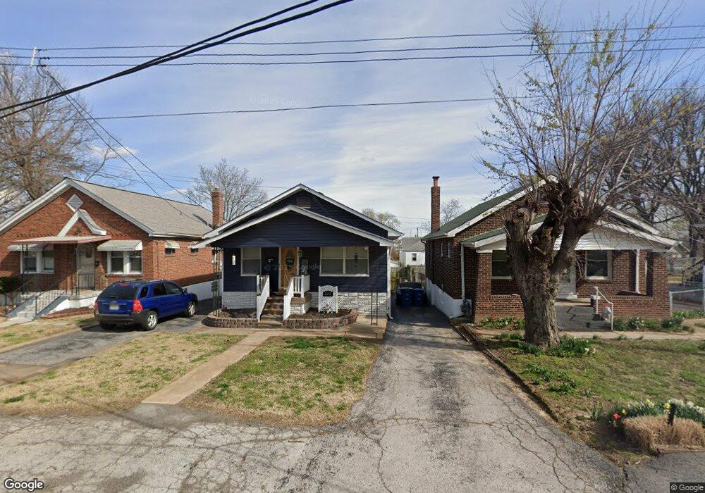
212 Avenue H Saint Louis, MO 63125
Lemay NeighborhoodEstimated Value: $153,547 - $183,000
2
Beds
1
Bath
960
Sq Ft
$176/Sq Ft
Est. Value
About This Home
This home is located at 212 Avenue H, Saint Louis, MO 63125 and is currently estimated at $169,137, approximately $176 per square foot. 212 Avenue H is a home located in St. Louis County with nearby schools including Hancock Place Elementary School, Hancock Place Middle School, and Hancock Place High School.
Ownership History
Date
Name
Owned For
Owner Type
Purchase Details
Closed on
Nov 26, 2003
Sold by
Bell Matthew D and Bell Nichole K
Bought by
Blair Angela
Current Estimated Value
Home Financials for this Owner
Home Financials are based on the most recent Mortgage that was taken out on this home.
Original Mortgage
$92,064
Outstanding Balance
$42,711
Interest Rate
6.01%
Mortgage Type
FHA
Estimated Equity
$126,426
Purchase Details
Closed on
May 14, 1998
Sold by
Jackson Terry W
Bought by
Bell Matthew D and Bell Nicole K
Home Financials for this Owner
Home Financials are based on the most recent Mortgage that was taken out on this home.
Original Mortgage
$54,400
Interest Rate
7.22%
Mortgage Type
FHA
Create a Home Valuation Report for This Property
The Home Valuation Report is an in-depth analysis detailing your home's value as well as a comparison with similar homes in the area
Home Values in the Area
Average Home Value in this Area
Purchase History
| Date | Buyer | Sale Price | Title Company |
|---|---|---|---|
| Blair Angela | $93,510 | -- | |
| Bell Matthew D | -- | -- |
Source: Public Records
Mortgage History
| Date | Status | Borrower | Loan Amount |
|---|---|---|---|
| Open | Blair Angela | $92,064 | |
| Previous Owner | Bell Matthew D | $54,400 |
Source: Public Records
Tax History Compared to Growth
Tax History
| Year | Tax Paid | Tax Assessment Tax Assessment Total Assessment is a certain percentage of the fair market value that is determined by local assessors to be the total taxable value of land and additions on the property. | Land | Improvement |
|---|---|---|---|---|
| 2025 | $2,104 | $29,810 | $10,030 | $19,780 |
| 2024 | $2,104 | $26,940 | $4,010 | $22,930 |
| 2023 | $1,999 | $26,940 | $4,010 | $22,930 |
| 2022 | $1,823 | $20,850 | $4,640 | $16,210 |
| 2021 | $1,668 | $20,850 | $4,640 | $16,210 |
| 2020 | $1,541 | $18,380 | $4,640 | $13,740 |
| 2019 | $1,537 | $18,380 | $4,640 | $13,740 |
| 2018 | $1,459 | $15,200 | $3,550 | $11,650 |
| 2017 | $1,434 | $15,200 | $3,550 | $11,650 |
| 2016 | $1,334 | $13,610 | $1,540 | $12,070 |
| 2015 | $1,338 | $13,610 | $1,540 | $12,070 |
| 2014 | $1,471 | $15,930 | $2,930 | $13,000 |
Source: Public Records
Map
Nearby Homes
- 4023 Healy Ct
- 3733 Comstock Dr
- 3708 Comstock Dr
- 5321 Tesson Ct
- 514 E Dallas Ct
- 4140 Tesson St
- 8439 Tennessee Ave
- 8626 Shoss Ave
- 3806 Waller Ave
- 4338 Seibert Ave
- 8523 Idaho Ave
- 3651 Germania St
- 3624 Steins St
- 4530 Grasso Ave
- 8015 Carlsbad Dr
- 622 Kayser Ave
- 3619 Steins St
- 4116 Koeln Ave
- 7316 Sharp Ave
- 8120 Parkridge Dr